Merrivale, Devon facts for kids
Quick facts for kids Merrivale |
|
|---|---|
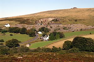 Merrivale hamlet and quarry with Staple Tor beyond. The quarry's crane was in the process of being dismantled when this photo was taken. |
|
| OS grid reference | SX547752 |
| Civil parish |
|
| District |
|
| Shire county | |
| Region | |
| Country | England |
| Sovereign state | United Kingdom |
| Post town | YELVERTON |
| Postcode district | PL20 |
| Dialling code | 01822 |
| Police | Devon and Cornwall |
| Fire | Devon and Somerset |
| Ambulance | South Western |
| EU Parliament | South West England |
| UK Parliament |
|
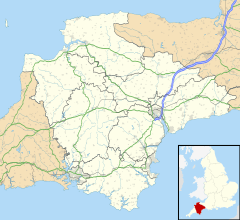
Merrivale is a small area in western Dartmoor, Devon, England. It is well-known for its ancient stone structures from the Bronze Age. These amazing monuments are found just south of the main village. Merrivale also used to have a large granite quarry.
Merrivale Village
The small village of Merrivale is part of the Whitchurch area. It sits where the River Walkham flows, right on the B3357 road. This road was once the main route between Ashburton and Tavistock.
There is an old, unused bridge north of the modern road. The village is mostly known for the large pile of waste rock from the Merrivale granite quarry. This quarry closed in 1997. The few buildings in Merrivale include homes for former quarry workers and the Dartmoor Inn, a local pub.
Ancient Stone Monuments
The most interesting part of Merrivale for history lovers is south-east of the village. Even though some parts have been lost over time, this site has many ancient stone structures.
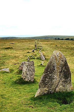
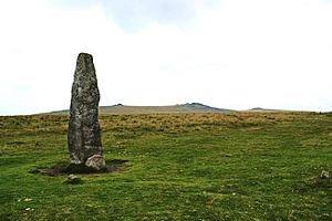
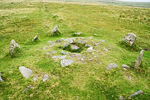
One of the main features is a tall standing stone, which is about 3.8 meters (12.5 feet) high. There is also a stone circle and a stone row, which is a line of stones.
You can also see two stone avenues here. These are lines of stones running side-by-side, with a small stream between them. The southern avenue is about 263.5 meters long and has the remains of an ancient burial mound in its middle. The northern avenue is a bit shorter. Both avenues are only about 1 meter wide in the center.
The southernmost double row of stones has a kistvaen built into it. A kistvaen is an ancient stone burial box. A part of the Great Western Reave, an old boundary wall, runs past the eastern end of these stone rows.
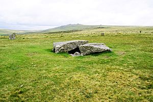
South of the stone avenues, there is another large kistvaen. Inside this kistvaen, archaeologists found a flint scraper, some flint flakes, and a whetstone. A farmer accidentally broke the lid of this kistvaen in the past and used a piece as a gatepost. From this ancient site, you can see many natural rock formations called tors, including King's Tor and Staple Tor.
The stone row was once known as the Potato Market or Plague Market. People believed that food for Tavistock was left here during a time when the plague was spreading.
More recently, people also mined and processed tin along the River Walkham and its smaller streams.
Geology and Landscape
Merrivale is located on the western edge of the Dartmoor granite area. The village, the quarry, and the Staple Tors to the north are all on granite rock.
The Merrivale Site of Special Scientific Interest (SSSI) is north of the village. It was named an SSSI in 1997 because it is very important for understanding the landscape. This area includes Cox Tor, Roos Tor, and Staple Tors.
The SSSI has many features formed during the Pleistocene Ice Age. These include areas covered in large rocks and lines of boulders. These features were created when the climate was very cold, like a tundra. Studying them helps us understand how the landscape of South West England and the granite tors of Devon and Cornwall were formed. The Duchy of Cornwall owns all the land in the Merrivale SSSI.
 | Audre Lorde |
 | John Berry Meachum |
 | Ferdinand Lee Barnett |


