Misrata facts for kids
Quick facts for kids
Misratah
مصراتة
|
|
|---|---|
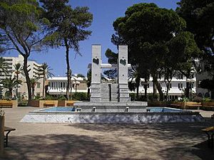
A central park in Misrata
|
|
Nickname(s):
|
|
| Country | |
| Region | Tripolitania |
| District | Misrata |
| Elevation | 10 m (30 ft) |
| Population
(2024)
|
|
| • Total | 1,011,000 |
| Demonym(s) | Misrati |
| Time zone | UTC+2 (EET) |
| Area code(s) | 31 |
| License Plate Code | 3 |
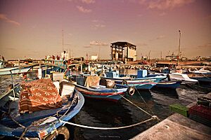
Misrata (pronounced miss-RAH-tuh) is a large city in northwestern Libya. It is located on the Mediterranean coast, about 187 kilometers (116 miles) east of Tripoli. With over 1 million people, it is the third-largest city in Libya, after Tripoli and Benghazi. Misrata is known as the economic and trade capital of Libya. Its main harbor is at Qasr Ahmad.
Contents
- What's in a Name? The History of Misrata's Name
- Misrata Through Time: A City's Journey
- Misrata's Location and Look
- Who Lives in Misrata?
- Misrata's Economy: How the City Works
- Learning in Misrata: Education and Universities
- Sports Teams in Misrata
- Getting Around: Transport in Misrata
- Famous People from Misrata
- See also
What's in a Name? The History of Misrata's Name
The name "Misrata" comes from the Misrata tribe. This tribe was part of a larger group called the Hawwara confederacy. Their home for a long time was the coastal area of Tripolitania.
An ancient Greek geographer named Strabo called the area "Cephalae Promentorium." This means it was an important place where land stretched into the sea. The city was also a trading stop built by the Phoenicians over 3,000 years ago. Later, it was known as Thubactis. The name Misrata is also linked to the Berber tribe of Misurata, which means "the sailors."
Misrata Through Time: A City's Journey
Early Days: A Trading Hub
Modern Misrata began around the 7th century AD. This was when Libya first came under the rule of the Caliphate. Some people believe the town existed even earlier, during the Roman Empire. It was known as Thubactis back then.
Misrata was an important stop for caravans and a busy port. Traders from Misrata were famous across the Sahara desert for many centuries. The city was also known for making beautiful luxury carpets.
Ottoman Rule: Trade and Growth
Misrata became part of the Ottoman Empire in 1551. By the early 1800s, it was a major center for Trans-Saharan trade. Caravans carrying gold, leather, and other goods would stop here. Misrata also had good rainfall and underground springs. This allowed its people to grow many crops like wheat, barley, date palms, and olives. The city's carpet industry also grew during this time.
When the Trans-Saharan trade slowed down, Misrata changed. It started having weekly markets instead of just seasonal ones. Farmers focused on growing crops to sell, and many Bedouin people settled in the city. Misrata grew a lot in the late 1800s. New markets, shops, and government buildings were built.
Italian Occupation: New Buildings and Roads
In 1911, Italy invaded Tripolitania. Misrata played a big role in the resistance against the Italian Army during World War I. The city became a base for Libyan and Ottoman forces. It even had its own ammunition factory and printed its own money.
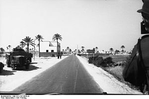
In the 1920s and 1930s, Misrata became a center for Italian colonization. A new part of the town was planned with straight streets. Many public buildings were built, including a new city office, the first hospital, and a large hotel. Important roads like the Via Balbia were built, connecting Misrata with Tripoli and Benghazi.
Independent Libya: Modern Growth
After Libya became independent, Misrata grew very quickly from the 1970s. Two iron and steel factories were built in the city. This brought many Libyans from nearby areas to Misrata. The city's marina (port) was also developed to help the steel plants.
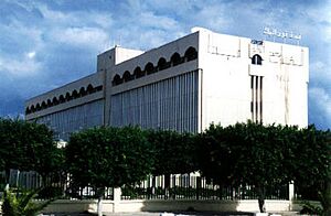
Misrata became a key center for business, education, and government in eastern Tripolitania. It has many government offices, universities, schools, and hospitals. The city's growth has attracted people from many places, making it a diverse and lively city.
The 2011 Revolution: A Time of Change
In 2011, Misrata saw protests as part of a larger uprising in Libya. The city became a place of conflict. With help from NATO forces, anti-government groups gained control of Misrata. After this, Misrata's forces played an important part in other battles during the 2011 Libyan Civil War.
Misrata's Location and Look
Misrata is on the coast of the Mediterranean Sea. It is surrounded by the sea to the north and east. To the south, there are golden sands with palm and olive trees.
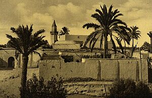
The city has two main parts. The older part has small stone houses and narrow streets. The newer part, built in the 20th century, has modern buildings, factories, and industrial areas. Misrata has good infrastructure, including paved roads, electricity, and communication systems.
Climate: Misrata's Weather
Misrata has a hot semi-arid climate. This means it is generally hot and dry. The city gets some rain, especially in winter. Summers are very hot, and winters are mild.
| Climate data for Misrata (Misrata International Airport) (1991–2020 normals, extremes 1925–2020) | |||||||||||||
|---|---|---|---|---|---|---|---|---|---|---|---|---|---|
| Month | Jan | Feb | Mar | Apr | May | Jun | Jul | Aug | Sep | Oct | Nov | Dec | Year |
| Record high °C (°F) | 30.0 (86.0) |
36.1 (97.0) |
40.0 (104.0) |
45.0 (113.0) |
45.1 (113.2) |
51.1 (124.0) |
47.5 (117.5) |
48.9 (120.0) |
47.8 (118.0) |
46.1 (115.0) |
36.7 (98.1) |
32.4 (90.3) |
51.1 (124.0) |
| Mean daily maximum °C (°F) | 18.0 (64.4) |
18.7 (65.7) |
21.1 (70.0) |
23.8 (74.8) |
27.1 (80.8) |
30.0 (86.0) |
31.7 (89.1) |
32.5 (90.5) |
31.6 (88.9) |
29.0 (84.2) |
24.0 (75.2) |
19.5 (67.1) |
25.6 (78.1) |
| Daily mean °C (°F) | 13.9 (57.0) |
14.3 (57.7) |
16.5 (61.7) |
19.1 (66.4) |
22.2 (72.0) |
25.2 (77.4) |
27.3 (81.1) |
28.2 (82.8) |
27.3 (81.1) |
24.5 (76.1) |
19.5 (67.1) |
15.4 (59.7) |
21.1 (70.0) |
| Mean daily minimum °C (°F) | 9.8 (49.6) |
9.9 (49.8) |
11.8 (53.2) |
14.3 (57.7) |
17.3 (63.1) |
20.4 (68.7) |
23.0 (73.4) |
23.9 (75.0) |
23.0 (73.4) |
19.9 (67.8) |
15.0 (59.0) |
11.2 (52.2) |
16.6 (61.9) |
| Record low °C (°F) | −1.0 (30.2) |
−1.0 (30.2) |
0.1 (32.2) |
0.1 (32.2) |
6.3 (43.3) |
10.1 (50.2) |
13.9 (57.0) |
16.0 (60.8) |
12.0 (53.6) |
6.9 (44.4) |
3.0 (37.4) |
−0.7 (30.7) |
−1.0 (30.2) |
| Average precipitation mm (inches) | 51.6 (2.03) |
31.1 (1.22) |
22.5 (0.89) |
9.5 (0.37) |
3.4 (0.13) |
1.7 (0.07) |
0.0 (0.0) |
1.6 (0.06) |
11.8 (0.46) |
28.7 (1.13) |
39.4 (1.55) |
53.3 (2.10) |
254.6 (10.02) |
| Average precipitation days (≥ 0.1 mm) | 6.6 | 5.5 | 3.2 | 1.6 | 0.6 | 0.4 | 0.0 | 0.3 | 1.4 | 3.3 | 4.6 | 7.2 | 34.7 |
| Average relative humidity (%) | 68.7 | 68.6 | 68.6 | 67.1 | 68.2 | 69.3 | 71.1 | 71.1 | 69.4 | 68.2 | 67.1 | 67.7 | 68.8 |
| Average dew point °C (°F) | 8.0 (46.4) |
8.0 (46.4) |
9.8 (49.6) |
11.7 (53.1) |
14.9 (58.8) |
18.3 (64.9) |
21.2 (70.2) |
22.2 (72.0) |
20.7 (69.3) |
17.2 (63.0) |
12.3 (54.1) |
8.9 (48.0) |
14.4 (57.9) |
| Mean monthly sunshine hours | 182.9 | 217.5 | 238.7 | 255.0 | 316.2 | 303.0 | 378.2 | 353.4 | 273.0 | 238.7 | 213.0 | 179.8 | 3,149.4 |
| Mean daily sunshine hours | 5.9 | 7.7 | 7.7 | 8.5 | 10.2 | 10.1 | 12.2 | 11.4 | 9.1 | 7.7 | 7.1 | 5.8 | 8.6 |
| Source 1: NOAA | |||||||||||||
| Source 2: Deutscher Wetterdienst (extremes 1925–1989), Arab Meteorology Book (sun only) | |||||||||||||
Who Lives in Misrata?
Misrata is home to a large community of people with Turkish origins. They make up about two-thirds of the city's population.
Misrata's Economy: How the City Works
Misrata is known as Libya's business center. It is a clean and well-organized city. The people of Misrata are often seen as very good at business.
Key Industries and Jobs
The city's iron and steel industry is a major source of income and jobs. The government-owned Libyan Iron and Steel Company is a big employer. The port was improved to help bring in raw materials for these factories.
Al-Naseem Dairy, one of the largest private companies in Libya, is also in Misrata. It employs about 750 workers.
Traditional Markets and Shops
A historic part of the local economy is the cloth and textile industry. Near the city's main square, you can find souks (open-air markets). Here, merchants sell beautiful carpets, furniture cloth, and traditional clothing.
Most major businesses, shops, and social places are on Tripoli Street. This is Misrata's main road. After the 2011 conflict, many buildings were damaged. However, small businesses are now rebuilding and reopening.
Learning in Misrata: Education and Universities
Misurata University is located in the city. It has 15 different departments. There are also other higher education schools linked to universities in other Libyan cities. Misurata University was started in 1983. Its goal is to help people get a good education and end illiteracy. The university is known for its teaching, research, and training. It has often been ranked as one of the top universities in Libya.
Sports Teams in Misrata
Misrata has many sports clubs where young people can play and compete:
- Asswehly Sports Club (founded 1944)
- Alittihad Misurata Sports Club (founded 1965)
- Alahly Misurata Sports Club (founded 1974)
- Assabah Sports Club (founded 1976)
- Attahaddy Misurata Sports Club (founded 1979)
- Annajem Arrefi Sports Club (founded 1979)
- Aschumooe Sports Club (founded 1982)
- Attasaddy Misurata Sports Club (founded 1983)
- Aljihad Sports Club (founded 1984)
- Assakhra Sports Club (founded 1984)
Getting Around: Transport in Misrata
Misrata has its own airport, Misurata Airport, which is one of Libya's largest. There is also a port in the nearby town of Qasr Ahmad. In 2019, a bus service started connecting the airport to Tripoli. A railway line was planned in 2008, but it has not been built yet.
Famous People from Misrata
- Ali Elmusrati
- Ahmad Zarruq
- Ramadan Asswehly
See also
 In Spanish: Misurata para niños
 | Jackie Robinson |
 | Jack Johnson |
 | Althea Gibson |
 | Arthur Ashe |
 | Muhammad Ali |


