Morro Peak facts for kids
Quick facts for kids Morro Peak |
|
|---|---|

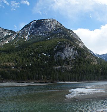
Morro Peak and Athabasca River
|
|
| Highest point | |
| Elevation | 1,679 m (5,509 ft) > |
| Prominence | 109 m (358 ft) |
| Listing | Mountains of Alberta |
| Geography | |
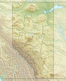
| Location | Jasper National Park Alberta, Canada |
| Parent range | Colin Range Canadian Rockies |
| Topo map | NTS 83E/01 |
| Type of rock | limestone |
| Climbing | |
| Easiest route | Scrambling |
Morro Peak is a mountain summit located in Jasper National Park in Alberta, Canada. It stands about 1,679 meters (5,509 feet) tall. This peak is at the northwest end of the Colin Range, which is a smaller group of mountains within the larger Canadian Rockies.
You can find Morro Peak about 17 kilometers (11 miles) north of the town of Jasper. It's a very noticeable landmark in the Athabasca Valley. You can easily see it from Highway 16 and from the Canadian train. The closest taller mountain is Hawk Mountain, which is about 4.0 kilometers (2.5 miles) to the southeast.
Morro Peak got its name in 1916 from Morrison P. Bridgland. He chose the Spanish word morro, which means rounded hill. This name fits the mountain well because of its shape. Bridgland (1878-1948) was a Dominion Land Surveyor. This means he was a government surveyor who mapped out land. He named many peaks in Jasper Park and other parts of the Canadian Rockies. The mountain's name was officially accepted in 1956 by the Geographical Names Board of Canada.
Weather at Morro Peak
Morro Peak has a type of weather called a subarctic climate. This means it has very cold and snowy winters, but its summers are mild. During winter, temperatures can drop below -20 °C (-4 °F). With the wind blowing, it can feel even colder, sometimes below -30 °C (-22 °F).
If you want to visit or climb Morro Peak, the best time for good weather is usually from June through September. Water from rain and melting snow on Morro Peak flows into the Athabasca River.
 | Mary Eliza Mahoney |
 | Susie King Taylor |
 | Ida Gray |
 | Eliza Ann Grier |


