
Mount Canobolas facts for kids
Quick facts for kids Mount Canobolas |
|
|---|---|

Mount Canobolas from the Pinnacle.
|
|
| Highest point | |
| Elevation | 1,397 m (4,583 ft) |
| Geography | |

Mount Canobolas
Location in New South Wales
|
|
| Location | Central Tablelands, New South Wales, Australia |
| Parent range | Main Range, Great Dividing Range |
| Topo map | Cudal |
| Geology | |
| Mountain type | Extinct volcano |
| Climbing | |
| First ascent | 1835 – Major Thomas Mitchell (European) |
| Easiest route | Drive |
Mount Canobolas is a mountain in the Central Tablelands area of New South Wales, Australia. It is part of the Great Dividing Range.
This mountain is an extinct volcano. It is the highest mountain in its region, standing at 1,390 meters (about 4,560 feet) above sea level. Mount Canobolas is located about 13 kilometers (8 miles) southwest of the city of Orange. It is also about 250 kilometers (155 miles) west of Sydney.
The northern parts of the mountain have very rich volcanic soil. This makes them a great place for growing grapes to make cold-climate wine.
Contents
What's in a Name?
The name "Canobolas" comes from two words in the Wiradjuri language. This is the language of the local Aboriginal people. The words are "gaahna" and "bula," which together mean "two shoulders." This name refers to the two main peaks of the mountain: Mount Canobolas itself and a smaller peak called Young Man Canobolas.
About Mount Canobolas

Mount Canobolas is an extinct volcano. This means it no longer erupts. It had several eruptions between 13 and 11 million years ago. This makes the mountain a fairly new feature in terms of geology.
The first eruptions were not very strong. They produced runny lava that spread over a large area. Later eruptions became more powerful. They created thicker lava that did not spread as far.
Today, you can see many signs of erosion on Mount Canobolas. There are several peaks left from the old volcano. You can also find other volcanic features nearby. These include vents (where lava came out), dykes (old lava cracks), and domes.
The mountain's history has created many different landforms. These provide homes for various plants and animals. For example, rocky areas are home to rare types of lichens. There are also cliffs with waterfalls, like the popular Federal Falls. Mount Canobolas was once listed as important for its geology.
From the top of the mountain, you can see all around for 360 degrees. In winter, the summit often gets covered in snow. You can even see the mountain from up to 100 kilometers (62 miles) away!
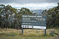
The mountain is now part of the Mount Canobolas Conservation Area. This area covers about 15 square kilometers (5.8 square miles). The NSW National Parks & Wildlife Service looks after it. There are many walking trails here. You can walk to Bald Hill, Young Man Canobolas, or from Federal Falls to Mount Towac. The volcanic peaks offer amazing views, and there are beautiful waterfalls.
Since 1962, the top of the mountain has had many towers. These towers are used for communication, radio, and television. They send signals across large parts of the Central Tablelands. These include towers for TV stations like Australian Broadcasting Corporation, Prime7, Southern Cross Nine, and WIN Television. There are also towers for Airservices Australia and the Royal Australian Air Force.
Every year, the community of Orange holds the Great Volcanic Mountain Challenge. This is an 11-kilometer (6.8-mile) walk and fun run. It goes from the Pinnacle to the Summit of Mount Canobolas. The path passes by other volcanic plugs like Mount Towac and Young Man Canobolas. The first event was held in 2006.
Indigenous Importance
Mount Canobolas is very important to the Wiradjuri people. They are the original Indigenous people of this area. On the peak and nearby, there are several special sites. These include rock carvings, a place where axes were sharpened, and old campsites.
Fires on the Mountain
Mount Canobolas has experienced several bushfires. A large fire in 1967 burned 415 hectares (about 1,025 acres) in the northern part of the conservation area. Another fire in 1982 affected 414 hectares (about 1,023 acres) in the western part. A third fire happened in the southern part in 1985.
In February 2018, another bushfire burned most of the northern area of Mount Canobolas. Because of this fire, the entire Mount Canobolas Conservation Area (except the very top) was closed for a while. This was to fix damage to walking tracks and remove dangerous falling trees.
Fires on Mount Canobolas are not very common. The plants there have grown mostly without many intense fires. However, local landowners say that in the 1940s and 1950s, people used to burn the mountain lightly each year. This helped keep fresh food for their animals.
Highest Point Claims
Sometimes, tourism guides say that Mount Canobolas is the highest point between Australia's Great Dividing Range and Africa. This is not quite true. Other mountains like Mount Zeil in Australia's Northern Territory and Mount Woodroffe in South Australia are further west and taller. Also, some peaks on Madagascar and Réunion are higher.
However, Mount Canobolas is the highest point if you draw a straight line from the Blue Mountains in the east to the western coast of Australia.
Images for kids
-
Mount Canobolas Walks sign

