Mount Collins facts for kids
Quick facts for kids Mount Collins |
|
|---|---|

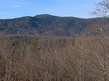
Mount Collins, looking west from Newfound Gap Road
|
|
| Highest point | |
| Elevation | 6,188 ft (1,886 m) |
| Prominence | 465 ft (142 m) |
| Geography | |
| Location | Swain County, North Carolina / Sevier County, Tennessee, U.S. |
| Parent range | Great Smoky Mountains |
| Topo map | USGS Clingmans Dome |
| Climbing | |
| Easiest route | Hike |
Mount Collins is a tall mountain in the Great Smoky Mountains in the southeastern United States. It stands about 6,188 feet (1,886 meters) high. This mountain is a popular spot for hikers, especially those walking the entire Appalachian Trail. It sits right between Clingmans Dome and Newfound Gap.
On the mountain's northeastern side, you'll find a shelter for backpackers and a main trail crossing. The very top of Mount Collins is covered by a special kind of forest. This forest is called the Southern Appalachian spruce–fir forest. It grows in the higher parts of the central Smoky Mountains.
Mount Collins is located on the border between Tennessee and North Carolina. Sevier County is to the north, and Swain County is to the south. The mountain rises about 4,000 feet (1,219 meters) above the area near Bryson City. It is also over 3,000 feet (914 meters) above its base near Meigs Post Prong.
This mountain is one of the tallest in the eastern United States. It is the 7th-highest mountain in Tennessee. It also ranks as the 10th-highest mountain inside the Great Smoky Mountains National Park.
The Sugarland Mountain area connects with the Smokies crest at Mount Collins. This area stretches almost 10 miles (16 kilometers) across the northern part of the park. Two important river systems start high up on the northern slopes of Mount Collins. These are the Little River and the West Fork of the Little Pigeon River.
The Little River flows down to Townsend. It drains the northwestern part of the Smokies. Then it empties into the Little Tennessee River. The Little Pigeon River drains the north-central part of the park. It flows through areas like the Sugarlands, Gatlinburg, Pigeon Forge, and Sevierville. Finally, it joins the French Broad River.
How Mount Collins Got Its Name
Mount Collins is named after Robert Collins. He lived in the Oconaluftee area. In the late 1850s, he guided a scientist named Arnold Henry Guyot across the top of the Smokies.
In 1859, Guyot correctly measured the mountain's height at 6,188 feet (1,886 meters). For a while, the mountain was known as "Meigs Post." This name came from a station built by Return Meigs near the summit.
In 1931, a writer named Horace Kephart wanted the mountain to be named after him. However, people from Tennessee wanted it named after Robert Collins. So, Kephart ended up with a different mountain named after him, Mount Kephart, which is a few miles to the east.
Exploring Mount Collins: Hiking Trails
Many important hiking trails meet at the top of Mount Collins. The famous Appalachian Trail crosses the summit. From here, Clingmans Dome is about 4 miles (6.4 kilometers) to the west. Newfound Gap is just over 3 miles (4.8 kilometers) to the east.
The Sugarland Mountain Trail also meets the Appalachian Trail close to the summit. This trail connects the Smokies crest to the Sugarlands and Elkmont areas to the north. The Mountains-to-Sea Trail also crosses the Appalachian Trail near the summit. This trail connects the Smokies to the Atlantic Ocean. On park maps, this part of the trail is called "Fork Ridge Trail."
The Noland Divide Trail goes down the south side of Mount Collins. It connects the Appalachian Trail to Bryson City, North Carolina. You can get to all these trails from Clingmans Dome Road. This road is usually open from April 1 to December 1. In winter, you can reach the Appalachian Trail from U.S. Route 441 at Newfound Gap.
Mount Collins Shelter
The Mount Collins Shelter is a place where backpackers can stay overnight. It is located along the Sugarland Mountain Trail. It's about half a mile north of where the Sugarland Mountain Trail meets the Appalachian Trail. This shelter can hold up to 12 backpackers.
 | Emma Amos |
 | Edward Mitchell Bannister |
 | Larry D. Alexander |
 | Ernie Barnes |


