Mount Coolon, Queensland facts for kids
Quick facts for kids Mount CoolonQueensland |
|||||||||||||||
|---|---|---|---|---|---|---|---|---|---|---|---|---|---|---|---|

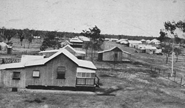
Town of Mount Coolon, 1932
|
|||||||||||||||
| Population | 172 (2021 census) | ||||||||||||||
| • Density | 0.02828/km2 (0.0732/sq mi) | ||||||||||||||
| Postcode(s) | 4804 | ||||||||||||||
| Area | 6,081.0 km2 (2,347.9 sq mi) | ||||||||||||||
| Time zone | AEST (UTC+10:00) | ||||||||||||||
| Location |
|
||||||||||||||
| LGA(s) | Whitsunday Region | ||||||||||||||
| State electorate(s) | Burdekin | ||||||||||||||
| Federal Division(s) | Capricornia | ||||||||||||||
|
|||||||||||||||
Mount Coolon is a small town and area in the Whitsunday Region of Queensland, Australia. It's a rural place, meaning it's mostly countryside with farms and open spaces. In 2021, about 172 people lived there.
Contents
Discovering Mount Coolon's Location
Mount Coolon is in a part of Queensland with lots of natural features. The Suttor River starts here and forms a big part of the town's borders. Another river, the Selheim River, makes up a small part of the northern boundary. The area has many waterholes and hills that are part of the Leichhardt Range.
The Story Behind Mount Coolon's Name
Mount Coolon was first called Koala. But it was later renamed after a person named Thomas Coolon. He was a prospector, someone who searches for valuable minerals like gold. The town's post office opened on May 1, 1925, and stayed open until 1984.
Who Lives in Mount Coolon?
The number of people living in Mount Coolon has changed over the years.
- In 2011, there were 567 people living in the area.
- By 2016, the population was 64 people.
- In 2021, the population grew to 172 people.
Important Places in Mount Coolon
Mount Coolon has some special places that are protected because of their history. These are called heritage-listed sites. They include:
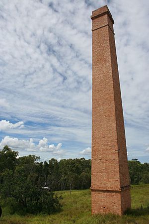
- Barclay's Battery: You can find this on Collinsville Road. A "battery" in this sense is old machinery used to crush rocks to get minerals.
- Suttor River Causeway: This is a crossing over the Suttor River on St Annes Road, part of the old Bowen Downs Road.
Learning and Staying in Mount Coolon
There aren't any schools right in Mount Coolon. The closest government school for both primary and secondary students is Glenden State School, which is to the east. Because it's quite a distance, students often learn through distance education (learning from home) or go to boarding schools.
For visitors or locals, the Mount Coolon Hotel is on Mill Street. It offers meals and a place to stay. The old Mount Coolon State School building is now used as the Mount Coolon Community Centre, a place for local events and gatherings.
 | Delilah Pierce |
 | Gordon Parks |
 | Augusta Savage |
 | Charles Ethan Porter |


