Mount Dungarvan facts for kids
Quick facts for kids Mount Dungarvan |
|
|---|---|

Mount Dungarvan
|
|
| Highest point | |
| Elevation | 2,575 m (8,448 ft) |
| Prominence | 243 m (797 ft) |
| Parent peak | Cloudy Peak (2591 m) |
| Listing | Mountains of Alberta |
| Geography | |
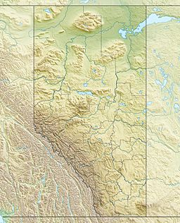
| Location | Alberta, Canada |
| Parent range | Canadian Rockies |
| Topo map | NTS 82H04 |
| Geology | |
| Age of rock | Cambrian |
| Climbing | |
| Easiest route | Scramble |
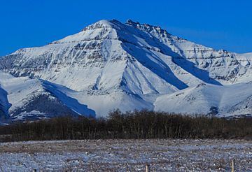
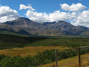
Mount Dungarvan is a mountain in the beautiful Canadian Rockies. It stands tall at 2,575 meters (about 8,448 feet) above sea level. You can find this impressive peak in Waterton Lakes National Park, located in Alberta, Canada.
The mountain's closest higher neighbor is Cloudy Peak. Cloudy Peak is just 2.8 kilometers (about 1.7 miles) to the west.
The Story Behind Mount Dungarvan's Name
Mount Dungarvan received its name in 1943. It was named after a town called Dungarvan in Ireland. Interestingly, the word Dungarvan also means a rough and broken mountain in the Irish language.
The mountain's name was officially recognized in 1943. This was done by the Geographical Names Board of Canada.
How Mount Dungarvan Was Formed
Like many other mountains in Waterton Lakes National Park, Mount Dungarvan is made of sedimentary rock. This type of rock forms from layers of sand, mud, and tiny bits of sea creatures that settle over millions of years. The rocks here were laid down during the Precambrian to Jurassic periods.
Later, during a time called the Laramide orogeny, these sedimentary rocks were pushed eastward. They even slid over younger rocks from the Cretaceous period. The very top of Mount Dungarvan has unique rock formations. These are a series of basalt pinnacles, which are like tall, pointed rock spires, from something called the Purcell Sill.
Weather and Climate Around Mount Dungarvan
Mount Dungarvan is located in a subarctic climate zone. This means it has very cold and snowy winters. The summers are usually mild.
Temperatures can drop quite low, sometimes below -20 °C (-4 °F). With the wind chill, it can feel even colder, going below -30 °C (-22 °F). The snow and rain that fall on the mountain eventually flow into streams and rivers. These streams then join the Waterton River.


