Mount Fray facts for kids
Quick facts for kids Mount Fray |
|
|---|---|
| Highest point | |
| Elevation | 1,893 ft (577 m) |
| Geography | |
| Location | Copake, New York and southwest Berkshire County, Massachusetts |
| Parent range | Taconic Mountains |
| Geology | |
| Age of rock | Ordovician |
| Mountain type | Thrust fault; metamorphic rock |
| Climbing | |
| Easiest route | South Taconic Trail |
Mount Fray is a cool mountain that stands tall at 1,893 feet (577 m) high. It's also known as Catamount because of the Catamount Ski Area found on its northern side. This mountain is a big part of the southern Taconic Mountains, which stretch across parts of southwest Massachusetts and nearby New York.
The very top of Mount Fray is open and covered with small, bushy scrub oak trees. From here, you can see amazing views looking west over the wide Hudson River Valley. The lower parts of the mountain are covered in thick forests with many different kinds of trees, like those found in a northern hardwood area. A long path called the 15.7 mi (25.3 km) South Taconic Trail goes right over the top of Mount Fray, making it a great spot for hikers!
Where is Mount Fray?
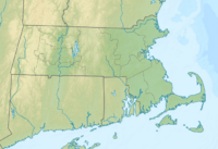
Mount Fray is located in a special spot where three different areas meet. The southern and western parts of the mountain are inside Taconic State Park, which is a public park. The northern side is home to the Catamount Ski area, where people go to ski and snowboard. Other parts of the mountain are owned by private people or are protected for nature.
The top and northeast side of Mount Fray are in a town called Egremont, Massachusetts. The southeast side is part of Mount Washington, Massachusetts. And the western side of the mountain is in Copake, New York.
Water Flowing from the Mountain
Water from Mount Fray flows in different directions!
- The eastern side of the mountain drains into small streams like Kenner Brook and Hubbard Brook. These streams then flow into the Housatonic River, which eventually reaches the Long Island Sound.
- The western side of the mountain sends its water into the Roeliff Jansen Kill. This river then flows into the mighty Hudson River, and that water also ends up in the Long Island Sound.
- Massachusetts Trail Guide (2004). Boston: Appalachian Mountain Club.
 | James Van Der Zee |
 | Alma Thomas |
 | Ellis Wilson |
 | Margaret Taylor-Burroughs |


