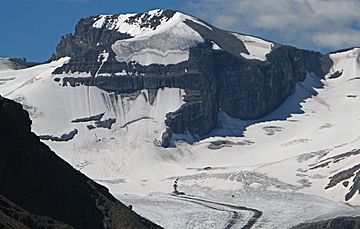
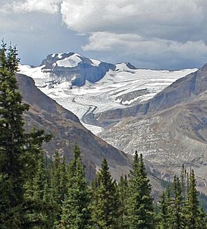
Mount Habel facts for kids
Quick facts for kids Mount Habel |
|
|---|---|

Mount Habel seen from Peyto Lake Overlook
|
|
| Highest point | |
| Elevation | 3,087 m (10,128 ft) |
| Prominence | 232 m (761 ft) |
| Parent peak | Mount Baker (3180 m) |
| Listing | Mountains of Alberta Mountains of British Columbia |
| Geography | |
| Location | Alberta British Columbia |
| Parent range | Waputik Mountains |
| Topo map | NTS 82N/10 |
| Climbing | |
| First ascent | 1923 A. Geoffrion, JWA Hickson, E. Feuz Jr. |
Mount Habel is a tall mountain in the Canadian Rockies. It stands 3,087 meters (about 10,128 feet) high. This mountain is special because it sits right on the Continental Divide of the Americas. This means it's on the border between Alberta and British Columbia. Mount Habel is part of the Waputik Mountains.
The mountain was named in 1986 after a person named Jean Habel. Jean Habel was a geographer from Germany. He explored the Canadian Rockies a long time ago. In 1897, he was the first person to step onto the Wapta Icefield. This large area of ice and snow surrounds Mount Habel.
How Mount Habel Was Formed
Like other mountains in Banff National Park, Mount Habel is made of sedimentary rock. This type of rock forms from layers of sand, mud, and tiny bits of sea creatures. These layers settled at the bottom of ancient seas over millions of years.
The rocks that make up Mount Habel were formed during very old time periods. These include the Precambrian and Jurassic periods. Later, a huge event called the Laramide orogeny happened. During this time, powerful forces pushed the sedimentary rock eastward. This movement caused the rocks to fold and stack up. This is how the tall mountains we see today were created.
Weather at Mount Habel
Mount Habel is located in a subarctic climate zone. This means the weather there is very cold for much of the year. Winters are long and snowy. Temperatures can often drop below -20 °C (which is -4 °F). When the wind blows, it can feel even colder, sometimes below -30 °C (-22 °F). Summers at Mount Habel are usually mild, not too hot.
 | Precious Adams |
 | Lauren Anderson |
 | Janet Collins |


