Mount Irving, Queensland facts for kids
Quick facts for kids Mount IrvingQueensland |
|||||||||||||||
|---|---|---|---|---|---|---|---|---|---|---|---|---|---|---|---|

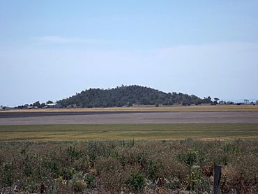
Mount Irving, 2014
|
|||||||||||||||
| Population | 34 (2021 census) | ||||||||||||||
| • Density | 1.98/km2 (5.1/sq mi) | ||||||||||||||
| Postcode(s) | 4401 | ||||||||||||||
| Area | 17.2 km2 (6.6 sq mi) | ||||||||||||||
| Time zone | AEST (UTC+10:00) | ||||||||||||||
| Location |
|
||||||||||||||
| LGA(s) | Toowoomba Region | ||||||||||||||
| State electorate(s) | Condamine | ||||||||||||||
| Federal Division(s) | Groom | ||||||||||||||
|
|||||||||||||||
Mount Irving is a small country area, also called a locality, in Queensland, Australia. It's part of the Toowoomba Region. In 2021, only 34 people lived there.
Contents
Exploring Mount Irving's Location
Mount Irving is located in a famous farming area called the Darling Downs.
The Mount Irving Mountain
The mountain named Mount Irving is in the north-east part of the locality. Its highest point is about 463 meters (1,519 feet) above sea level. The flat land around it is about 400 meters (1,312 feet) high.
Roads and Land Use
The Toowoomba–Cecil Plains Road passes through Mount Irving. It enters from the south-east and forms the southern border before leaving to the south-west. Most of the land in Mount Irving is used for growing crops. Some areas are also used for grazing animals on natural grasslands.
A Brief History of Mount Irving
The name "Mount Irving" comes from the nearby mountain. The mountain itself was named after Clark Irving. He was a person connected to a large farming property called Warra (or Warra Warra).
Who Lives in Mount Irving?
Mount Irving is a very small community. In 2016, only 15 people lived there. By 2021, the population had grown slightly to 34 people.
Learning Opportunities Near Mount Irving
There are no schools directly in Mount Irving. However, students can attend nearby schools.
Primary School Options
The closest government primary schools are:
- Mount Tyson State School in Mount Tyson, which is to the south.
- Biddeston State School in Biddeston, located to the south-east.
Secondary School Options
For high school students, the nearest government secondary school is Oakey State High School. It is located in Oakey, to the north-east of Mount Irving.
 | Emma Amos |
 | Edward Mitchell Bannister |
 | Larry D. Alexander |
 | Ernie Barnes |


