Mount Jukes (Tasmania) facts for kids
Quick facts for kids Mount Jukes |
|
|---|---|

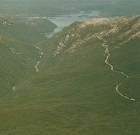
Aerial photograph of lower slopes of Mount Huxley (to the left), King River gorge in the left lower, Crotty Dam and Lake Burbury (to the rear), northern slopes (that is Proprietary Peak) of Mount Jukes on the right, Mount Jukes Road in right foreground, and to the right rear the different coloured upper part of East Jukes Peak.
|
|
| Highest point | |
| Elevation | 1,168 m (3,832 ft) |
| Prominence | 911 m (2,989 ft) |
| Isolation | 23.09 km (14.35 mi) |
| Geography | |
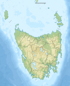
| Location | West Coast, Tasmania, Australia |
| Parent range | Jukes Range, West Coast Range |
| Topo map |
|
| Geology | |
| Age of rock | Jurassic |
Mount Jukes is a mountain located in Tasmania, Australia. It is part of the Jukes Range, which is a branch of the West Coast Range. This mountain is found in the West Coast region of Tasmania.
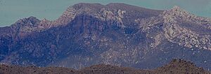
Mount Jukes stands 1,168 metres (3,832 ft) (about 3,832 feet) above sea level. It has several peaks and even some lakes formed by glaciers on its upper eastern slopes. The mountain is located above the town of Crotty and sits west of Lake Burbury.
The mountain was given its name in 1862 by Charles Gould. He named it after Professor Joseph Jukes, an English geologist. Jukes had visited Hobart in 1842-43.
Mining History
Mount Jukes has a history of mining. There were small mines and mining camps located near the lakes and on the northern upper slopes. These areas are close to where the Mount Jukes road goes through the upper parts of the King River Gorge.
These mines were important for getting resources. They also helped provide power to the nearby communities.
Getting Around and Special Features
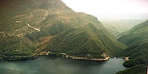
The Mount Jukes Road is about 22 kilometres (14 mi) (14 miles) long. It was built in the 1980s by Hydro when the Crotty Dam was being constructed. This road connects southern Queenstown to Darwin Dam. Before the road, a railway line was used, but it was covered by Lake Burbury.
On the eastern side of Mount Jukes, there are two special lakes formed by glaciers. They are called Upper Lake Jukes and Lower Lake Jukes. These lakes are where several small mines began in the early 1900s.
Other mountains are also nearby. Mount Huxley is to the north of Mount Jukes, and Mount Darwin is to the south.
Peaks and Spurs
Mount Jukes has many different parts, including several named peaks and ridges.
- Jukes Range—This is the ridge that runs between Proprietary Peak in the north and South Jukes Peak.
- Mount Jukes—This is the main peak, standing at 1,168 metres (3,832 ft).
- Proprietary Peak—Located north-west of the main Mount Jukes, it is 1,104 metres (3,622 ft) tall. The Crown Spur is a very noticeable part of this peak when seen from Queenstown.
- Pyramid Peak—This peak reaches 1,080 metres (3,540 ft).
- West Jukes Peak—It stands at 1,062 metres (3,484 ft).
- South Jukes Peak—This peak is 1,014 metres (3,327 ft) high.
- East Jukes Peak—At 731 metres (2,398 ft), this peak is closest to the King River Gorge and the Crotty Dam. It is north of the Mount Jukes Road.
- Central Peak
Other named features on Mount Jukes include Yellow Knob, Yellow Knob Spur, South Jukes Spur, Crown Spur, East Jukes Spur, Intercolonial Spur, Cliff Spur, and Newall Spur. These are all parts of the mountain's unique shape.


