Mount Outram (British Columbia) facts for kids
Quick facts for kids Mount Outram |
|
|---|---|

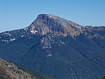
Mt. Outram, west aspect, from Eaton Peak
|
|
| Highest point | |
| Elevation | 2,461 m (8,074 ft) |
| Prominence | 1,121 m (3,678 ft) |
| Parent peak | Castle Peak |
| Geography | |
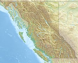
| Location | British Columbia, Canada |
| Parent range | Hozameen Range Canadian Cascades |
| Topo map | NTS 92 H/6 |
| Geology | |
| Mountain type | Intrusive |
| Climbing | |
| First ascent | 1924 F. Perry, H. Selwood, L. Ford, T. Thacker |
| Easiest route | Scrambling |
Mount Outram is a tall mountain peak in southwestern British Columbia, Canada. It stands at 2,461-metre (8,074-foot) high. This mountain is part of the Canadian Cascades and is the fourth-highest peak in the Hozameen Range. It is also the highest point of the Manson Ridge area.
Mount Outram is located about 23 km (14 mi) southeast of Hope. Water flowing from the mountain eventually reaches the Skagit River. The mountain was known as Beaver Mountain before it was officially named Mount Outram on October 6, 1936. It was named after Sir James Outram, 1st Baronet. The first people to climb Mount Outram were Fred Perry, Herbert Selwood, Leslie Ford, and T.L. Thacker on August 12, 1924.
How Mount Outram Formed
Mount Outram was created by a process called intrusion. This means that a large body of molten rock, called the Chilliwack batholith, pushed up from deep inside the Earth. This happened about 26 to 29 million years ago. This area is also part of the Pemberton Volcanic Belt, which was formed by ancient volcanoes. These volcanoes appeared when one of Earth's plates, the Farallon Plate, slid under another plate.
Over two million years ago, during the Pleistocene period (also known as the Ice Ages), huge glaciers covered the land. These glaciers moved across the landscape many times, carving out the valleys. This is why many river valleys in the area have a "U"-shape. The combination of the Earth's crust moving (called uplift and faulting) and the glaciers has created the tall peaks and deep valleys you see in the North Cascades today.
The North Cascades region has some of the most rugged and dramatic landscapes in the Cascade Range. You can see jagged peaks, sharp ridges, deep glacial valleys, and tall granite spires. These geological events created a wide variety of landscapes and big changes in elevation. This leads to different climates and types of plants in various ecoregions. Mount Outram is special because it has many different kinds of "arctic flora," which are plants that grow in cold, northern places.
Weather and Climate
Most of the weather in this region starts over the Pacific Ocean. These weather systems then travel east towards the Cascade Mountains. When they reach the North Cascades, the mountains force the air to rise. As the air goes higher, it cools down and drops its moisture as rain or snow onto the Cascades. This process is called Orographic lift.
Because of this, the western side of the North Cascades gets a lot more rain and snow than the eastern side, especially during the winter. In winter, the weather is usually cloudy. However, during the summer, high-pressure systems over the Pacific Ocean often bring clear skies. Temperatures in winter can drop very low, sometimes below −20 °C (or −4 °F), with wind making it feel even colder. The best time to climb Mount Outram is usually from July through September, when the weather is most favorable.
Climbing Mount Outram
There are several ways to climb Mount Outram. Some of the known routes include:


