Mount Warspite facts for kids
Quick facts for kids Mount Warspite |
|
|---|---|

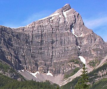
Mount Warspite, northeast face
|
|
| Highest point | |
| Elevation | 2,860 m (9,380 ft) |
| Prominence | 240 m (790 ft) |
| Parent peak | Mount Black Prince (2939 m) |
| Listing | Mountains of Alberta |
| Geography | |
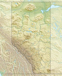
| Location | Alberta, Canada |
| Parent range | Spray Mountains Canadian Rockies |
| Topo map | NTS 82J/11 |
| Climbing | |
| Easiest route | Scrambling |
Mount Warspite is a tall mountain peak in Alberta, Canada. It stands about 2,860 meters (9,383 feet) high. You can find it in Peter Lougheed Provincial Park, which is part of the amazing Canadian Rockies.
This mountain is easy to see from nearby roads. It is especially visible from the Smith-Dorrien Road and Alberta Highway 40. Mount Warspite is close to another peak called Mount Black Prince. That mountain is about 2.4 kilometers (1.5 miles) away.
Why is it Called Mount Warspite?
Many mountains in Kananaskis Country got their names from important events. Mount Warspite was named after a big sea battle. This battle was called the Battle of Jutland. It happened in 1916 during World War I.
The mountain was named in 1917 after a British battleship. This ship was called HMS Warspite. It was a very famous ship in the Royal Navy. The HMS Warspite fought in World War I. Amazingly, it also survived to fight in World War II! The name for the mountain was officially approved in 1922. This was done by the Geographical Names Board of Canada.
How Mount Warspite Was Formed
Mount Warspite is made of sedimentary rock. This type of rock forms from layers of sand, mud, and tiny bits of sea creatures. These layers were laid down over millions of years. This happened during the Precambrian and Jurassic periods.
Long ago, this area was covered by shallow seas. Over time, these rock layers were pushed up. This happened during a major event called the Laramide orogeny. This event created many of the mountains you see in the Rockies today.
Weather and Climate
Mount Warspite is in a subarctic climate zone. This means it has very cold and snowy winters. The summers are usually mild. Winter temperatures can drop below −20 °C (–4 °F). With the wind, it can feel even colder, sometimes below −30 °C (–22 °F).
Rain and melting snow from the mountain flow into small streams. These streams then join the Kananaskis River. Finally, this water flows into the Bow River.
 | Frances Mary Albrier |
 | Whitney Young |
 | Muhammad Ali |


