
Mountainside, New Jersey facts for kids
Quick facts for kids
Mountainside, New Jersey
|
||
|---|---|---|
|
Borough
|
||
|
||

Map of Mountainside in Union County. Inset: Union County highlighted in the State of New Jersey.
|
||

Census Bureau map of Mountainside, New Jersey
|
||

Mountainside, New Jersey
Location in Union County, New Jersey

Mountainside, New Jersey
Location in New Jersey

Mountainside, New Jersey
Location in the United States
|
||
| Country | ||
| State | ||
| County | Union | |
| Incorporated | September 25, 1895 | |
| Government | ||
| • Type | Faulkner Act (mayor–council) | |
| • Body | Borough Council | |
| Area | ||
| • Total | 4.04 sq mi (10.47 km2) | |
| • Land | 4.00 sq mi (10.35 km2) | |
| • Water | 0.04 sq mi (0.12 km2) 1.11% | |
| Area rank | 295th of 565 in state 12th of 21 in county |
|
| Elevation | 233 ft (71 m) | |
| Population
(2020)
|
||
| • Total | 7,020 | |
| • Estimate
(2023)
|
6,924 | |
| • Rank | 319th of 565 in state 19th of 21 in county |
|
| • Density | 1,756.8/sq mi (678.3/km2) | |
| • Density rank | 312th of 565 in state 21st of 21 in county |
|
| Time zone | UTC−05:00 (Eastern (EST)) | |
| • Summer (DST) | UTC−04:00 (Eastern (EDT)) | |
| ZIP Code |
07092
|
|
| Area code(s) | 908 | |
| FIPS code | 3403948510 | |
| GNIS feature ID | 0885311 | |
| Website | ||

Mountainside is a small town, also known as a borough, located in Union County, New Jersey. It's nestled on a ridge in the northern-central part of the state. This area is part of the larger New York metropolitan area.
Mountainside became an official borough on September 25, 1895. This happened after people voted for it, separating the area from Westfield Township.
In 2020, about 7,020 people lived in Mountainside. This was a small increase from the 6,685 people counted in 2010. New Jersey Monthly magazine has often listed Mountainside as one of the "Best Places To Live" in New Jersey.
Contents
History of Mountainside
In 1958, a part of a Nike missile battery was set up near Mountainside. The missile launchers were in Mountainside, while the radar station was in Berkeley Heights. These missiles were used for defense until 1963.
Today, you can still find parts of the control site near Governor Livingston High School. Also, a section of Watchung Reservation that was cleared for the missile launchers is now the Watchung Stables.
Geography and Location
Mountainside covers a total area of about 4.04 square miles (10.47 square kilometers). Most of this is land, with a small amount of water.
The borough shares its borders with several other towns in Union County:
- To the north: Summit
- To the east: Springfield Township
- To the south: Westfield
- To the west: Berkeley Heights and Scotch Plains
Population and People
| Historical population | |||
|---|---|---|---|
| Census | Pop. | %± | |
| 1900 | 367 | — | |
| 1910 | 362 | −1.4% | |
| 1920 | 493 | 36.2% | |
| 1930 | 965 | 95.7% | |
| 1940 | 1,148 | 19.0% | |
| 1950 | 2,046 | 78.2% | |
| 1960 | 6,325 | 209.1% | |
| 1970 | 7,520 | 18.9% | |
| 1980 | 7,118 | −5.3% | |
| 1990 | 6,657 | −6.5% | |
| 2000 | 6,602 | −0.8% | |
| 2010 | 6,685 | 1.3% | |
| 2020 | 7,020 | 5.0% | |
| 2023 (est.) | 6,924 | 3.6% | |
| Population sources: 1900–1920 1900–1910 1910–1930 1940–2000 2000 2010 2020 |
|||
In 2010, there were 6,685 people living in Mountainside. Most residents (over 91%) were White. About 5% were Asian, and nearly 2% were Black or African American. Around 6% of the population identified as Hispanic or Latino.
The average household in Mountainside had about 2.64 people. The average family had about 3.10 people. The median age in the borough was 47.2 years. This means half the people were younger than 47.2 and half were older.
Education in Mountainside
The Mountainside School District serves students from pre-kindergarten up to eighth grade. The district has two schools:
- Beechwood School: For students in PreK through 2nd grade.
- Deerfield School: For students in 3rd through 8th grade.
After eighth grade, students attend Governor Livingston High School in Berkeley Heights. This is part of a special agreement between the school districts. Students also have the option to attend programs at the Union County Vocational Technical Schools. These schools offer specialized training for students from all over Union County.
Emergency Services
The Mountainside Rescue Squad provides emergency medical services (EMS) during nights and weekends. During weekdays, Atlantic Ambulance EMS helps out. They have a paramedic unit stationed right in Mountainside.
Transportation and Roads
_in_Mountainside,_Union_County,_New_Jersey.jpg)
Mountainside has a total of about 41 miles of roads. Most of these roads are maintained by the town itself. The main highways that run through Mountainside are U.S. Route 22 and Interstate 78.
Public Transportation Options
- Bus Service: NJ Transit Bus Operations offers routes 114 and 117, which go to the Port Authority Bus Terminal in Midtown Manhattan, New York City. Routes 65 and 66 travel to Downtown Newark. These buses also make local stops in nearby towns.
- Bus Bypass Shoulder (BBS): A special lane on Route 22 allows buses to bypass traffic during busy hours. This helps buses move faster.
- Air Travel: Newark Liberty International Airport is only about 11 miles east of Mountainside, making air travel convenient.
- Train Service: You can catch an NJ Transit train at Summit station, which is about 2 miles away. This station offers frequent direct service to New York Penn Station. The Westfield station, about 4 miles away, is also an option.
Notable People from Mountainside
Many interesting people have lived in or are connected to Mountainside:
- Erika Amato (born 1969): A singer and actress, known for being a founding member of the band Velvet Chain.
- John W. Campbell (1910–1971): A famous science fiction writer and editor of Astounding Science Fiction magazine.
- Bob Clotworthy (1931–2018): An Olympic diver who won a bronze medal in 1952 and a gold medal in 1956.
- Laurie Collyer (born 1967): A film director, known for movies like Sherrybaby.
- Harry Devlin (born 1918): A cartoonist whose work appeared in magazines like Collier's Weekly.
- Ina Golub (1938–2015): A fiber artist who created beautiful works, especially those related to Judaica.
- Charles J. Irwin (1930–2005): A politician who served in the New Jersey General Assembly.
- Bitty Schram (born 1968): An actress who appeared on the TV show Monk and in the movie A League of Their Own.
- Dale Torborg (born 1971): A conditioning coordinator for the Chicago White Sox and a former professional wrestler.
- Jeff Torborg (born 1941): A former Major League Baseball player and manager.
- Hela Yungst (1950–2002): A television entertainer and beauty pageant winner.
Images for kids
-
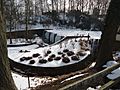
Echo Lake Park in winter

See also
 In Spanish: Mountainside para niños
