Westfield, New Jersey facts for kids
Quick facts for kids
Westfield, New Jersey
|
||
|---|---|---|
|
Town
|
||
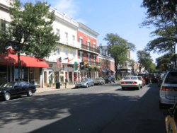
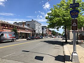
Downtown Westfield
|
||
|
||
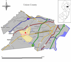
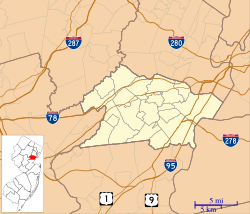
Map of Westfield in Union County. Inset: Location of Union County highlighted in the State of New Jersey.
|
||
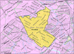
Census Bureau map of Westfield, New Jersey
|
||
| Country | ||
| State | ||
| County | Union | |
| Formed | January 27, 1794 | |
| Incorporated | February 21, 1798 (as township) | |
| Reincorporated | March 4, 1903 (as town) | |
| Government | ||
| • Type | Special charter | |
| • Body | Town Council | |
| Area | ||
| • Total | 6.74 sq mi (17.46 km2) | |
| • Land | 6.72 sq mi (17.42 km2) | |
| • Water | 0.02 sq mi (0.05 km2) 0.28% | |
| Area rank | 246th of 565 in state 5th of 21 in county |
|
| Elevation | 118 ft (36 m) | |
| Population
(2020)
|
||
| • Total | 31,032 | |
| • Estimate
(2023)
|
30,559 | |
| • Rank | 77th of 565 in state 5th of 21 in county |
|
| • Density | 4,615.1/sq mi (1,781.9/km2) | |
| • Density rank | 126th of 565 in state 12th of 21 in county |
|
| Time zone | UTC−05:00 (Eastern (EST)) | |
| • Summer (DST) | UTC−04:00 (Eastern (EDT)) | |
| ZIP Codes |
07090–07091
|
|
| Area code(s) | 908 | |
| FIPS code | 3403979040 | |
| GNIS feature ID | 0885436 | |
Westfield is a town in Union County, New Jersey. It is located about 16 miles southwest of Manhattan. In 2020, the town had a population of 31,032 people. This was a small increase from its population in 2010.
Westfield is known as a high-income community in New Jersey. In 2018, it was ranked among the highest-income places in the United States. It is also considered one of the safest cities to live in the country.
Contents
History of Westfield
Westfield got its name because it was located in the "fields west of Elizabeth Town." For over a hundred years, it was called "West Fields." The first settlement in Westfield dates back to 1699. More settlers arrived around 1720, making it a distinct community.
Westfield officially became a township on January 27, 1794. It was formed from parts of Elizabeth Township. Later, on February 21, 1798, it became one of New Jersey's first 104 townships. In 1857, it became part of the new Union County. Over the years, parts of Westfield Township were used to create other towns like Rahway, Plainfield, Cranford, Scotch Plains, and Mountainside. Finally, on March 4, 1903, Westfield became an official town, replacing the township.
Geography and Location
Westfield covers about 6.74 square miles (17.46 square kilometers). Most of this area is land, with a small amount of water.
Several smaller communities and places are located within Westfield. These include Germantown and Tamaques Reservation Mill.
Westfield shares borders with six other towns:
- Mountainside to the north
- Springfield Township to the northeast
- Garwood and Cranford to the east
- Clark to the southeast
- Scotch Plains to the west and southwest
The Rahway River Parkway runs through Westfield, following parts of the Rahway River. The Robinson's Branch of the Rahway River also flows through the southern part of town. Westfield is about an hour's drive from Manhattan.
Community Life
Downtown Westfield
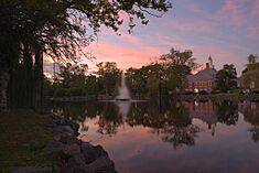
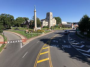
Westfield's downtown area is a lively place with many local and national shops. It also has over 40 restaurants and casual dining spots. The downtown is mostly located north of the train station. It offers a mix of unique local stores and well-known national brands. Many businesses have been there for 25 years or more.
The Downtown Westfield Corporation (DWC) helps manage and improve the downtown area. They work to promote businesses, plan special events, and improve the look of the area. In 2004, Westfield won a national award for its downtown. In 2010, it won the America in Bloom contest for towns of its size. People from all over New Jersey come to Westfield to shop and eat.
Several memorials are in a plaza downtown. These honor those who served in wars and residents who died on September 11. The downtown also hosts events and festivals throughout the year. These include summer jazz performances and the AddamsFest, which celebrates cartoonist Charles Addams.
Westfield Memorial Library
The Westfield Memorial Library started in 1873 as a book club. Today, it is a large, modern building with over 250,000 books. It also has public computers, many multimedia options, and a large area for kids. The library offers classes and storytimes for all ages.
Parks and Recreation
Westfield has several parks for residents to enjoy:
- Brightwood Park
- Gumbert Park
- Lenape Park is a large wildlife reserve and park. It is part of Union County's Rahway River Parkway. A paved path runs through the park, great for walking or biking.
- Mindowaskin Park
- Tamaques Park
- Gary Kehler Stadium is named after a former Westfield High School football coach.
Population and Demographics
| Historical population | |||
|---|---|---|---|
| Census | Pop. | %± | |
| 1810 | 2,152 | — | |
| 1820 | 2,358 | 9.6% | |
| 1830 | 2,492 | 5.7% | |
| 1840 | 3,150 | 26.4% | |
| 1850 | 1,577 | * | −49.9% |
| 1860 | 1,719 | 9.0% | |
| 1870 | 2,753 | 60.2% | |
| 1880 | 2,216 | * | −19.5% |
| 1890 | 2,739 | 23.6% | |
| 1900 | 4,328 | * | 58.0% |
| 1910 | 6,420 | 48.3% | |
| 1920 | 9,063 | * | 41.2% |
| 1930 | 15,801 | 74.3% | |
| 1940 | 18,458 | 16.8% | |
| 1950 | 21,243 | 15.1% | |
| 1960 | 31,447 | 48.0% | |
| 1970 | 33,720 | 7.2% | |
| 1980 | 30,447 | −9.7% | |
| 1990 | 28,870 | −5.2% | |
| 2000 | 29,644 | 2.7% | |
| 2010 | 30,316 | 2.3% | |
| 2020 | 31,032 | 2.4% | |
| 2023 (est.) | 30,559 | 0.8% | |
| Population sources: 1810–1920 1840 1850–1870 1850 1870 1880–1890 1890–1910 1910–1930 1940–2000 2000 2010 2020 * = Lost territory in previous decade. |
|||
In 2020, Westfield had 31,032 people living in 10,426 households. The town's population density was about 4,615 people per square mile. Most residents were White (76.76%), followed by Asian (8.81%), and Black or African American (2.55%). About 7.24% of the population identified as Hispanic or Latino.
In 2010, the town had 30,316 people. The racial makeup was similar, with 88.17% White, 5.67% Asian, and 3.25% Black or African American. About 4.92% of the population was Hispanic or Latino.
Government and Services
Local Government
Westfield is governed by a mayor and an eight-member Town Council. The mayor is elected for a four-year term. Two council members are elected from each of the town's four wards, also for four-year terms. The Town Council meets every two weeks to discuss town matters, and these meetings are open to the public.
As of 2024, the mayor of Westfield is Shelley Brindle. The Town Council members represent different wards and serve staggered terms.
Emergency Services
Westfield has its own police and fire departments, along with a volunteer rescue squad.
Police Department
The Westfield Police Department (WPD) has protected the town since 1903. The chief of police is Christopher Battiloro. The department has different divisions, including Patrol, Traffic Safety, and Detectives. They also manage parking services in the downtown area.
Fire Department
The Westfield Fire Department (WFD) was formed in 1875. It has both paid and volunteer firefighters. The department operates out of two fire stations, providing 24-hour service. They respond to about 2,000 calls each year. All firefighters are trained in CPR, and many are certified EMTs. The WFD also helps other towns in Union County when needed.
Rescue Squad
The Westfield Volunteer Rescue Squad is made up of volunteer certified EMTs. They provide emergency medical services around the clock. The squad has three ambulances and volunteers are always ready to respond to calls.
Federal, State, and County Representation
Westfield is part of the 7th Congressional District for national elections. For state elections, it is in New Jersey's 21st legislative district.
Politics
As of March 2011, Westfield had over 20,000 registered voters. About 31.4% were registered as Democrats, 25.4% as Republicans, and 43.2% as Unaffiliated (not part of a major party).
Education System
Westfield has public schools for students from pre-kindergarten through twelfth grade. The Westfield Public Schools district has 10 schools. As of the 2023–24 school year, there were nearly 6,000 students.
The district includes:
- Lincoln Early Childhood Center (PreK-K)
- Six elementary schools (grades 1-5): Franklin, Jefferson, McKinley, Tamaques, Washington, and Wilson.
- Two middle schools (grades 6-8): Thomas Alva Edison Intermediate School and Roosevelt Intermediate School.
- Westfield High School (grades 9-12).
Students in Union County, including Westfield, can also apply to special vocational-technical schools. These include schools for magnet programs, information technology, health sciences, and performing arts.
Holy Trinity School is a private Catholic school in Westfield. It offers education from pre-kindergarten to 8th grade.
Transportation Options
Roads and Highways
Westfield has over 108 miles of roads. Most are maintained by the town, with some by Union County and the state. The main road through Westfield is Route 28. You can also reach Westfield from the Garden State Parkway (Exits 135 and 137) or U.S. Route 22.
Public Transportation
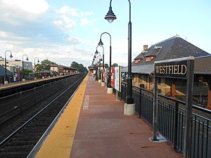
NJ Transit provides train service from the Westfield train station. The Raritan Valley Line connects Westfield to Newark Penn Station. From Newark, you can connect to New York Penn Station. During certain times, trains offer a direct ride to New York Penn Station, taking about 50 minutes.
NJ Transit also offers bus service. The 113 bus goes directly to New York City's Port Authority Bus Terminal. Other bus routes like the 114 and 117 run along Route 22. The 59 route provides local service between Plainfield and Newark.
Newark Liberty International Airport is about 20 minutes away. It can be reached by car or train.
Services for Residents
Verizon Communications provides residential telephone service. Comcast and Verizon FiOS offer cable television and internet. Electricity is supplied by Public Service Electric and Gas Company. Gas is from Elizabethtown Gas, and water from American Water of New Jersey. Recycling is collected every two weeks, and residents arrange for trash collection.
Media and News
Westfield has a local weekly newspaper called The Westfield Leader. Other newspapers like the Courier News and The Star-Ledger also cover the area. Online news sources like Westfield Patch and TAPInto Westfield provide local news updates. A monthly magazine, Westfield + Cranford Local, also covers the two towns.
Westfield Community Television (WCT)
Westfield Community Television (channel 36) operates from the Municipal Building. It shows community programs, town council meetings, and a bulletin board. Blue Devil Television, from Westfield High School, also shares this channel.
Culture
The Metropolis of New Jersey, part of the Greek Orthodox Archdiocese of America, has its headquarters in Westfield.
Notable People
Many interesting people have been born in, lived in, or are connected to Westfield:
- Charles Addams (1912–1988), a famous cartoonist who created The Addams Family.
- Virginia Apgar (1909–1974), a doctor who created the Apgar score to check the health of newborn babies.
- Billy Ard (born 1959), a former NFL football player for the New York Giants.
- Robert L. Barchi (born 1946), the former president of Rutgers University.
- Bryan Beller (born 1971), a bass guitarist who has played with famous musicians.
- Jon Bramnick (born 1953), a New Jersey politician.
- Dave Brown (born 1970), a former NFL quarterback.
- Chris Campbell (born 1954), an Olympic bronze medalist in wrestling.
- Michael Chertoff (born 1953), a former U.S. Secretary of Homeland Security.
- Chris Christie (born 1962), a former Governor of New Jersey.
- Robert S. Dietz (1914–1995), a scientist who studied the ocean floor.
- Tamecka Dixon (born 1975), a former WNBA basketball player.
- Kevin Feige (born 1973), a film producer and head of Marvel Studios.
- Robert Greifeld (born 1957), the former CEO of NASDAQ.
- Langston Hughes (1902–1967), a famous poet.
- Zora Neale Hurston (1891–1960), a folklorist and writer.
- Jared Isaacman (born 1983), an entrepreneur and commercial astronaut.
- Thomas Kean Jr. (born 1968), a New Jersey State Senator.
- Kevin Kelly (born 1952), a founder of Wired magazine.
- Andrew McCarthy (born 1962), an actor.
- Sy Montgomery (born 1958), a naturalist and author.
- Paul Robeson (1898–1976), a famous athlete, actor, singer, and activist.
- John Rzeznik (born 1965), the lead singer of the band Goo Goo Dolls.
- Coleen Sexton (born 1979), a Broadway actress.
- Matthew Sklar (born 1973), a Tony Award-nominated composer for Broadway musicals.
- Jessica St. Clair (born 1976), an actress and comedian.
- Jeff Torborg (born 1941), a former Major League Baseball player and manager.
- P. Roy Vagelos (born 1929), a former chairman and CEO of Merck & Co.
- Malinda Williams (born 1975), an actress.
See also
 In Spanish: Westfield (Nueva Jersey) para niños
 | Valerie Thomas |
 | Frederick McKinley Jones |
 | George Edward Alcorn Jr. |
 | Thomas Mensah |


