Mud Creek Glacier facts for kids
Quick facts for kids Mud Creek Glacier |
|
|---|---|
| Type | Mountain glacier |
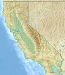
| Location | Mount Shasta, Siskiyou County, California, United States |
| Coordinates | 41°23′16″N 122°11′29″W / 41.38778°N 122.19139°W |
| Terminus | talus |
| Status | retreating |
The Mud Creek Glacier is the southernmost glacier on Mount Shasta in California, USA. It sits on the eastern side of Sargents Ridge, about 10,915 feet (3,327 meters) above sea level. This glacier is smaller than some of the other glaciers on Mount Shasta, like the Whitney, Hotlum, Bolam, and Wintun Glaciers.
California has about 80 glaciers. Unlike many glaciers in places like Alaska, California's glaciers are quite young. They are not left over from the last Ice Age, but formed about 1,000 years ago. The Mud Creek Glacier is one of at least seven glaciers on Mount Shasta that are officially recognized by the United States Geological Survey (USGS). The others are the Whitney, Hotlum, Bolam, Wintun, Konwakiton, and Watkins.
Contents
Discovering the Mud Creek Glacier
Scientists first described the glaciers of Mount Shasta in 1871. This happened after Clarence King climbed the mountain and wrote about the Pacific Northwest.
For a long time, the USGS mainly focused on bigger glaciers like the Whitney and Hotlum. They didn't pay much attention to smaller ones, including the Mud Creek Glacier. But in 1987, while creating new maps of the Pacific Northwest, the USGS officially added the Mud Creek Glacier to their map of Mount Shasta. This is when it became known as one of the mountain's seven main glaciers.
How Glaciers Shape the Land
Glaciers are powerful forces that can change the shape of mountains. You can see many landforms created by glaciers on Mount Shasta. These include Cirques (bowl-shaped hollows), Crevasses (deep cracks in the ice), and moraines (piles of rock and dirt left by glaciers).
Below the Mud Creek Glacier is Mud Creek Canyon. This canyon is a hanging valley, which means it's a valley that ends abruptly, often with a waterfall. It was carved out of Mount Shasta's side as the glacier moved forward about 1,000 years ago. You can see lateral moraines along the sides of the canyon, showing where the glacier once advanced. There are also terminal moraines at the end, which mark where the glacier stopped and then retreated.
At the end of Mud Creek Canyon, there's a beautiful 150-foot (46-meter) waterfall called Mud Creek Falls. This is one of three cascading waterfalls on Mount Shasta that flow over hanging valleys. The others are Ash Creek Falls and Konwakiton Falls.
Dangers from Glaciers
Glaciers on Mount Shasta, including Mud Creek Glacier, can cause natural hazards. Because of loose rock and the fast melting of ice due to warmer temperatures, these glaciers can lead to mudflows and landslides.
There have been floods from these events that caused damage to nearby towns like Weed, McCloud, Dunsmuir, and Shasta. Some of the biggest events in history have come from the Mud Creek Glacier. For example, in 2014, part of the Mud Creek Glacier melted. This caused a huge mudflow in Mud Creek that carried thousands of tons of rock and debris. It destroyed roads and bridges in its path.
Fun on Mount Shasta
Mount Shasta is a very popular place for outdoor activities and mountaineering in California. It stands tall at 14,162 feet (4,317 meters) above sea level.
There are several paths climbers can take to reach the top of Mount Shasta. One route starts at the Crystal Creek trailhead. This path goes up Sergeants Ridge, where you can see the Mud Creek Glacier. As you hike, you'll cross over lateral moraines and loose rocky areas made mostly of volcanic rock.


