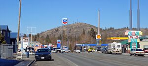
Weed, California facts for kids
Quick facts for kids
Weed, California
|
|
|---|---|
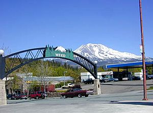
Entrance to Weed in 2004, with Mount Shasta in the background
|
|
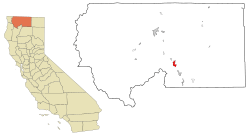
Location in Siskiyou County and the U.S. state of California
|
|
| Country | |
| State | |
| County | Siskiyou |
| Incorporated | January 25, 1961 |
| Area | |
| • Total | 4.79 sq mi (12.40 km2) |
| • Land | 4.78 sq mi (12.38 km2) |
| • Water | 0.01 sq mi (0.01 km2) 0.10% |
| Elevation | 3,425 ft (1,044 m) |
| Population
(2020)
|
|
| • Total | 2,862 |
| • Density | 597.5/sq mi (230.81/km2) |
| Time zone | UTC-8 (Pacific (PST)) |
| • Summer (DST) | UTC-7 (PDT) |
| ZIP code |
96094
|
| Area code(s) | 530 |
| FIPS code | 06-83850 |
| GNIS feature ID | 1652650 |
Weed is a city in Siskiyou County, California, United States. In 2020, about 2,862 people lived there. It is located near Mount Shasta, a very tall volcano in California.
Weed's city motto is "Weed like to welcome you". The city's name is often noticed because it sounds unusual.
Contents
History of Weed
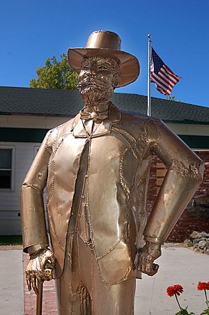
The city of Weed is named after its founder, Abner Weed. He started a lumber mill here. Abner Weed noticed that the strong winds in the area were great for drying wood. In 1897, he bought the mill and 280 acres of land for $400. By the 1940s, Weed had one of the biggest sawmills in the world.
Fires in Weed
Weed has faced challenges from wildfires.
The Boles Fire
On September 15, 2014, the Boles Fire quickly spread through Weed. Strong winds of 40 miles per hour pushed the fire. It started in the afternoon and grew very fast. People had to leave their homes right away.
Over 200 buildings were damaged or destroyed. This included two churches and parts of the elementary and high schools. Many homes were lost. Power was also lost for thousands of people in Weed and nearby Mt. Shasta.
The Mill Fire
In early September 2022, the Mill Fire also started near Weed. This fire burned down the Lincoln Heights neighborhood.
Weed's Water Source
The city of Weed gets its water from the Beaughan Spring. This spring water is piped directly to homes.
In 2016, there was a discussion about the city's water. A French bottled water company wanted more water from the spring. This would have meant Weed might lose its public water supply. However, in 2021, a solution was found. Weed will continue to have access to water from Beaughan Spring forever.
Where is Weed Located?
Weed is located off Interstate 5. This major highway runs north and south along the west coast of the United States. Weed is about 49 miles south of the border between California and Oregon.
To the north on I-5 is Yreka. To the south is the City of Mount Shasta. U.S. Route 97 goes northeast from Weed towards Klamath Falls, Oregon.
The city covers about 4.8 square miles of land. Only a tiny part is covered by water. The closest larger cities are Redding, California (69 miles south) and Medford, Oregon (91 miles north).
Weed's Climate
Weed has a warm-summer Mediterranean climate. This means it has cool, wet winters with some snow. Summers are hot and dry. The city gets about 23.64 inches of rain each year.
| Weather chart for Weed (1971-2000 normals) | |||||||||||||||||||||||||||||||||||||||||||||||
|---|---|---|---|---|---|---|---|---|---|---|---|---|---|---|---|---|---|---|---|---|---|---|---|---|---|---|---|---|---|---|---|---|---|---|---|---|---|---|---|---|---|---|---|---|---|---|---|
| J | F | M | A | M | J | J | A | S | O | N | D | ||||||||||||||||||||||||||||||||||||
|
3.7
44
24
|
3.3
49
28
|
3.5
54
30
|
1.9
60
33
|
1.4
68
38
|
0.8
77
44
|
0.3
85
48
|
0.4
85
48
|
0.5
78
41
|
1.4
66
34
|
3.1
51
29
|
3.7
44
25
|
||||||||||||||||||||||||||||||||||||
| temperatures in °F precipitation totals in inches source: Western Regional Climate Center |
|||||||||||||||||||||||||||||||||||||||||||||||
|
Metric conversion
|
|||||||||||||||||||||||||||||||||||||||||||||||
| Climate data for Weed, CA | |||||||||||||
|---|---|---|---|---|---|---|---|---|---|---|---|---|---|
| Month | Jan | Feb | Mar | Apr | May | Jun | Jul | Aug | Sep | Oct | Nov | Dec | Year |
| Record high °F (°C) | 64 (18) |
73 (23) |
78 (26) |
86 (30) |
95 (35) |
99 (37) |
102 (39) |
103 (39) |
101 (38) |
90 (32) |
73 (23) |
63 (17) |
103 (39) |
| Mean daily maximum °F (°C) | 43.5 (6.4) |
48.2 (9.0) |
52.0 (11.1) |
58.2 (14.6) |
67.3 (19.6) |
77.4 (25.2) |
85.4 (29.7) |
85.1 (29.5) |
76.5 (24.7) |
65.9 (18.8) |
51.3 (10.7) |
44.1 (6.7) |
62.9 (17.2) |
| Mean daily minimum °F (°C) | 26.9 (−2.8) |
28.5 (−1.9) |
30.4 (−0.9) |
33.6 (0.9) |
39.0 (3.9) |
45.8 (7.7) |
51.0 (10.6) |
49.5 (9.7) |
44.0 (6.7) |
37.0 (2.8) |
31.0 (−0.6) |
26.7 (−2.9) |
36.9 (2.8) |
| Record low °F (°C) | −8 (−22) |
−1 (−18) |
8 (−13) |
14 (−10) |
18 (−8) |
25 (−4) |
29 (−2) |
30 (−1) |
24 (−4) |
15 (−9) |
2 (−17) |
−12 (−24) |
−12 (−24) |
| Average precipitation inches (mm) | 4.08 (104) |
3.85 (98) |
3.20 (81) |
2.10 (53) |
1.48 (38) |
0.99 (25) |
0.29 (7.4) |
0.24 (6.1) |
0.51 (13) |
1.49 (38) |
3.19 (81) |
4.17 (106) |
25.59 (650.5) |
| Average snowfall inches (cm) | 5.2 (13) |
3.7 (9.4) |
3.7 (9.4) |
1.1 (2.8) |
0.0 (0.0) |
0.0 (0.0) |
0.0 (0.0) |
0.0 (0.0) |
0.0 (0.0) |
0.0 (0.0) |
2.2 (5.6) |
4.7 (12) |
20.6 (52.2) |
| Source: NOAA | |||||||||||||
Getting Around Weed
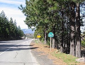
Weed is a key point for travel because Interstate 5 and U.S. Route 97 meet there. These highways connect many parts of the country. California State Route 265 also runs through Weed. It is one of the shortest state highways in California.
Public buses called "The STAGE" serve Siskiyou County, including Weed. For air travel, the closest airports are in Medford, Oregon, and Redding, California. Weed also has a small airport for private planes. It is used for search and rescue missions on Mount Shasta.
While Amtrak trains pass through Weed, they do not stop. However, an Amtrak bus shuttle does have a stop in South Weed. The nearest train station is in Dunsmuir, about 15 miles south. Greyhound Bus Lines also has a bus station in Weed.
Weed's Economy
For many years, Weed's main industry was lumber. From its founding in 1901 until the 1980s, large lumber companies operated here. These included Roseburg Forest Products and International Paper Company.
Today, the lumber industry is smaller. Weed's economy now relies more on tourism. Businesses like the Mt. Shasta Brewing Company get most of their customers from tourists. New businesses, including a bottled water company called Crystal Geyser Water Company, have also helped the economy.
Weed is part of the Shasta Valley Enterprise Zone. This zone offers benefits like tax breaks to companies that move there. This helps create jobs.
In 2007, the biggest employers in Weed were:
- College of the Siskiyous (100–249 employees)
- Roseburg Forest Products (100–249 employees)
- Crystal Geyser CG Roxane (25–99 employees)
- Weed Union Elementary School District (25–99 employees)
In 2014, voters in Weed approved a small sales tax increase.
Education in Weed
Weed has schools for all ages.
- Weed Elementary School teaches students from kindergarten to 8th grade.
- Butteville Elementary School is just outside Weed and also serves K-8th grade.
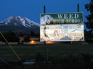
- Weed High School is for students in grades 9-12. It is known for its beautiful campus and diverse students.
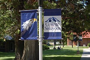
- College of the Siskiyous is a two-year college located in Weed. It offers many programs and provides jobs for teachers and staff. It also brings visitors to the area.
Fun Things to Do in Weed
Weed is a great place for outdoor adventures and exploring history. Many visitors use Weed as a starting point for their trips.
Outdoor Activities
- Fishing: You can go trout fishing in nearby rivers like the Klamath, Sacramento, and McCloud.
- Mountain Adventures: People come to see and climb Mount Shasta, Castle Crags, or the Trinity Alps.
- Winter Sports: You can go skiing (both downhill and cross-country) at Mount Shasta Ski Park. In summer, the park offers mountain biking and concerts.
- Hiking and Lakes: There are many waterfalls, streams, and lakes to explore. These include Mossbrae Falls, Lake Siskiyou, Castle Lake, and Shasta Lake.
- Windsurfing: The strong winds that helped dry lumber now make Lake Shastina a popular spot for windsurfing.
- Snowmobiling: The Deer Mountain Snowmobile Park is northeast of Weed and has 250 miles of trails.
Parks and Recreation Areas
- State and National Parks: Weed is close to Castle Crags State Park, Lava Beds National Monument, and Lower Klamath National Wildlife Refuge.
- Local Parks: The Weed Parks and Recreation District manages local parks.
- Charles Byrd Community Park (formerly Lincoln Park) is an 11-acre park with restrooms, a playground, and basketball courts. It also has the Weed Skatepark.
- Bel Air Park is next to the College of the Siskiyous and has a community swimming pool.
- Scenic Routes: Weed is on the Volcanic Legacy Scenic Byway. It is also a short distance from the Pacific Crest Trail, a famous long-distance hiking trail.
- Golf: The Lake Shastina Golf Resort offers an 18-hole golf course and a 9-hole course.
History and Museums
- Weed Historic Lumber Town Museum: This small museum in Weed shows sawmill machines and items from the city's early days.
- Veterans' Living Memorial Sculpture Garden: About 13 miles northeast of Weed, this garden has steel sculptures and other memorials honoring U.S. veterans.
People of Weed
| Historical population | |||
|---|---|---|---|
| Census | Pop. | %± | |
| 1950 | 2,739 | — | |
| 1960 | 3,223 | 17.7% | |
| 1970 | 2,983 | −7.4% | |
| 1980 | 2,879 | −3.5% | |
| 1990 | 3,062 | 6.4% | |
| 2000 | 2,978 | −2.7% | |
| 2010 | 2,967 | −0.4% | |
| 2020 | 2,862 | −3.5% | |
| 2023 (est.) | 2,574 | −13.2% | |
| U.S. Decennial Census | |||
In 2010, Weed had a population of 2,967 people. Most residents lived in homes. The average household had about 2.49 people.
Weed has a diverse population. Many different groups of people have moved to Weed over the years. This happened because of the jobs available in the lumber industry.
Italian and African American Communities
Many Italian immigrants came to Weed in the early 1900s to work in the lumber mills. They became an important part of Weed's community life. Some streets in the old Italian neighborhood are named after Italian cities like Rome and Venice. Every year, Weed holds the Weed Carnevale, which used to be called the Italian Carnevale. It often includes traditional bocce ball games.
A large number of African Americans also moved to Weed. This happened when a lumber company closed mills in Louisiana and offered jobs and housing in Weed in 1922.
More recently, people from Mexico and Laos have moved to Weed. Because of these different groups, Weed is more diverse than other parts of Siskiyou County.
Notable People from Weed
- Mario Pastega (1916–2012), a businessman and helper, was born in Weed.
- Pamela Courson (1946–1974), who was with Jim Morrison of The Doors, was born in Weed.
- Aaron Thomas (1937–2024), an NFL football player, grew up in Weed and went to Weed High School.
- Maurice A. Preston, a general.
Local Media
Weed has a few local media options:
- Radio stations like KHWA and KZRO-FM.
- MCTV 15, a community TV channel at College of the Siskiyous.
- Weed Press is the city's official newspaper.
See also
 In Spanish: Weed (California) para niños
 | Victor J. Glover |
 | Yvonne Cagle |
 | Jeanette Epps |
 | Bernard A. Harris Jr. |


