Mount Shasta, California facts for kids
Quick facts for kids
Mount Shasta, California
|
|
|---|---|
| City of Mount Shasta | |

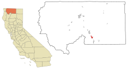
Location in Siskiyou County and the state of California
|
|
| Country | |
| State | |
| County | Siskiyou |
| Incorporated | May 31, 1905 |
| Area | |
| • Total | 3.77 sq mi (9.76 km2) |
| • Land | 3.77 sq mi (9.75 km2) |
| • Water | 0.00 sq mi (0.01 km2) 0.10% |
| Elevation | 3,586 ft (1,093 m) |
| Population
(2020)
|
|
| • Total | 3,223 |
| • Density | 854.9/sq mi (330.23/km2) |
| Time zone | UTC−8 (Pacific (PST)) |
| • Summer (DST) | UTC−7 (PDT) |
| ZIP Code |
96067
|
| Area code(s) | 530 |
| FIPS code | 06-49852 |
| GNIS feature IDs | 277559, 2411181 |
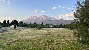
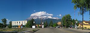
Mount Shasta (also called Mount Shasta City) is a city in Siskiyou County, California, United States. It sits about 3,600 feet (1,093 meters) above sea level. The city is on the side of Mount Shasta, a famous volcano in northern California. The city is less than 9 miles (14 km) southwest of the volcano's top. In 2020, about 3,223 people lived there. This number was a little lower than in 2010.
Contents
History of Mount Shasta City
The area where Mount Shasta City is today was once home to the Okwanuchu tribe. They were a group of Native Americans.
In the 1820s, early European-American trappers and hunters came through this area. They followed an old path called the Siskiyou Trail. This trail was made up of ancient Native American footpaths. It connected California with the Pacific Northwest.
When gold was found near Yreka, California in 1851, many more people used the Siskiyou Trail. This meant more travelers came through the future site of Mount Shasta. A pioneer named Ross McCloud built one of the first sawmills here. It was close to where the Sisson Museum is now.
By the late 1850s, a stagecoach road was finished. It ran between Yreka and Upper Soda Springs. This led to the building of Sisson's Hotel. It was a place for tired travelers to rest. It was also a starting point for brave tourists who wanted to climb Mount Shasta.
The town was first known as Strawberry Valley. Later, it was called Berryvale. The post office opened as Berryvale in 1870. After 1886, the town was named Sisson. This was after a local businessman, Justin Hinckley Sisson. He ran an inn and tavern called Strawberry Valley Station. He also gave land for the town and the Central Pacific Railroad station in 1886. Some street names in the city still honor Sisson's family.
In 1887, the Central Pacific Railroad was completed. It followed the path of the Siskiyou Trail. This brought many more tourists, logging businesses, and people to Mount Shasta. The town continued to grow, focusing on tourism and lumber. In the early 1900s, many Italian immigrants moved to Mount Shasta. Most of them worked in the timber industry.
The city officially became a city on May 31, 1905. After a public vote in 1922, its name was officially changed to "City of Mount Shasta" on November 10, 1925.
Geography and Climate
Mount Shasta City is located at 41°18'52" North, 122°18'41" West. It is along Interstate 5. The city is south of Weed and north of Dunsmuir, California.
The city covers about 3.8 square miles (9.8 square kilometers) of land. Only a tiny part of it, about 0.10%, is covered by water.
Water in the area comes from a small stream in the south. This stream joins Big Springs Creek. Big Springs Creek then flows south as Cold Creek. It eventually joins the beginning of the South Fork of the Sacramento River. The ground water here is usually very close to the surface.
The city sits on the gently sloping southwest side of Mount Shasta. The soil is mostly made of Quaternary alluvium. This is soil and rock deposited by water. This soil is likely on top of volcanic rock from Mount Shasta.
Weather in Mount Shasta
Mount Shasta is a large mountain. It makes the air rise and cool, which causes moisture to fall as rain or snow. Because of this, Mount Shasta City gets a lot of precipitation. It gets more than the drier areas to the north.
In winter, the city often gets a lot of snow. It can get almost 103 inches (2.6 meters) of snow. This is a lot, especially since the city is only about 3,600 feet (1,093 meters) high. Other nearby towns get much less snow. For example, Yreka gets only about 11.8 inches (0.3 meters) of snow.
The climate here is called a Csb or warm-summer Mediterranean climate. This means it has warm, dry summers and mild, wet winters.
The highest temperature ever recorded was 106°F (41°C) on July 29, 2022. The lowest temperature was -13°F (-25°C) on December 22, 1990. The most snow in one year was 349.6 inches (8.88 meters) in 1952. The most snow on the ground at one time was 52 inches (1.3 meters) on December 31, 1992.
| Climate data for Mount Shasta, California, 1991–2020 normals, extremes 1948–present | |||||||||||||
|---|---|---|---|---|---|---|---|---|---|---|---|---|---|
| Month | Jan | Feb | Mar | Apr | May | Jun | Jul | Aug | Sep | Oct | Nov | Dec | Year |
| Record high °F (°C) | 68 (20) |
71 (22) |
80 (27) |
87 (31) |
96 (36) |
103 (39) |
106 (41) |
105 (41) |
103 (39) |
93 (34) |
80 (27) |
72 (22) |
106 (41) |
| Mean maximum °F (°C) | 58.5 (14.7) |
62.3 (16.8) |
69.5 (20.8) |
77.2 (25.1) |
86.0 (30.0) |
91.7 (33.2) |
96.3 (35.7) |
95.3 (35.2) |
91.5 (33.1) |
81.5 (27.5) |
67.6 (19.8) |
55.9 (13.3) |
97.5 (36.4) |
| Mean daily maximum °F (°C) | 44.4 (6.9) |
47.6 (8.7) |
52.7 (11.5) |
59.0 (15.0) |
68.1 (20.1) |
76.0 (24.4) |
85.2 (29.6) |
84.3 (29.1) |
77.9 (25.5) |
64.3 (17.9) |
50.1 (10.1) |
42.7 (5.9) |
62.7 (17.1) |
| Daily mean °F (°C) | 35.8 (2.1) |
37.9 (3.3) |
41.9 (5.5) |
46.5 (8.1) |
54.2 (12.3) |
61.1 (16.2) |
68.1 (20.1) |
66.8 (19.3) |
61.0 (16.1) |
50.9 (10.5) |
40.5 (4.7) |
34.8 (1.6) |
50.0 (10.0) |
| Mean daily minimum °F (°C) | 27.2 (−2.7) |
28.1 (−2.2) |
31.0 (−0.6) |
34.1 (1.2) |
40.4 (4.7) |
46.2 (7.9) |
51.0 (10.6) |
49.4 (9.7) |
44.2 (6.8) |
37.5 (3.1) |
30.9 (−0.6) |
26.9 (−2.8) |
37.2 (2.9) |
| Mean minimum °F (°C) | 15.1 (−9.4) |
17.1 (−8.3) |
20.7 (−6.3) |
24.6 (−4.1) |
30.1 (−1.1) |
36.5 (2.5) |
42.5 (5.8) |
41.5 (5.3) |
34.4 (1.3) |
26.3 (−3.2) |
18.1 (−7.7) |
13.7 (−10.2) |
9.9 (−12.3) |
| Record low °F (°C) | −2 (−19) |
−3 (−19) |
11 (−12) |
14 (−10) |
21 (−6) |
25 (−4) |
32 (0) |
34 (1) |
25 (−4) |
15 (−9) |
6 (−14) |
−13 (−25) |
−13 (−25) |
| Average precipitation inches (mm) | 7.11 (181) |
7.44 (189) |
6.18 (157) |
3.23 (82) |
2.23 (57) |
1.23 (31) |
0.23 (5.8) |
0.21 (5.3) |
0.53 (13) |
2.18 (55) |
4.28 (109) |
7.78 (198) |
42.63 (1,083.1) |
| Average snowfall inches (cm) | 18.2 (46) |
19.5 (50) |
13.3 (34) |
5.4 (14) |
0.3 (0.76) |
0.0 (0.0) |
0.0 (0.0) |
0.0 (0.0) |
0.0 (0.0) |
0.2 (0.51) |
9.0 (23) |
23.1 (59) |
89 (227.27) |
| Average precipitation days (≥ 0.01 in) | 13.2 | 12.8 | 13.2 | 11.2 | 9.0 | 4.9 | 1.8 | 1.5 | 2.7 | 6.1 | 10.8 | 13.9 | 101.1 |
| Average snowy days (≥ 0.1 in) | 6.3 | 5.6 | 4.3 | 2.9 | 0.2 | 0.0 | 0.0 | 0.0 | 0.0 | 0.3 | 3.0 | 6.9 | 29.5 |
| Source 1: NOAA | |||||||||||||
| Source 2: National Weather Service | |||||||||||||
Population of Mount Shasta City
| Historical population | |||
|---|---|---|---|
| Census | Pop. | %± | |
| 1890 | 556 | — | |
| 1910 | 636 | — | |
| 1920 | 542 | −14.8% | |
| 1930 | 1,009 | 86.2% | |
| 1940 | 1,618 | 60.4% | |
| 1950 | 1,909 | 18.0% | |
| 1960 | 1,936 | 1.4% | |
| 1970 | 2,256 | 16.5% | |
| 1980 | 2,837 | 25.8% | |
| 1990 | 3,460 | 22.0% | |
| 2000 | 3,621 | 4.7% | |
| 2010 | 3,394 | −6.3% | |
| 2020 | 3,223 | −5.0% | |
| U.S. Decennial Census | |||
In 2010, the population of Mount Shasta was 3,394 people. Most residents, about 89.6%, were White. About 8.2% of the population was Hispanic or Latino.
There were 1,664 households in the city. About 24.1% of these households had children under 18 living there. Many households, 43.2%, were made up of single individuals. About 17.1% of these individuals were 65 years old or older. The average household had about 2 people.
The population included 20.4% under 18 years old. About 18.2% were 65 years or older. The average age in the city was 45.7 years.
In 2000, the city had 3,621 people. There were 1,669 households. The average household income was $26,500. About 19.4% of the people lived below the poverty line.
Economy and Activities
Mount Shasta City is in the Shasta Cascade area of Northern California. Many visitors come to the city for outdoor activities.
People enjoy trout fishing in nearby rivers. These include the Sacramento, McCloud, and Klamath rivers. The city is also a great base for climbing Mount Shasta. Other climbing spots are Castle Crags or the Trinity Alps.
Visitors also come to see the beautiful scenery. You can go alpine or cross-country skiing nearby. There are also trails for biking or hiking to waterfalls, streams, and lakes. Popular spots include Mossbrae Falls, Lake Siskiyou, Castle Lake, and Shasta Lake.
Media and News
Mount Shasta City has several local media options. These include radio stations and a newspaper.
- KHWA 99.3/102.3 FM Jefferson Public Radio
- KZRO-FM 100.1 Mount Shasta
- KKLC 107.9 K-LOVE, Fall River Mills
- KNSQ-FM 88.1 Jefferson Public Radio, Mount Shasta
- KLDD-FM 91.9 Jefferson Public Radio, Mount Shasta
- KMJC-AM 620 Jefferson Public Radio, Mount Shasta
- Mount Shasta Herald (local newspaper)
- Vyve Broadband (internet and TV)
- MCTV 15 Mountain Community Television/Siskiyou Media Council (local TV)
Famous People from Mount Shasta
Several notable people have connections to Mount Shasta City.
- Terry Huntingdon – She was Miss California USA in 1959 and Miss USA in 1959.
- Ann Little – A silent-film actress.
- Anita Loos – A writer and author of the movie script Gentlemen Prefer Blondes. She was born in Sisson (now Mount Shasta) in 1888.
- Tony Olmos – A film director and screenwriter.
- Jason Sehorn – A former NFL cornerback. He graduated from Mount Shasta High School in 1989.
- D. J. Wilson – A basketball player. He was a first-round pick in the 2017 NBA draft and was born in Mount Shasta.
See also
 In Spanish: Mount Shasta (California) para niños
 | John T. Biggers |
 | Thomas Blackshear |
 | Mark Bradford |
 | Beverly Buchanan |


