Muncaster Mountain facts for kids
Quick facts for kids Muncaster Mountain |
|
|---|---|
 |
|
| Highest point | |
| Elevation | 5,910 ft (1,800 m) |
| Prominence | 990 ft (300 m) |
| Isolation | 2.72 mi (4.38 km) |
| Parent peak | June 10th Peak (6,019 ft) |
| Geography | |
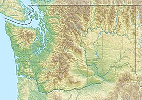
| Location | Olympic National Park Jefferson County, Washington, US |
| Parent range | Olympic Mountains |
| Topo map | USGS Mount Christie |
| Geology | |
| Age of rock | Eocene |
| Climbing | |
| First ascent | 1941 |
| Easiest route | class 3 scrambling via Quinualt River trail |
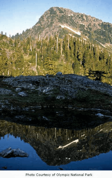
Muncaster Mountain is a mountain peak about 5,910 feet (1,801 meters) high. It is located inside Olympic National Park in Jefferson County, Washington state.
The mountain is about 4.4 miles (7.1 km) south-southeast of Mount Christie. It is also about 14.6 miles (23.5 km) southeast of Mount Olympus. Rain and melted snow from Muncaster Mountain flow into Rustler Creek, which then joins the Quinault River. Even though it's not the tallest mountain, it rises very steeply! The top of the mountain is 4,000 feet (1,219 meters) higher than the Rustler Creek valley, all within just one mile.
Mountain's Name and First Climb
The Seattle Press Expedition, a group that explored the Olympic Mountains in 1889–1890, first named this peak "Mount DeYoung." They named it after M. H. de Young, who was involved with the San Francisco Chronicle newspaper.
Later, the mountain was renamed to honor a brave soldier named Roy Muncaster (1892–1918). He was a U.S. Army Private and also worked as a forest ranger for the Olympic National Forest. Sadly, he drowned on February 5, 1918. This happened when his troop transport ship, the SS Tuscania, was hit by a torpedo and sunk during World War I. The name Muncaster Mountain was officially approved in 1918 by the United States Board on Geographic Names, a group that decides names for places in the U.S.
The very first ascent (first time someone successfully climbed to the top) of Muncaster Mountain happened in 1941. It was climbed by T. Nelson, who worked for the United States Geological Survey.
Weather and Climate
Muncaster Mountain is in a "marine west coast" climate zone. This means it has weather similar to coastal areas, with lots of rain. Most of the weather systems that bring rain and snow start over the Pacific Ocean. These systems then travel northeast towards the Olympic Mountains.
When these weather systems reach the Olympic Range, the mountains force the air to rise. As the air goes higher, it cools down and drops its moisture. This causes a lot of rain or snow to fall on the mountains. This effect is called Orographic lift. Because of this, the Olympic Mountains get a lot of precipitation, especially in the winter.
During the winter, the weather is usually cloudy. However, in the summer, high-pressure systems often form over the Pacific Ocean. These systems bring clear skies and less cloud cover. The best time to visit or climb Muncaster Mountain is usually from July through September, when the weather is most pleasant.
How the Mountain Was Formed
The Olympic Mountains are made up of different kinds of rock. These rocks include sandstone, a type of rock formed from sand, and basalt, a type of rock that comes from cooled lava. These rocks were pushed up from the ocean floor a very long time ago, during a period called the Eocene epoch.
The shape of the mountains we see today was created during the Pleistocene era, also known as the Ice Age. During this time, huge sheets of ice called glaciers grew and then melted many times. As these glaciers moved, they carved out valleys and shaped the mountain peaks through a process called erosion. This is how Muncaster Mountain and the other Olympic Mountains got their unique look.
 | Percy Lavon Julian |
 | Katherine Johnson |
 | George Washington Carver |
 | Annie Easley |


