Municipal District of Bighorn No facts for kids
Quick facts for kids
Municipal District of Bighorn No. 8
|
||
|---|---|---|
|
Municipal district
|
||
|
||
| Country | ||
| Province | ||
| Region | Calgary Region | |
| Census division | No. 15 | |
| Incorporated | 1988 | |
| Area
(2016)
|
||
| • Land | 2,761.18 km2 (1,066.10 sq mi) | |
| Population
(2016)
|
||
| • Total | 1,334 | |
| • Density | 0.5/km2 (1/sq mi) | |
| Time zone | UTC−7 (MST) | |
| • Summer (DST) | UTC−6 (MDT) | |
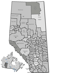
The Municipal District of Bighorn No. 8 is a special type of local government area in Alberta, Canada. It is located in Census Division No. 15. This area sits between the big city of Calgary and the beautiful Banff National Park. It is also north of the Kananaskis Improvement District. The main road, Highway 1, also known as the Trans-Canada Highway, goes right through this district.
The Municipal District of Bighorn No. 8 was officially created on January 1, 1988. It was formed from an older area called Improvement District No. 8. In the early 1990s, the Town of Canmore became part of this district.
Places to Live in Bighorn No. 8
This area has different kinds of communities. Some are small villages, and others are called hamlets or localities.
|
The Municipal District of Bighorn No. 8 surrounds some towns and villages. However, there are no cities or towns directly inside it.
These are small communities where many people have summer homes.
The following small communities are located within the Municipal District of Bighorn No. 8:
Hamlets are small settlements that are part of a larger municipal district.
|
Other small places within the Municipal District of Bighorn No. 8 are called localities.
These are even smaller areas, often with a few homes or businesses.
|
How Many People Live Here?
We can learn about the population of Bighorn No. 8 from official counts called censuses. These are done by Statistics Canada.
In 2016, the Municipal District of Bighorn No. 8 had a population of 1,334 people. These people lived in 556 homes. This number was a little bit less than the population in 2011.
In 2011, there were 1,341 people living in the district. This was a small increase from the 2006 population.
Back in 2006, the population was 1,264 people. The district covers a large area of land, about 2,761 square kilometers (1,066 square miles). This means there are not many people living in each square kilometer.
 | George Robert Carruthers |
 | Patricia Bath |
 | Jan Ernst Matzeliger |
 | Alexander Miles |


