
Musselshell County, Montana facts for kids
Quick facts for kids
Musselshell County
|
|
|---|---|

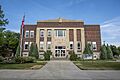
The Musselshell County Courthouse in Roundup
|
|

Location within the U.S. state of Montana
|
|
 Montana's location within the U.S. |
|
| Country | |
| State | |
| Founded | February 2, 1911 |
| Seat | Roundup |
| Largest city | Roundup |
| Area | |
| • Total | 1,871 sq mi (4,850 km2) |
| • Land | 1,868 sq mi (4,840 km2) |
| • Water | 2.8 sq mi (7 km2) 0.1% |
| Population
(2020)
|
|
| • Total | 4,730 |
| • Estimate
(2022)
|
5,197 |
| • Density | 2.528/sq mi (0.9761/km2) |
| Time zone | UTC−7 (Mountain) |
| • Summer (DST) | UTC−6 (MDT) |
| Congressional district | 2nd |
|
|
Musselshell County is a county located in south-central Montana. In 2020, about 4,730 people lived there. Its main town, or county seat, is Roundup.
Contents
History of Musselshell County
Musselshell County was created on February 2, 1911. It was formed by Montana Governor Edwin L. Norris. The land for the new county came from parts of Fergus, Yellowstone, and Meagher counties.
The county was named after the Musselshell River. This river flows through the county from southwest to northeast. The Lewis and Clark Expedition named the river in 1805. They found many freshwater mussels along its banks.
In 1915, a western part of Musselshell County was used to create Golden Valley County. This change gave Musselshell County the borders it has today.
The northwestern part of the county has rolling grasslands. These lands gently slope southeast towards the Musselshell River. In the southeast, you can find the forested Bull Mountains. The county has many natural resources. These include coal, oil found underground, and timber from its forests.
Geography of Musselshell County
Musselshell County covers a total area of about 1,864 square miles (4,828 square kilometers). Most of this area, about 1,861 square miles (4,820 square kilometers), is land. A small part, about 2.75 square miles (7.1 square kilometers), is water.
Main Roads in Musselshell County
 U.S. Highway 12
 U.S. Highway 87
Neighboring Counties
- Fergus County - to the northwest
- Petroleum County - to the north
- Rosebud County - to the east
- Yellowstone County - to the south
- Golden Valley County - to the west
Protected Natural Areas
People of Musselshell County
| Historical population | |||
|---|---|---|---|
| Census | Pop. | %± | |
| 1920 | 12,030 | — | |
| 1930 | 7,242 | −39.8% | |
| 1940 | 5,717 | −21.1% | |
| 1950 | 5,408 | −5.4% | |
| 1960 | 4,888 | −9.6% | |
| 1970 | 3,734 | −23.6% | |
| 1980 | 4,428 | 18.6% | |
| 1990 | 4,106 | −7.3% | |
| 2000 | 4,497 | 9.5% | |
| 2010 | 4,538 | 0.9% | |
| 2020 | 4,730 | 4.2% | |
| 2022 (est.) | 5,197 | 14.5% | |
| U.S. Decennial Census 1790–1960, 1900–1990, 1990–2000, 2010–2020 |
|||
Population in 2020
According to the 2020 United States census, there were 4,730 people living in Musselshell County.
Population in 2010
In 2010, there were 4,538 people in the county. These people lived in 2,046 homes (households), and 1,276 of these were families. On average, about 2.4 people lived in each square mile.
Most people in the county were white (96.1%). Other groups included American Indian (1.3%), Black or African American (0.2%), and Asian (0.2%). About 2.6% of the population was of Hispanic or Latino background.
Many people had German (28.1%), English (16.5%), Irish (16.1%), or Norwegian (7.6%) roots. The average age of people in the county was about 49.1 years old.
The average income for a household was $37,033 per year. For families, the average income was $47,860 per year. About 17.8% of all people and 14.1% of families lived below the poverty line. This included 28.6% of those under 18 years old.
Towns and Communities
City
- Roundup (This is the county seat, the main town where the county government is located.)
Town
Other Communities
These are smaller places that are not officially cities or towns:
- Delphia
- Elso
- Klein
- Queens Point
Census-Designated Places
These are areas identified by the census for statistical purposes:
- Camp Three
- Flat Willow Colony
- Kilby Butte Colony
- Klein
- Musselshell
Images for kids
-
The Musselshell County Courthouse in Roundup
See also
 In Spanish: Condado de Musselshell para niños
