Musselshell River facts for kids
Quick facts for kids Musselshell River |
|
|---|---|

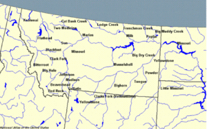
Map of Montana rivers with the Musselshell in the center
|
|
| Country | Petroleum, Phillips, Rosebud, Musselshell, Golden Valley and Wheatland County, Montana |
| Physical characteristics | |
| Main source | 46°28′47″N 110°16′21″W / 46.47972°N 110.27250°W |
| River mouth | 2,247 ft (685 m) 47°22′29″N 107°56′35″W / 47.37472°N 107.94306°W |
| Length | 342 mi (550 km) |
| Basin features | |
| River system | Missouri River |
| Basin size | 9,570 sq mi (24,800 km2) |
The Musselshell River is a river in Montana, United States. It flows into the Missouri River. The Musselshell River is about 342 miles (550 km) long. It starts where its North and South Forks meet near Martinsdale, Montana. The river is entirely within Montana, east of the Continental Divide. If you count its smaller streams before they join, the river can be up to 500 miles (800 km) long.
The Musselshell River has had several other names over time. These include Cockkleshell River, Muscleshell River, and Shell River. The Lewis and Clark Expedition explored the river on May 20, 1805. They named it for the freshwater mussels they saw along its banks. The local Minnetare people had a similar name for the river. The Blackfeet people, who hunted buffalo in the Musselshell area, called it the Dried Meat River.
Contents
Where the Musselshell River Begins
The Musselshell River starts in several mountain ranges in central Montana. These include the Crazy, Little Belt, and Castle mountains.
North and South Forks
The main part of the river forms when the North Fork and South Fork join together. This meeting point is in Meagher County. It's about 25 miles (40 km) east of White Sulphur Springs, Montana.
The North Fork flows south from the Little Belt Mountains. It passes through Bair Reservoir. The South Fork flows northeast from the Crazy Mountains.
River's Journey to the Missouri
From where the two forks meet, the main Musselshell River flows mostly east. It goes past towns like Two Dot, Harlowton, and Roundup. After Melstone, it turns north. It then continues to the UL Bend on the Missouri River. This is near the start of Fort Peck Reservoir.
Exploring the Musselshell River's Landscape
The land around the Musselshell River changes a lot. It goes from the mountains where the river starts to flat prairie lands. The river gets most of its water from melting snow. This means it flows fastest in the spring and early summer.
River's Width and Plants
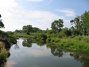
The Musselshell River is about 60 feet (18 m) wide where its two forks meet. As it flows, it gets wider. About 50 miles (80 km) before Roundup, the river is wider. In this part, you can find plants like honeysuckle, wild rose, willow trees, and cottonwood trees. In its last 90 miles (140 km), the river is about 100 feet (30 m) wide. The climate here is drier, so there are fewer plants.
Tributaries and Reservoirs
Many smaller streams, called tributaries, flow into the Musselshell River. Some of these include Middle Fork, Dry Fork, Big Elk Creek, and Willow Creek. Three reservoirs were built in the 1930s to help control the river's flow. These are Bair Reservoir on the North Fork, Martinsdale Reservoir near the forks' meeting point, and Deadman's Basin on the main river.
How People Use the Musselshell River
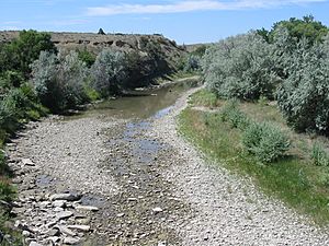
Many people enjoy visiting the Musselshell River for fun activities. About 63,000 people visit the river each year. Farmers and ranchers use a lot of the river's water for irrigation to grow crops and raise animals. Because of this, some parts of the river can become dry or nearly dry during summer and fall. People who live further up the river have older rights to use the water, so there is less water available in the lower parts of the river.
Fishing in the River
Fishing is a popular activity along most of the Musselshell River. In the North and South Forks, and down to Harlowton, you might catch mountain whitefish, brown trout, cutthroat trout, rainbow trout, and brook trout. In the eastern part of the river, where the water is warmer due to irrigation and the drier climate, you can find different fish. These include channel catfish, sauger, smallmouth bass, and walleye. The river is also home to three types of freshwater mussels and crawdads.
Future Energy Project
There is a plan for a pumped hydroelectric power plant called the Gordon Butte Pumped Storage Project. It will use water from Cottonwood Creek, which is a stream that flows into the Musselshell River.
The Big Flood of 2011
In May 2011, there was a very large flood on the Musselshell River. On May 26, the flooding covered parts of Roundup. The river reached record high levels in several areas, including Mosby and Shawmut. The flood crest in Roundup was 14.16 feet (4.32 m) high. This was more than 4 feet (1.2 m) above the flood level and broke the previous record from 1975.
Historical Importance of the Musselshell Area
The Musselshell region is famous because it was where the last wild herds of American buffalo lived. In 1886, a scientist named William Temple Hornaday collected buffalo specimens from this area. He wanted to make sure that future generations would know what these animals looked like.
The Musselshell River has also been mentioned in popular culture. It was talked about in the movie Jeremiah Johnson. The river is also mentioned in the classic 1985 book Lonesome Dove by Larry McMurtry. In Roundup, Montana, you can visit the Musselshell Valley Historical Museum. This museum shares the history of the region.
See also
 In Spanish: Río Musselshell para niños
 | Precious Adams |
 | Lauren Anderson |
 | Janet Collins |


