Harlowton, Montana facts for kids
Quick facts for kids
Harlowton
|
|
|---|---|
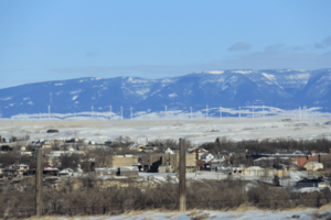
Skyline, Harlowton, MT
|
|
| Nickname(s):
Harlo
|
|
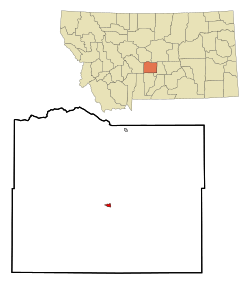
Location of Harlowton, Montana
|
|
| Country | United States |
| State | Montana |
| County | Wheatland |
| Area | |
| • Total | 0.63 sq mi (1.62 km2) |
| • Land | 0.63 sq mi (1.62 km2) |
| • Water | 0.00 sq mi (0.00 km2) |
| Elevation | 4,219 ft (1,286 m) |
| Population
(2020)
|
|
| • Total | 955 |
| • Density | 1,525.56/sq mi (589.30/km2) |
| Time zone | UTC−7 (Mountain (MST)) |
| • Summer (DST) | UTC−6 (MDT) |
| ZIP code |
59036
|
| Area code(s) | 406 |
| FIPS code | 30-34450 |
| GNIS feature ID | 2410704 |
Harlowton is a small city in Montana, USA. It's the main town, or county seat, of Wheatland County. In 2020, about 955 people lived there.
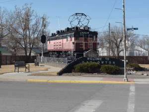
This city was once a very important stop for trains. From 1914 to 1974, it was where steam or diesel trains switched to electric ones. These electric trains would then travel 438 miles through the Rocky Mountains to Avery, Idaho. Harlowton was started in 1900 as a train station. It was named after Richard A. Harlow, who was the president of the Montana Railroad.
Contents
- Harlowton's History and Growth
- Discovering Ancient Life: Paleontology
- Harlowton's Location and Climate
- People of Harlowton: Demographics
- Harlowton's Economy and Jobs
- Arts, Culture, and Fun
- Parks and Outdoor Activities
- Education in Harlowton
- Local Media
- City Infrastructure and Services
- Notable People from Harlowton
- See also
Harlowton's History and Growth
The area around Harlowton is called the Upper Musselshell River Valley. It's named after the Musselshell River, which had many freshwater mussels. Long ago, bison would come to this valley in winter. This made it a popular hunting spot for many Native American tribes. Tribes like the Crow, Blackfeet, and Nez Perce traveled through here.
Harlowton is in the Montana High Plains. This area is known for a rock line that marked the border between the Crow and Blackfeet tribes. This line stretched 50 miles from the Big Snowy Mountains to the Crazy Mountains. It was a hunting boundary and led to many battles.
In Wheatland County, many old sites have been found. These include Sentinel Rock, the Fish Creek Pictograph, and several buffalo jumps. These sites show how people lived long ago.
Early Settlements and Changes
On May 7, 1868, a treaty opened the Musselshell River Valley for new settlers. The first sheep farm started in 1878. A large cattle farm began in 1882.
On June 17, 1907, a big fire destroyed 24 buildings on Main Street in Harlowton. The town was rebuilt, mostly on Central Avenue, to be closer to the Milwaukee Railroad.
The first town election was held on June 6, 1908. Mr. A. T. Anderson became the first mayor. The famous Graves Hotel opened on June 19, 1909. It was added to the National Register of Historic Places in 1980.
In 1917, Wheatland County was created. Harlowton became the county seat. During World War I, Wheatland County was the first in the U.S. to reach its goal for the Liberty Bond drive. Because of this, a ship, the USS Wheatland (AKA-85), was named after the county.
The 163rd Infantry Regiment of the Montana National Guard is based in Harlowton. It served overseas in World War II.
The Jawbone Creek Country Club is in the Guinness World Records. It's the only golf course with a cemetery on it!
From Merino to Harlowton
The town of Merino was officially started in 1881. It was named after the Merino sheep breed. The first railroad, the Montana Railroad, arrived in 1899. Its station was a mile from Merino. So, the town decided to move closer to the railroad.
On June 10, 1900, new town lots were sold. The name Merino was changed to Harlowton on November 9, 1900. The first building in the new town was a barber shop.
The Milwaukee Road's Impact
In 1906, the Chicago, Milwaukee, St. Paul and Pacific Railroad (called "Milwaukee Road") began building its tracks west through Harlowton. Work on the Milwaukee Railroad Roundhouse in Harlowton started on December 5, 1907. The first passenger train arrived from the east on March 9, 1908.
In 1915, the Milwaukee Railroad became electric from Harlowton to Avery, Idaho. This was over 450 miles of mountains! Harlowton became known as "the place where electricity replaces steam." The electric system stopped in 1974. The Milwaukee Railroad closed down completely in 1980. The old train depot is now the Harlowton Milwaukee Depot Museum.
Discovering Ancient Life: Paleontology
Harlowton is in the Fort Union Geological formation. This area is famous for its Paleocene fossils. In 1902, Albert Silberling, a local homesteader and self-taught paleontologist, found the Douglass Quarry. He and Earl Douglass, a paleontologist from Princeton University, found fossils of early mammals. These included the Ptilodus, Phenacodus, and Plesiadapis. Silberling's finds helped us learn a lot about life in the Paleozoic era.
Two new dinosaur species were found southwest of Harlowton. The Rugocaudia cooneyi is a new sauropod dinosaur. It was named in 2012. Its name means "wrinkle tail." The Tatankacephalus cooneyorum is a new ankylosaur dinosaur. It was found in 1997.
The Avaceratops lammersi dinosaur was found northeast of Harlowton. It's a small horned dinosaur from the Ceratopsidaie family. Eddie and Ava Cole found its fossils in 1981. A cast of the Avaceratops lammersi is on display at the Upper Musselshell Museum in Harlowton.
Harlowton's Location and Climate
Harlowton is located on the slopes of the Crazy Mountains. Other nearby mountains include the Big Snowy Mountains, Little Belt Mountains, and Castle Mountains. It is also close to the Lewis and Clark National Forest.
The city covers about 0.63 square miles (1.62 square kilometers) of land.
Climate Conditions
Harlowton has a cold semi-arid climate. This means it's generally dry and can have cold winters.
| Climate data for Harlowton, Montana, 1991–2020 normals, extremes 1948–present | |||||||||||||
|---|---|---|---|---|---|---|---|---|---|---|---|---|---|
| Month | Jan | Feb | Mar | Apr | May | Jun | Jul | Aug | Sep | Oct | Nov | Dec | Year |
| Record high °F (°C) | 69 (21) |
74 (23) |
77 (25) |
87 (31) |
91 (33) |
99 (37) |
103 (39) |
101 (38) |
98 (37) |
90 (32) |
78 (26) |
66 (19) |
103 (39) |
| Mean maximum °F (°C) | 55.8 (13.2) |
57.4 (14.1) |
65.9 (18.8) |
76.4 (24.7) |
82.1 (27.8) |
89.8 (32.1) |
95.4 (35.2) |
95.0 (35.0) |
90.0 (32.2) |
79.9 (26.6) |
65.0 (18.3) |
53.8 (12.1) |
97.0 (36.1) |
| Mean daily maximum °F (°C) | 35.7 (2.1) |
38.2 (3.4) |
47.5 (8.6) |
54.3 (12.4) |
64.3 (17.9) |
73.6 (23.1) |
83.9 (28.8) |
83.2 (28.4) |
72.5 (22.5) |
57.4 (14.1) |
44.6 (7.0) |
35.4 (1.9) |
57.6 (14.2) |
| Daily mean °F (°C) | 24.5 (−4.2) |
26.2 (−3.2) |
33.7 (0.9) |
41.0 (5.0) |
50.7 (10.4) |
59.6 (15.3) |
66.9 (19.4) |
65.8 (18.8) |
56.1 (13.4) |
43.5 (6.4) |
32.6 (0.3) |
25.0 (−3.9) |
43.8 (6.6) |
| Mean daily minimum °F (°C) | 13.3 (−10.4) |
14.1 (−9.9) |
19.8 (−6.8) |
27.8 (−2.3) |
37.1 (2.8) |
45.5 (7.5) |
49.9 (9.9) |
48.4 (9.1) |
39.6 (4.2) |
29.5 (−1.4) |
20.6 (−6.3) |
14.7 (−9.6) |
30.0 (−1.1) |
| Mean minimum °F (°C) | −16.3 (−26.8) |
−9.2 (−22.9) |
0.6 (−17.4) |
14.0 (−10.0) |
22.6 (−5.2) |
34.1 (1.2) |
40.6 (4.8) |
37.7 (3.2) |
26.9 (−2.8) |
11.5 (−11.4) |
−3.5 (−19.7) |
−11.5 (−24.2) |
−23.3 (−30.7) |
| Record low °F (°C) | −38 (−39) |
−39 (−39) |
−29 (−34) |
−6 (−21) |
4 (−16) |
24 (−4) |
33 (1) |
24 (−4) |
10 (−12) |
−8 (−22) |
−29 (−34) |
−39 (−39) |
−39 (−39) |
| Average precipitation inches (mm) | 0.31 (7.9) |
0.30 (7.6) |
0.55 (14) |
1.34 (34) |
2.53 (64) |
2.81 (71) |
1.42 (36) |
1.25 (32) |
1.07 (27) |
0.68 (17) |
0.51 (13) |
0.41 (10) |
13.18 (333.5) |
| Average snowfall inches (cm) | 3.7 (9.4) |
1.9 (4.8) |
2.6 (6.6) |
3.1 (7.9) |
0.3 (0.76) |
0.0 (0.0) |
0.0 (0.0) |
0.0 (0.0) |
0.1 (0.25) |
0.6 (1.5) |
3.6 (9.1) |
3.7 (9.4) |
19.6 (49.71) |
| Average precipitation days (≥ 0.01 in) | 3.8 | 3.3 | 4.8 | 8.0 | 9.1 | 10.7 | 8.3 | 6.1 | 4.9 | 4.9 | 3.9 | 3.0 | 70.8 |
| Average snowy days (≥ 0.1 in) | 2.9 | 2.3 | 2.3 | 1.5 | 0.1 | 0.0 | 0.0 | 0.0 | 0.1 | 0.4 | 1.9 | 2.5 | 14.0 |
| Source 1: NOAA | |||||||||||||
| Source 2: National Weather Service | |||||||||||||
People of Harlowton: Demographics
| Historical population | |||
|---|---|---|---|
| Census | Pop. | %± | |
| 1910 | 770 | — | |
| 1920 | 1,856 | 141.0% | |
| 1930 | 1,473 | −20.6% | |
| 1940 | 1,547 | 5.0% | |
| 1950 | 1,733 | 12.0% | |
| 1960 | 1,734 | 0.1% | |
| 1970 | 1,375 | −20.7% | |
| 1980 | 1,181 | −14.1% | |
| 1990 | 1,049 | −11.2% | |
| 2000 | 1,062 | 1.2% | |
| 2010 | 997 | −6.1% | |
| 2020 | 955 | −4.2% | |
| U.S. Decennial Census | |||
In 2010, there were 997 people living in Harlowton. They lived in 478 households. Most residents (95.4%) were White. About 19.3% of the people were under 18 years old. The average age in the city was 49.8 years.
Harlowton's Economy and Jobs
Farming is very important to Harlowton's economy. Farmers here grow wheat, barley, oats, and hay. They also raise cattle, sheep, and produce honey. Many businesses in town support these farms.
Some of the biggest employers in Harlowton include:
- Wheatland Memorial Healthcare (a hospital)
- Harlowton High School and Hillcrest Elementary School
- Musselshell Ranger District (part of the forest service)
- Midtown Market 2 Grocery Store
- Rays Sport and Western Wear
- Cream of the West (a food company)
- Rocky Mountain Cookware (makes cooking tools)
- TicketPrinting.com (an online printing company)
- The Judith Gap Wind Farm (produces electricity)
Harlowton also has unique businesses. They make products from stone to steel griddles. E S Stone & Structure and Montana Rock and Stone have many stone quarries. Rocky Mountain Cookware makes steel griddles. Steve Park Apiaries provides pollination services and sells honey and beeswax. Cream of the West, a hot cereal company, moved its production to Harlowton in 2002. Eventgroove, a company for event ticketing and online printing, opened its main printing facility in Harlowton in 2001. It is the largest private employer in Wheatland County.
Arts, Culture, and Fun
Harlowton has two museums. The Upper Musselshell Museum was started in 1984. It shows the history and paleontology of the area. Its main display is a full-size copy of the Avaceratops lammersi dinosaur. This museum is part of Montana's 'Dinosaur Trail'.
The Milwaukee Depot Museum is in the old train station. It was built in 1908. The museum shows the town's rich train history. Harlowton Public Library serves the community.
Annual events in Harlowton include the Rodeo, Wheatland County Youth Fair, and the Harlowton Kiwanis Show. Nearby, you can find the Nez Perce National Historic Trail and the Charles M. Bair Museum.
Parks and Outdoor Activities
The Lewis and Clark National Forest offers many fun activities. You can go camping, sightseeing, hunting, OHV riding, and snowmobiling. You can also go fishing in the Musselshell River or at Deadman's Basin and Martinsdale Reservoir.
Harlowton has three parks: Chief Joseph Park, Deer Park, and Fischer Park. The old Milwaukee Railroad track has been turned into the "Smoking Boomer" trail. You can also see a bronze sculpture called And They Called the Land Montana and a Veteran's Honor Wall at the Wheatland County Court House.
Education in Harlowton
Harlowton Public Schools teaches students from kindergarten to 12th grade. Hillcrest Elementary School is for K-6, and Harlowton High School is for grades 7-12. The high school's sports teams are called the Engineers.
Local Media
Harlowton's local newspaper is The Times Clarion. It comes out every week.
City Infrastructure and Services
U.S. Route 12 and U.S. Route 191 pass through Harlowton. The Wheatland County Airport is just two miles northwest of town.
The Judith Gap Wind Farm is north of Harlowton. It has 90 wind turbines that produce 135 Megawatts of clean power. This power goes into the main energy grid. Other wind farms are also nearby.
Harlowton has several health facilities. These include Wheatland Memorial Healthcare, Deer Creek Dental, and Remedies Pharmacy. The Wheatland Memorial Healthcare Center has an Emergency Room, Laboratory, and Physical Therapy.
For banking, there's Citizens Bank and Trust Company and Tricounty Federal Credit Union. Harlowton also has two motels, clothing stores, restaurants, and other shops.
Notable People from Harlowton
- S. Stillman Berry, a zoologist, passed away near Harlowton.
- Thomas Patrick Gerrity, a former United States general, was born here.
See also
 In Spanish: Harlowton (Montana) para niños
 | John T. Biggers |
 | Thomas Blackshear |
 | Mark Bradford |
 | Beverly Buchanan |


