
National Register of Historic Places listings in Aleutians West Census Area, Alaska facts for kids

The Aleutians West Census Area in Alaska is home to many important historical places. These sites are so special that they are listed on the National Register of Historic Places. This list helps protect places that are important to the history of the United States.
In this part of Alaska, there are 15 places listed on the National Register. Ten of these are even more important and are called National Historic Landmarks. They tell amazing stories about ancient cultures, brave soldiers, and unique natural history.
Contents
Exploring Historic Places in the Aleutians West
The Aleutians West Census Area holds many secrets from the past. From ancient villages to World War II battlegrounds, these sites help us understand what life was like long ago. They show us how people lived, fought, and built communities in this remote part of Alaska.
Ancient History and Early Settlements
Some of the oldest sites in the Aleutians West Census Area show us where people lived thousands of years ago. These places are like giant history books, telling us about the first people to settle in Alaska.
Anangula Archeological District
The Anangula Archeological District is on the southern end of Anangula Island. This area is super old! It shows us where some of the very first people in the Aleutian Islands lived. Scientists have found tools and other items here that are thousands of years old. It helps us learn about how ancient people survived and thrived in this challenging environment.

Chaluka Site
The Chaluka Site is another important archaeological spot near Nikolski. It's like a giant trash heap from ancient times, but in a good way! Scientists have dug up many things here, like bones, tools, and other artifacts. These finds tell us a lot about the daily lives of the Aleut people who lived here for thousands of years. It's one of the longest-occupied sites in the Aleutian Islands.

World War II Battlegrounds and Bases
During World War II, the Aleutian Islands became a very important battleground. Japanese forces attacked and occupied some of these islands. The United States military built many bases here to fight back. Several of these sites are now protected as historic places.
The Adak Army Base and Adak Naval Operating Station was a huge military base on Adak Island. It was built quickly during World War II to help the U.S. fight against the Japanese. Thousands of soldiers and sailors lived and worked here. The base played a key role in the Aleutian Islands Campaign, helping the U.S. take back islands that the Japanese had invaded.

Attu Battlefield
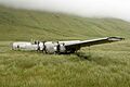
The Attu Battlefield is on Attu Island. This was the site of the only land battle fought in North America during World War II. In 1943, U.S. forces fought a very difficult battle to take back Attu Island from Japanese soldiers. It was a harsh fight in a very cold and foggy place. The battlefield is a reminder of the bravery and sacrifices made during the war.

Cape Field at Fort Glenn
Cape Field at Fort Glenn was an important airfield on Umnak Island. It was one of the first airfields built by the U.S. in the Aleutians during World War II. Planes from Fort Glenn helped defend against the Japanese attack on Dutch Harbor and supported later operations. It was a critical part of the defense system for Alaska.

The Dutch Harbor Naval Operating Base and Fort Mears, U.S. Army was a major military base on Amaknak Island near Unalaska. In June 1942, the Japanese attacked Dutch Harbor, hoping to draw out the U.S. fleet. This attack led to the Aleutian Islands Campaign. The remains of the base, including bunkers and gun emplacements, tell the story of this important event.

Japanese Occupation Site, Kiska Island
The Japanese Occupation Site on Kiska Island is a unique historic place. Japanese forces occupied Kiska Island for over a year during World War II. When U.S. and Canadian forces landed to take it back, they found the island deserted. The Japanese had secretly left! Today, you can still see remnants of the Japanese occupation, like bunkers and equipment.

S.S. Northwestern Shipwreck Site
The S.S. NORTHWESTERN Shipwreck Site is located in Captains Bay near Unalaska. This ship was bombed by the Japanese during the attack on Dutch Harbor in World War II. It was badly damaged and later sank in 1945. The shipwreck is a powerful reminder of the war's impact on the Aleutian Islands.

Cultural and Religious Landmarks
The Aleutian Islands are also home to beautiful and historic churches that show the influence of Russian culture and the Orthodox faith.
Church of the Holy Ascension
The Church of the Holy Ascension is a stunning Russian Orthodox church in Unalaska. Built in the 1890s, it's one of the oldest Russian Orthodox churches in Alaska. It has beautiful onion domes and a rich history, serving the local Aleut community for generations. It's a symbol of the strong cultural ties between Alaska and Russia.

St. George the Great Martyr Orthodox Church
On St. George Island, you'll find the St. George the Great Martyr Orthodox Church. This church is another important example of Russian Orthodox architecture in Alaska. It reflects the deep faith and traditions of the people living on the Pribilof Islands.

St. Nicholas Church (Nikolski, Alaska)
The St. Nicholas Church in Nikolski is a smaller, but equally important, Russian Orthodox church. It's a central part of the community's life and history, showing the lasting influence of the Russian Orthodox mission in the Aleutian Islands.

Sts. Peter and Paul Church (St. Paul Island, Alaska)
On St. Paul Island, the Sts. Peter and Paul Church stands as another historic Russian Orthodox church. Like the others, it's a testament to the cultural and religious heritage of the Aleut people and the Russian presence in Alaska.

Unique Natural and Historical Sites
Beyond battles and ancient villages, some sites are recognized for their unique natural features or their role in protecting wildlife.
Seal Island Historic District
The Seal Island Historic District includes parts of St. Paul and St. George Islands, which are part of the Pribilof Islands. These islands are famous for their huge populations of fur seals. The district protects the areas where these seals gather to breed, as well as sites related to the historic fur seal industry. It's important for both wildlife conservation and understanding human interaction with nature.

Sitka Spruce Plantation
The Sitka Spruce Plantation is a very unusual site north of Unalaska on Amaknak Island. It's a group of Sitka spruce trees that were planted here. What makes it special is that these trees are not native to the Aleutian Islands, which are mostly treeless. This plantation is a unique experiment in growing trees in this harsh environment.

Images for kids
-
Wreckage of the Atka B-24D Liberator plane

