Aleutians West Census Area, Alaska facts for kids
Quick facts for kids
Aleutians West Census Area
|
|
|---|---|

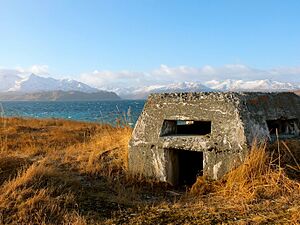
A World War II bunker abandoned in Dutch Harbor, Amaknak Island
|
|

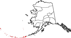
Location within the U.S. state of Alaska
|
|
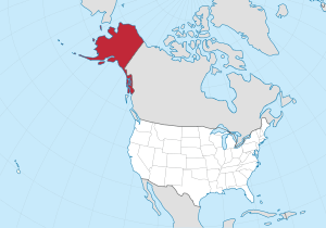
 Alaska's location within the U.S. |
|
| Country | |
| State | |
| Established | 1980 |
| Named for | Aleutian Islands |
| Largest city | Unalaska |
| Area | |
| • Total | 14,116 sq mi (36,560 km2) |
| • Land | 4,390 sq mi (11,400 km2) |
| • Water | 9,726 sq mi (25,190 km2) 68.9%% |
| Population
(2020)
|
|
| • Total | 5,122 |
| • Density | 1.27/sq mi (0.49/km2) |
| Time zones | UTC−9 (Alaska) |
| • Summer (DST) | UTC−8 (ADT) |
| UTC−10 (Hawaii–Aleutian) | |
| • Summer (DST) | HADT |
| Congressional district | At-large |

The Aleutians West Census Area (which is Западные Алеутские острова in Russian) is a special area in Alaska, United States. It's called a census area because it helps the government count people. It's not a regular county with its own local government.
In 2020, about 5,232 people lived here. This area is part of the Unorganized Borough. This means it doesn't have a main city or "seat" for its government.
The biggest city in this area is Unalaska. Most of the people, about 80%, live there. The Aleutians West Census Area includes most of the Aleutian Islands. These islands stretch from Attu Island in the west to Unalaska Island in the east. It also includes the Pribilof Islands, which are north of the Aleutians in the Bering Sea.
Contents
Land and Water
This area has a lot of land and even more water! The U.S. Census Bureau says it covers about 14,116 square miles in total.
About 4,390 square miles of this is land. The rest, about 9,726 square miles, is water. That means almost 69% of the area is water! To the east, it shares a border with the Aleutians East Borough.
Special Protected Places
This area is home to some important protected places:
- Alaska Maritime National Wildlife Refuge: This refuge protects many islands and waters. Parts of it are in the Aleutians and Bering Sea.
- Aleutian Islands Wilderness: A wild, untouched part of the Aleutian Islands.
- Bogoslof Wilderness: Another wild area, focused on Bogoslof Island.
- Pribilof Islands: These islands are also part of the refuge.
- Aleutian World War II National Historic Area: This place remembers the history of World War II in the Aleutian Islands.
Important Capes
- Moss Point: A notable point of land in the area.
People Living Here
In 2014, a study by The Atlantic magazine found something interesting. The Aleutians West Census Area was the most diverse place in the United States. This means many different groups of people live there.
The Brookings Institution also found that Asian Americans are the largest group of people of color here. Many of them are Filipino Americans.
2020 Census Information
The table below shows the different racial groups in the Aleutians West Census Area from the 2020 census.
| Race | Percentage of Population |
|---|---|
| White | 37.82% |
| Black or African American | 6.02% |
| American Indian or Alaska Native | 17.16% |
| Asian | 31.02% |
| Native Hawaiian and Other Pacific Islander | 5.39% |
| Some other race | 10.55% |
This next table shows the most common family backgrounds reported by people in the area. This information is from a 2020 survey.
| Ancestry | Percentage of Population |
|---|---|
| Filipino | 39.68% |
| Aleut | 11.79% |
| Mexican | 8.62% |
| German | 5.71% |
| Black or African American | 4.63% |
| European | 4.08% |
| Irish | 3.98% |
| Vietnamese | 3.56% |
| Samoan | 2.65% |
| Cuban | 2.30% |
| Historical population | |||
|---|---|---|---|
| Census | Pop. | %± | |
| 1960 | 6,011 | — | |
| 1970 | 8,057 | 34.0% | |
| 1980 | 7,768 | −3.6% | |
| 1990 | 9,478 | 22.0% | |
| 2000 | 5,465 | −42.3% | |
| 2010 | 5,561 | 1.8% | |
| 2020 | 5,232 | −5.9% | |
| 2023 (est.) | 5,160 | −7.2% | |
| U.S. Decennial Census 1790-1960 1900-1990 1990-2000 2010-2020 |
|||
Towns and Villages
The biggest place where people live in the Aleutians West Census Area is the city of Unalaska.
Cities
Census-Designated Places
These are areas that are like towns but don't have their own city government.
- Attu Station
- Nikolski
- Eareckson Station
Schools
There are a few school districts in this area:
- Aleutian Region School District
- Pribilof School District
- Unalaska City School District
See also
 In Spanish: Área censal de Aleutianas Occidentales para niños
 | George Robert Carruthers |
 | Patricia Bath |
 | Jan Ernst Matzeliger |
 | Alexander Miles |

