National Register of Historic Places listings in Berrien County, Michigan
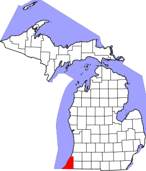
Berrien County, located in Michigan, is a place filled with interesting history! All around the county, you can find special buildings, bridges, and areas that are so important, they've been added to a list called the National Register of Historic Places. This list helps protect and celebrate places that tell us stories about the past.
This article shares some of the amazing historic places you can find in Berrien County, Michigan. There are 30 different properties and districts in the county that are on this special list.
Contents
What is the National Register of Historic Places?
Imagine a special club for old buildings and places that are super important to American history. That's kind of what the National Register of Historic Places (NRHP) is! It's an official list kept by the United States government. When a place is added to this list, it means it's recognized for its historical, architectural, or archaeological importance.
Being on the NRHP helps protect these places. It also encourages people to learn about and preserve them for future generations. These sites tell us stories about how people lived, worked, and built things long ago.
Historic Treasures of Berrien County
Berrien County is home to many fascinating places that have earned a spot on the National Register. These sites include old courthouses, beautiful homes, important bridges, and even entire downtown areas. Each one has a unique story to tell about Michigan's past.
Bridges with a Past
Bridges are more than just ways to cross water; some are important parts of history! Berrien County has a few bridges on the National Register.
- The Avery Road-Galien River Bridge in Weesaw Township was built to help people cross the Galien River. It was added to the list in 1999.
- The Blossomland Bridge in St. Joseph carries M-63 over the St. Joseph River. This bridge is a key part of the local transportation history and was listed in 1999.
- The North Watervliet Road-Paw Paw Lake Outlet Bridge in Watervliet Township also made the list in 1999. It crosses the outlet of Paw Paw Lake.
Important Buildings and Homes
Many buildings in Berrien County have historical significance, from old courthouses to unique homes.
- The Berrien Springs Courthouse is a very old building in Berrien Springs. It was built in 1839 and served as the county's courthouse for many years. It was added to the National Register in 1970.
- The Henry A. Chapin House in Niles is a beautiful historic home. Henry A. Chapin was an important person in Niles' early history. His house was listed in 1981.
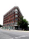
- The Fidelity Building in Benton Harbor is an interesting old building on Pipestone Street. It was recognized for its architecture and history in 2002.
- The Ring Lardner House in Niles belonged to a famous American sportswriter and satirist, Ring Lardner. His home was added to the list in 1972.
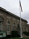
- The Old US Post Office in Niles is another historic building. It served as the main post office for many years and was listed in 1985.
- The Paine Bank in Niles, built in 1872, is a historic commercial building. It was added to the National Register in 1973.
- The Shiloh House in Benton Harbor is a significant building related to the House of David religious community. It was listed in 1972.
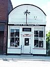
- The Union Meat Market in Three Oaks is a historic commercial building. It was added to the list in 1972.
- The Warren Featherbone Company Office Building in Three Oaks is a unique building. The company was known for making "featherbone" products, which were used in corsets and other clothing. This building was listed in 1986.
- The Zinc Collar Pad Company Building in Buchanan was added to the list in 2009. It's a reminder of the area's industrial past.
Downtown Districts and Special Sites
Sometimes, an entire area or district is historically important, not just one building.
- The Buchanan Downtown Historic District includes several blocks of historic buildings in downtown Buchanan. This area was recognized in 2009.
- The Buchanan North and West Neighborhoods Historic District covers a larger residential area in Buchanan. It was added to the list in 2011.
- The Fort St. Joseph Site in Niles is a very important archaeological site. This was once a French fort and trading post from the 17th and 18th centuries. It was listed in 1973.
- The House of David (also known as Mary's City of David) in Benton Charter Township is a historic religious community. Their unique buildings and history led to its listing in 2009.
- The Moccasin Bluff Site near Buchanan is an important archaeological site. It shows evidence of ancient Native American settlements. It was listed in 1977.
- The Niles Downtown Historic District includes the historic heart of Niles, with many old shops and buildings. It was added to the list in 2007.
- The Niles Railroad Depot is the historic train station in Niles. It has been serving travelers for many years and was listed in 1979.
- The Old Berrien County Courthouse Complex in Berrien Springs includes several historic buildings that were part of the county government. This complex was listed in 1982.
- The South Berrien Center Union Church and Cemetery in Berrien Township is a historic church and burial ground. It was added to the list in 2002.
- The Union Block in Buchanan is a historic commercial building. It was listed in 2007.
Lighthouses and Lake Michigan
Lighthouses are iconic structures, guiding ships and standing as symbols of maritime history.
- The Ninth District Lighthouse Depot in St. Joseph was an important base for maintaining lighthouses in the Great Lakes region. It was listed in 1993.
- The St. Joseph North Pier Inner and Outer Lights are the two lighthouses on the pier at the mouth of the St. Joseph River. These beautiful lighthouses have guided ships for many years and were added to the National Register in 2005.
| Name on the Register | Image | Date listed | Location | City or town | Description | |
|---|---|---|---|---|---|---|
| 1 | Avery Road-Galien River Bridge |
(#99001577) |
Avery Rd. over the Galien River 41°52′27″N 86°33′17″W / 41.874167°N 86.554722°W |
Weesaw Township | ||
| 2 | Berrien Springs Courthouse |
(#70000265) |
Corner of Union and Cass Sts. 41°57′27″N 86°20′28″W / 41.9575°N 86.341111°W |
Berrien Springs | ||
| 3 | Blossomland Bridge |
(#99001576) |
M-63 over the St. Joseph River 42°06′45″N 86°28′40″W / 42.1125°N 86.477778°W |
St. Joseph | ||
| 4 | Buchanan Downtown Historic District |
(#09000678) |
Front Street, between 117 West and 256 East; parts of Main Street, between 108 and 210-212; and 114 N. Oak Street 41°49′39″N 86°21′37″W / 41.8275°N 86.360278°W |
Buchanan | ||
| 5 | Buchanan North and West Neighborhoods Historic District |
(#11000863) |
Roughly bounded by Main, 4th, Chippewa, W. Front, S. Detroit, Chicago, Clark, Roe, and Charles Sts. 41°49′42″N 86°21′54″W / 41.828378°N 86.36495°W |
Buchanan | ||
| 6 | Henry A. Chapin House |
(#81000304) |
508 E. Main St. 41°49′45″N 86°15′12″W / 41.829167°N 86.253333°W |
Niles | ||
| 7 | Rock S. Edwards Farmstead |
(#95000868) |
3503 Edwards Rd. 42°03′13″N 86°22′21″W / 42.053611°N 86.3725°W |
Sodus Township | ||
| 8 | Fidelity Building |
(#02000042) |
162 Pipestone St. 42°06′52″N 86°27′15″W / 42.114444°N 86.454167°W |
Benton Harbor | ||
| 9 | Fort St. Joseph Site |
(#73000944) |
Bond St. along the St. Joseph River 41°48′54″N 86°15′39″W / 41.815000°N 86.260833°W |
Niles | ||
| 10 | Lakeside Inn |
(#09000521) |
15251 Lakeshore Rd. 41°50′49″N 86°40′32″W / 41.846908°N 86.675422°W |
Lakeside | ||
| 11 | Ring Lardner House |
(#72000595) |
519 Bond St. 41°49′39″N 86°15′17″W / 41.8275°N 86.254722°W |
Niles | ||
| 12 | Mary's City of David |
(#09000201) |
1158 E. Britain Ave. 42°06′32″N 86°25′51″W / 42.108783°N 86.430797°W |
Benton Charter Township | ||
| 13 | Moccasin Bluff Site |
(#77000710) |
Red Bud Trail 41°51′20″N 86°22′00″W / 41.855556°N 86.366667°W |
Buchanan | ||
| 14 | Niles Downtown Historic District |
(#07000568) |
Sycamore, Main, and Cedar between Front and 5th 41°49′47″N 86°15′22″W / 41.829722°N 86.256111°W |
Niles | ||
| 15 | Niles Railroad Depot |
(#09000085) |
598 Dey St. 41°50′14″N 86°15′08″W / 41.837222°N 86.252222°W |
Niles | ||
| 16 | Ninth District Lighthouse Depot |
(#93001348) |
128 N. Pier 42°06′51″N 86°29′09″W / 42.114167°N 86.485833°W |
St. Joseph | ||
| 17 | North Watervliet Road-Paw Paw Lake Outlet Bridge |
(#99001575) |
N. Watervliet Rd. over Paw Paw Lake outlet 42°12′28″N 86°15′00″W / 42.207778°N 86.25°W |
Watervliet Township | ||
| 18 | Old Berrien County Courthouse Complex |
(#82004941) |
Roughly bounded by Cass, Kimmel, Madison, and Union Sts. 41°56′53″N 86°20′28″W / 41.948056°N 86.341111°W |
Berrien Springs | ||
| 19 | Old US Post Office |
(#85002152) |
322 E. Main St. 41°49′46″N 86°16′02″W / 41.829444°N 86.267222°W |
Niles | ||
| 20 | Paine Bank |
(#73000945) |
1008 Oak St. 41°49′35″N 86°14′50″W / 41.826389°N 86.247222°W |
Niles | ||
| 21 | Wendell P. and Harriet Rounds Robbins House |
(#07000385) |
680 Pipestone St. 42°06′17″N 86°26′38″W / 42.104722°N 86.443889°W |
Benton Harbor | ||
| 22 | Sandburg House |
(#72001470) |
Address Restricted |
Harbert | ||
| 23 | Shiloh House |
(#72000594) |
1055 E. Britain Rd. 42°06′03″N 86°25′57″W / 42.100833°N 86.4325°W |
Benton Harbor | ||
| 24 | Snow Flake Motel |
(#98000270) |
3822 Red Arrow Highway 42°02′55″N 86°30′56″W / 42.048611°N 86.515556°W |
Lincoln Township | Building demolished March 27, 2006 | |
| 25 | South Berrien Center Union Church and Cemetery |
(#02001506) |
10408 M-140 41°55′46″N 86°16′19″W / 41.929444°N 86.271944°W |
Berrien | ||
| 26 | St. Joseph North Pier Inner and Outer Lights |
(#05001211) |
On the north pier of the mouth of the St. Joseph River, 0.9 mi (1.4 km) west of the M-63 bridge 42°06′57″N 86°29′32″W / 42.115833°N 86.492222°W |
St. Joseph | ||
| 27 | Union Block |
(#07000746) |
114 E. Front St. 41°49′37″N 86°21′38″W / 41.826944°N 86.360556°W |
Buchanan | ||
| 28 | Union Meat Market |
(#72000596) |
14 S. Elm St. 41°47′57″N 86°36′42″W / 41.799167°N 86.611667°W |
Three Oaks | ||
| 29 | Warren Featherbone Company Office Building |
(#86000117) |
3 N. Elm St. 41°48′05″N 86°36′38″W / 41.801389°N 86.610556°W |
Three Oaks | ||
| 30 | Zinc Collar Pad Company Building |
(#09000472) |
304 S. Oak St. 41°49′30″N 86°21′40″W / 41.82489°N 86.36111°W |
Buchanan |


