National Register of Historic Places listings in Cache County, Utah facts for kids
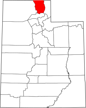
Have you ever wondered about the oldest and most special buildings in your community? In Cache County, Utah, there are many amazing places that are so important, they're listed on the National Register of Historic Places. This is like a special list of buildings, sites, and objects across the United States that are worth protecting because of their history.
This list tells you about 77 different places in Cache County that are on this important register. These spots include old homes, schools, churches, and even a historic farm! Some of these places are still standing strong, while a few others have been removed from the list over time. Let's explore some of these cool historic sites!
Contents
Historic Buildings and Sites in Cache County
Many buildings in Cache County have a rich history. They tell stories about the people who lived and worked there long ago. These places are preserved so we can learn from the past.
Homes with a Story
Some of the most interesting historic places are old houses. They show us how families lived in the past.
|- class="vcard" ! style="background:#A8EDEF" | 1 | George Washington Baker House
|
|
(#83004416)
| class="adr" | 115 N. 100 West
41°42′37″N 111°58′44″W / 41.710278°N 111.978889°W
| class="note" | This historic home in Mendon was built a long time ago. It shows us how people lived in the early days of the county.
|- class="vcard" ! style="background:#A8EDEF" | 2 | Samuel Baker House
|
|
(#83004417)
| class="adr" | 150 W. 200 North
41°42′46″N 111°58′47″W / 41.712778°N 111.979722°W
| class="note" | Another important house in Mendon, connected to the Baker family. It's a great example of early architecture.
|- class="vcard" ! style="background:#A8EDEF" | 3 | Heber K. and Rachel H. Bankhead House
|
|
(#97000261)
| class="adr" | 185 E. 800 South
41°37′20″N 111°55′49″W / 41.622222°N 111.930278°W
| class="note" | This house in Wellsville belonged to the Bankhead family. It is a well-preserved example of a historic home.
|- class="vcard" ! style="background:#A8EDEF" | 4 refnum=08000057 | William & Elizabeth Barrett Farmstead
|
|
(Ref. # missing)
| class="adr" | 20 S. 100 West
41°42′27″N 111°58′42″W / 41.7075°N 111.978333°W
| class="note" | This farmstead includes the home and other buildings used for farming. It shows how families lived and worked on the land.
|- class="vcard" ! style="background:#A8EDEF" | 5 | Bell-Johnson House
|
|
(#04001118)
| class="adr" | 12 N. 200 East
41°55′30″N 111°48′05″W / 41.925°N 111.801389°W
| class="note" | A beautiful historic house in Richmond, showing the architectural styles of its time.
|- class="vcard" ! style="background:#A8EDEF" | 7 | George Bradshaw House and Joshua Salisbury/George Bradshaw Barn
|
|
(#82004846)
| class="adr" | 73 S. Center St.
41°38′16″N 111°56′05″W / 41.637778°N 111.934722°W
| class="note" | This property includes both a historic house and a barn. It gives us a glimpse into farm life in the past.
|- class="vcard" ! style="background:#A8EDEF" | 8 | James and Amy Burnham Farmstead
|
|
(#04001120)
| class="adr" | 533 S. State St.
41°54′46″N 111°48′27″W / 41.912778°N 111.8075°W
| class="note" | Another farmstead that shows how families lived and worked on their land in Richmond.
|- class="vcard" ! style="background:#A8EDEF" | 9 | Carl F. and Sophia Christensen House
|
|
(#04001121)
| class="adr" | 208 N. 200 East
41°55′38″N 111°48′06″W / 41.927222°N 111.801667°W
| class="note" | This house in Richmond is a historic example of family homes from its era.
|- class="vcard" ! style="background:#A8EDEF" | 11 | Crockett House
|
|
(#09000017)
| class="adr" | 82 Crockett Ave.
41°44′04″N 111°48′44″W / 41.73445°N 111.812172°W
| class="note" | The Crockett House is a notable historic residence in Logan.
|- class="vcard" ! style="background:#A8EDEF" | 13 | David Eccles House
|
|
(#76001811)
| class="adr" | 250 W. Center St.
41°43′52″N 111°50′26″W / 41.731111°N 111.840556°W
| class="note" | This grand house belonged to David Eccles, an important businessman in Utah's history.
|- class="vcard" ! style="background:#A8EDEF" | 15 | Samuel and Lana Ewing House
|
|
(#93001576)
| class="adr" | 107 S. 100 East
41°50′02″N 111°49′46″W / 41.833889°N 111.829444°W
| class="note" | A historic family home located in Smithfield.
|- class="vcard" ! style="background:#A8EDEF" | 17 | James Gardner House
|
|
(#82004111)
| class="adr" | 173 N. Main St.
41°42′39″N 111°58′34″W / 41.710833°N 111.976111°W
| class="note" | This house in Mendon is recognized for its historical importance.
|- class="vcard" ! style="background:#A8EDEF" | 18 | Soren Hanson House
|
|
(#82004109)
| class="adr" | 166 W. Main St.
41°38′04″N 111°51′33″W / 41.634444°N 111.859167°W
| class="note" | The Soren Hanson House is a historic residence in Hyrum.
|- class="vcard" ! style="background:#A8EDEF" | 22 | Lafayette and Elizabeth W. Hendricks House
|
|
(#04001123)
| class="adr" | 109 S. State St.
41°55′13″N 111°48′27″W / 41.920278°N 111.8075°W
| class="note" | This historic home in Richmond belonged to the Hendricks family.
|- class="vcard" ! style="background:#A8EDEF" | 23 | William S. and Margaret R. Hendricks House
|
|
(#04001124)
| class="adr" | 112 W. Main St.
41°55′23″N 111°48′40″W / 41.923056°N 111.811111°W
| class="note" | Another historic Hendricks family home in Richmond.
|- class="vcard" ! style="background:#A8EDEF" | 24 | Hobson-Hill House
|
|
(#04001125)
| class="adr" | 108 S. 100 West
41°55′13″N 111°48′40″W / 41.920278°N 111.811111°W
| class="note" | This house is a part of Richmond's rich history.
|- class="vcard" ! style="background:#A8EDEF" | 27 | Howell-Theurer House
|
|
(#79002490)
| class="adr" | 30 S. 100 East
41°38′16″N 111°55′49″W / 41.637778°N 111.930278°W
| class="note" | This was the childhood home of Joseph Howell, a notable figure.
|- class="vcard" ! style="background:#A8EDEF" | 30 | John P. and Sarah James House
|
|
(#93001578)
| class="adr" | 210 W. 9000 South
41°34′06″N 111°50′17″W / 41.568333°N 111.838056°W
| class="note" | A historic house located in the town of Paradise.
|- class="vcard" ! style="background:#A8EDEF" | 31 | Morgan A. and Clarissa R. Knapp House
|
|
(#04001126)
| class="adr" | 106 S. 100 East
41°55′13″N 111°48′19″W / 41.920278°N 111.805278°W
| class="note" | The Knapp House is a historic residence in Richmond.
|- class="vcard" ! style="background:#A8EDEF" | 32 | John E. Lee House
|
|
(#82004108)
| class="adr" | 123 W. Center St.
41°28′33″N 111°29′32″W / 41.47581°N 111.492111°W
| class="note" | This house in Hyde Park is recognized for its historical value.
|- class="vcard" ! style="background:#A8EDEF" | 45 | Louis Edgar and Clara H. Merrill House
|
|
(#04001127)
| class="adr" | 244 W. Main St.
41°55′23″N 111°48′53″W / 41.923056°N 111.814722°W
| class="note" | The Merrill House is another historic home in Richmond.
|- class="vcard" ! style="background:#A8EDEF" | 46 | Samuel Crowthers Mitton House
|
|
(#82004847)
| class="adr" | 242 E. Main St.
41°38′18″N 111°55′36″W / 41.638333°N 111.926667°W
| class="note" | This house in Wellsville is a part of the county's historic past.
|- class="vcard" ! style="background:#A8EDEF" | 48 | Muir House
|
|
(#08000060)
| class="adr" | 145 S. Main St.
41°42′17″N 111°58′36″W / 41.70482°N 111.9766°W
| class="note" | The Muir House is a historic residence in Mendon.
|- class="vcard" ! style="background:#A8EDEF" | 51 | Erick Lehi and Ingrid Larsen Olson House
|
|
(#97000225)
| class="adr" | 490 E. 600 South
41°43′18″N 111°49′19″W / 41.721667°N 111.821944°W
| class="note" | This house in River Heights is recognized for its historical significance.
|- class="vcard" ! style="background:#A8EDEF" | 54 | Martin and Martha Pond Farmstead
|
|
(#97001308)
| class="adr" | 320 S. 800 West
41°58′13″N 111°52′11″W / 41.970278°N 111.869722°W
| class="note" | This farmstead in Lewiston includes the historic home and farm buildings.
|- class="vcard" ! style="background:#A8EDEF" | 63 | Zial Riggs House
|
|
(#82004114)
| class="adr" | 94 S. 100 East
41°38′13″N 111°55′49″W / 41.636944°N 111.930278°W
| class="note" | The Zial Riggs House is a historic home in Wellsville.
|- class="vcard" ! style="background:#A8EDEF" | 65 | William McNeil Smith House
|
|
(#82004110)
| class="adr" | 116 S. 100 East
41°43′44″N 111°49′53″W / 41.728889°N 111.831389°W
| class="note" | This historic house is located in Logan.
|- class="vcard" ! style="background:#A8EDEF" | 70 | S. Milton and Alba C. Webb House
|
|
(#04001131)
| class="adr" | 143 S. State St.
41°55′11″N 111°48′27″W / 41.919722°N 111.8075°W
| class="note" | The Webb House is a historic residence in Richmond.
|- class="vcard" ! style="background:#A8EDEF" | 73 | James F. & Mary Jane Whitney House
|
|
(#08000061)
| class="adr" | 195 W. 100 North
41°42′38″N 111°58′51″W / 41.710556°N 111.980833°W
| class="note" | This historic house in Mendon belonged to James F. and Mary Jane Whitney.
|- class="vcard" ! style="background:#A8EDEF" | 75 | James G. Willie House
|
|
(#83004418)
| class="adr" | 97 N. 100 West
41°42′35″N 111°58′44″W / 41.709722°N 111.978889°W
| class="note" | The James G. Willie House is a significant historic home in Mendon.
|- class="vcard" ! style="background:#A8EDEF" | 77 | Ferdinand Zollinger, Jr. House
|
|
(#92000892)
| class="adr" | 193 N. 100 East
41°42′42″N 111°48′53″W / 41.711667°N 111.814722°W
| class="note" | This historic house in Providence belonged to Ferdinand Zollinger, Jr.
Important Public Buildings
Many public buildings in Cache County are also on the National Register. These include schools, churches, and community centers.
|- class="vcard" ! style="background:#A8EDEF" | 6 | Benson Elementary School |
|
(#85000798)
| class="adr" | 3440 N. 3000 West
41°47′45″N 111°54′17″W / 41.795833°N 111.904722°W
| class="note" | This old school building in Benson is a historic landmark.
|- class="vcard" ! style="background:#A8EDEF" | 10 | Clarkston Tithing Granary
|
|
(#85000250)
| class="adr" | 10212 N. 8700 West
41°55′06″N 112°03′06″W / 41.918333°N 112.051667°W
| class="note" | A granary is a building for storing grain. This one in Clarkston is a historic example of how communities stored food.
|- class="vcard" ! style="background:#A8EDEF" | 14 | Elite Hall
|
|
(#03000736)
| class="adr" | 98 W. Main St.
41°38′04″N 111°51′25″W / 41.634444°N 111.856944°W
| class="note" | Elite Hall in Hyrum was a popular place for community gatherings and events.
|- class="vcard" ! style="background:#A8EDEF" | 26 | Home Economics/Commons Building
|
|
(#85000800)
| class="adr" | Off U.S. Route 89 on the Utah State University campus
41°44′25″N 111°48′40″W / 41.740278°N 111.811111°W
| class="note" | This building on the Utah State University campus is a historic part of the school's history.
|- class="vcard" ! style="background:#A8EDEF" | 28 | Hyrum First Ward Meetinghouse
|
|
(#80003891)
| class="adr" | 290 S. Center St.
41°37′41″N 111°51′19″W / 41.628056°N 111.855278°W
| class="note" | This meetinghouse in Hyrum is a historic place of worship and community gathering.
|- class="vcard" ! style="background:#A8EDEF" | 29 | Hyrum Stake Tithing Office
|
|
(#85000251)
| class="adr" | 26 W. Main St.
41°38′04″N 111°51′18″W / 41.634444°N 111.855°W
| class="note" | A tithing office was where people contributed to their church. This one in Hyrum is a historic example.
|- class="vcard" ! style="background:#A8EDEF" | 33 | Lewiston Community Building
|
|
(#85000799)
| class="adr" | 29 S. Main St.
41°58′31″N 111°51′20″W / 41.975278°N 111.855556°W
| class="note" | This building served as a community hub for the people of Lewiston.
|- class="vcard" ! style="background:#A8EDEF" | 34 | Lewiston Tithing Office and Granary
|
|
(#85000252)
| class="adr" | 81 E. 800 South
41°57′42″N 111°51′14″W / 41.961667°N 111.853889°W
| class="note" | This site in Lewiston includes both a tithing office and a granary.
|- class="vcard" ! style="background:#A8EDEF" | 37 | Logan High School Gymnasium |
|
(#85001844)
| class="adr" | 162 W. 100 South
41°43′44″N 111°50′16″W / 41.728889°N 111.837778°W
| class="note" | The old gymnasium at Logan High School is a historic part of the school's past.
|- class="vcard" ! style="background:#A8EDEF" | 38 | Logan LDS Sixth Ward Church
|
|
(#79002489)
| class="adr" | 395 S. Main St.
41°43′27″N 111°50′06″W / 41.724167°N 111.835°W
| class="note" | This church building in Logan has served its community for many years.
|- class="vcard" ! style="background:#A8EDEF" | 40 | Logan Tabernacle
|
|
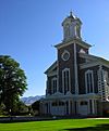
(#75001800)
| class="adr" | Bounded by Center, 1st North, Main, and 1st East Sts.
41°43′56″N 111°50′00″W / 41.732222°N 111.833333°W
| class="note" | The Logan Tabernacle is a very important and beautiful historic building in Logan.
|- class="vcard" ! style="background:#A8EDEF" | 41 | Logan Temple
|
|
(#75001801)
| class="adr" | Between 2nd and 3rd East and 1st and 2nd North
41°44′03″N 111°49′38″W / 41.734167°N 111.827222°W
| class="note" | The Logan Temple is a significant and historic religious building.
|- class="vcard" ! style="background:#A8EDEF" | 50 | Old Main, Utah State University
|
|
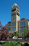
(#72001258)
| class="adr" | Utah State University campus
41°44′27″N 111°48′47″W / 41.740833°N 111.813056°W
| class="note" | Old Main is one of the oldest and most recognizable buildings on the Utah State University campus.
|- class="vcard" ! style="background:#A8EDEF" | 52 | Paradise Tithing Office
|
|
(#85000253)
| class="adr" | 8970 S. 200 West
41°34′09″N 111°50′14″W / 41.569167°N 111.837222°W
| class="note" | The tithing office in Paradise is a historic building that served the local community.
|- class="vcard" ! style="background:#A8EDEF" | 56 | Providence LDS Chapel and Meetinghouse
|
|
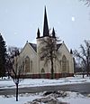
(#82004112)
| class="adr" | 10 S. Main St.
41°42′28″N 111°49′00″W / 41.707778°N 111.816667°W
| class="note" | This old rock church in Providence is a beautiful and historic place.
|- class="vcard" ! style="background:#A8EDEF" | 57 | Richmond Carnegie Library
|
|
(#84000147)
| class="adr" | 38 W. Main St.
41°55′23″N 111°48′32″W / 41.923056°N 111.808889°W
| class="note" | Carnegie libraries were built with money from Andrew Carnegie. This one in Richmond is a historic example.
|- class="vcard" ! style="background:#A8EDEF" | 59 | Richmond Community Building
|
|
(#86000731)
| class="adr" | 6 W. Main St.
41°55′23″N 111°48′30″W / 41.923056°N 111.808333°W
| class="note" | This building served as a gathering place for the Richmond community.
|- class="vcard" ! style="background:#A8EDEF" | 61 | Richmond Relief Society Hall
|
|
(#96000589)
| class="adr" | 15 E. Main St.
41°55′31″N 111°48′27″W / 41.925278°N 111.8075°W
| class="note" | This hall was used by the Relief Society, a women's organization, in Richmond.
|- class="vcard" ! style="background:#A8EDEF" | 62 | Richmond Tithing Office
|
|
(#85000256)
| class="adr" | 31 S. State St.
41°55′20″N 111°48′27″W / 41.922222°N 111.8075°W
| class="note" | The tithing office in Richmond is a historic building.
|- class="vcard" ! style="background:#A8EDEF" | 64 | Sigma Chi Fraternity House
|
|
(#05001038)
| class="adr" | 705 N. 800 East
41°44′42″N 111°48′52″W / 41.745°N 111.814444°W
| class="note" | This fraternity house in Logan is recognized for its historic architecture.
|- class="vcard" ! style="background:#A8EDEF" | 66 | Smithfield Public Library
|
|
(#81000580)
| class="adr" | 25 N. Main St.
41°50′14″N 111°49′13″W / 41.837222°N 111.820278°W
| class="note" | Another Carnegie library, this one in Smithfield, is a historic public building.
|- class="vcard" ! style="background:#A8EDEF" | 67 | Smithfield Tabernacle-Youth Center
|
|
(#100000509)
| class="adr" | 25 N. Main St.
41°50′13″N 111°49′59″W / 41.837006°N 111.832951°W
| class="note" | This building in Smithfield has served as both a tabernacle and a youth center.
|- class="vcard" ! style="background:#A8EDEF" | 68 | Smithfield Tithing Office
|
|
(#85000258)
| class="adr" | 35 W. Center St.
41°50′13″N 111°49′58″W / 41.836944°N 111.832778°W
| class="note" | The tithing office in Smithfield is a historic building.
|- class="vcard" ! style="background:#A8EDEF" | 71 | Wellsville Relief Society Meeting House
|
|
(#88003439)
| class="adr" | 67 S. Center St.
41°38′17″N 111°56′02″W / 41.638056°N 111.933889°W
| class="note" | This meeting house in Wellsville was used by the Relief Society.
|- class="vcard" ! style="background:#A8EDEF" | 72 | Wellsville Tabernacle
|
|
(#80003893)
| class="adr" | 75 S. 100 East
41°38′15″N 111°55′55″W / 41.6375°N 111.931944°W
| class="note" | The Wellsville Tabernacle is a historic religious building in the area.
|- class="vcard" ! style="background:#A8EDEF" | 74 | Whittier School
|
|
(#00001066)
| class="adr" | 290 N. 400 East
41°44′12″N 111°49′24″W / 41.736667°N 111.823333°W
| class="note" | Whittier School in Logan is a historic school building.
|- class="vcard" ! style="background:#A8EDEF" | 76 | Women's Residence Hall
|
|
(#86000735)
| class="adr" | Utah State University
41°44′27″N 111°48′31″W / 41.740833°N 111.808611°W
| class="note" | This residence hall at Utah State University is a historic part of the campus.
Other Unique Historic Sites
Cache County also has other special places that are important to its history.
|- class="vcard" ! style="background:#A8EDEF" | 12 | Douglas General Mercantile
|
|
(#82004113)
| class="adr" | 100 S. Main St.
41°50′03″N 111°49′54″W / 41.834167°N 111.831667°W
| class="note" | This old general store in Smithfield was once a busy place for shopping and trading.
|- class="vcard" ! style="background:#A8EDEF" | 16 | Forster Hotel
|
|
(#08000058)
| class="adr" | 176 N. 100 West
41°42′40″N 111°58′41″W / 41.711111°N 111.978056°W
| class="note" | The Forster Hotel in Mendon provided lodging for travelers in the past.
|- class="vcard" ! style="background:#A8EDEF" | 19 | Martin Harris Gravesite
|
|
(#80003890)
| class="adr" | 8400 W. 11000 North
41°55′53″N 112°02′20″W / 41.931389°N 112.038889°W
| class="note" | This is the burial site of Martin Harris, an important figure in early religious history.
|- class="vcard" ! style="background:#A8EDEF" | 20 | Hatch's Camp |
|
(#06001192)
| class="adr" | 8.3 miles (13.4 km) east from the mouth of Logan Canyon
41°46′32″N 111°38′57″W / 41.775556°N 111.649167°W
| class="note" | Hatch's Camp is a historic site located in the beautiful Cache National Forest.
|- class="vcard" ! style="background:#A8EDEF" | 21 | Hendricks Confectionery Building
|
|
(#04001122)
| class="adr" | 19 W. Main St.
41°55′21″N 111°48′31″W / 41.9225°N 111.808611°W
| class="note" | This building once housed a confectionery, a place where candies and sweets were made and sold.
|- class="vcard" ! style="background:#A8EDEF" | 25 | Holley-Globe Grain and Milling Company Elevator
|
|
(#85003386)
| class="adr" | 100 North and Center St.
41°38′11″N 111°51′14″W / 41.636389°N 111.853889°W
| class="note" | This grain elevator was used to store and process grain, important for farming communities.
|- class="vcard" ! style="background:#A8EDEF" | 36 | Logan Fish Hatchery Caretaker's Residence
|
|
(#85000801)
| class="adr" | 1469 W. 200 North
41°44′10″N 111°52′08″W / 41.736111°N 111.868889°W
| class="note" | This residence was home to the caretaker of the Logan Fish Hatchery.
|- class="vcard" ! style="background:#A8EDEF" | 39 | Logan Municipal Slaughterhouse
|
|
(#85000802)
| class="adr" | 265 N. 600 West
41°44′13″N 111°50′59″W / 41.736944°N 111.849722°W
| class="note" | This building was used for processing meat for the city of Logan.
|- class="vcard" ! style="background:#A8EDEF" | 42 | Logan Temple Barn
|
|
(#85003199)
| class="adr" | 368 E. 200 North
41°44′06″N 111°49′27″W / 41.735°N 111.824167°W
| class="note" | This barn was part of the historic Logan Temple complex.
|- class="vcard" ! style="background:#A8EDEF" | 43 | McMurdie-White Farmstead
|
|
(#05001106)
| class="adr" | 395 W. 9000 South
41°34′10″N 111°50′47″W / 41.569444°N 111.846389°W
| class="note" | This farmstead includes a historic creamery, where dairy products were made.
|- class="vcard" ! style="background:#A8EDEF" | 44 | Mendon Station
|
|
(#08000059)
| class="adr" | 95 N. Main St.
41°42′34″N 111°58′34″W / 41.709444°N 111.976111°W
| class="note" | The Mendon Station was likely a stop for trains or other transportation in the past.
|- class="vcard" ! style="background:#A8EDEF" | 47 | Hattie Merrill Morrison Farmstead
|
|
(#04001128)
| class="adr" | 1367 S. State St.
41°53′48″N 111°48′34″W / 41.896667°N 111.809444°W
| class="note" | This farmstead in Richmond is a historic example of agricultural life.
|- class="vcard" ! style="background:#A8EDEF" | 49 | Newton Reservoir |
|
(#73001860)
| class="adr" | 3 miles (4.8 km) north of Newton
41°54′36″N 112°00′18″W / 41.91°N 112.005°W
| class="note" | Newton Dam is a historic structure that created the Newton Reservoir.
|- class="vcard" ! style="background:#A8EDEF" | 53 | Plant Auto Company Building
|
|
(#04001129)
| class="adr" | 38 S. 200 West (State Route 91)
41°55′20″N 111°48′51″W / 41.922222°N 111.814167°W
| class="note" | This building, though no longer standing, was the first auto repair shop in Richmond, built in 1916.
|- class="vcard" ! style="background:#A8EDEF" | 58 | Richmond City Grandstand & Baseball Field
|
|
(#04001130)
| class="adr" | Approximately 50 S. State St.
41°55′17″N 111°48′34″W / 41.921389°N 111.809444°W
| class="note" | This historic grandstand and baseball field were important for community sports and events.
|- class="vcard" ! style="background:#A8EDEF" | 60 | Richmond Interurban Depot
|
|
(#02000508)
| class="adr" | 196 W. Main St.
41°54′51″N 111°48′48″W / 41.914167°N 111.813333°W
| class="note" | This depot was a station for the interurban railway, which connected towns.
Historic Districts
Some areas have many historic buildings together, forming a "historic district."
|- class="vcard" ! style="background: #E6E6FA" | 35 | Logan Center Street Historic District
|
|
(#79002488)
| class="adr" | Roughly bounded by 200 North, 200 South, 200 East, and 600 West
41°43′56″N 111°50′18″W / 41.732222°N 111.838333°W
| class="note" | This district includes many historic buildings along Center Street in Logan.
|- class="vcard" ! style="background: #E6E6FA" | 55 | Providence Historic District
|
|
(#07001169)
| class="adr" | Roughly bounded by 200 N., 400 E., 500 S., and 200 W.
41°42′18″N 111°48′56″W / 41.705°N 111.815556°W
| class="note" | This area in Providence contains many historic buildings, like the old blacksmith shop.
|- class="vcard" ! style="background: #E6E6FA" | 69 | Tony Grove Ranger Station Historic District |
|
(#92000338)
| class="adr" | U.S. Route 89, 23 miles (37 km) northeast of Logan in the Wasatch-Cache National Forest
41°53′08″N 111°33′59″W / 41.885556°N 111.566389°W
| class="note" | This historic district includes buildings used by forest rangers in the beautiful Tony Grove area. |}


