
National Register of Historic Places listings in Garfield County, Utah facts for kids

Garfield County, Utah, is a beautiful area known for its amazing natural landscapes, like Bryce Canyon National Park. But did you know it's also home to many important historical places? These special spots are listed on the National Register of Historic Places. This list is like a hall of fame for buildings, sites, and objects that are important to the history of the United States.
When a place is added to the National Register, it means it's recognized for its historical, architectural, or archaeological value. It helps protect these places so people can learn from them for many years to come. In Garfield County, there are 27 places on this list, including one very special site called a National Historic Landmark. A National Historic Landmark is even more important, recognized for its outstanding national significance.
Contents
- Exploring Garfield County's Historic Treasures
- Historic Buildings and Communities
- Historic Sites in Bryce Canyon National Park
- Bryce Canyon Lodge and Deluxe Cabins
- Bryce Canyon Lodge Historic District
- Bryce Canyon National Park Scenic Trails Historic District
- Bryce Inn
- Horse Barn
- Loop C Comfort Station and Loop D Comfort Station
- Old Administration Building
- Old National Park Service Housing Historic District
- Under-the-Rim Trail
- Utah Parks Company Service Station
- Ancient Sites and Trails
- Images for kids
Exploring Garfield County's Historic Treasures
Garfield County has many interesting places on the National Register. Let's take a closer look at some of them and what makes them special.
Historic Buildings and Communities
Many of the listed places are old buildings that tell stories about the people who lived and worked in Garfield County long ago.
Boulder Elementary School
The Boulder Elementary School is located in Boulder, Utah. It's an old school building that has been around since 1985. It reminds us of how education has changed over time in small towns.
William Jasper, Jr., and Elizabeth Henderson House
In Cannonville, Utah, you can find the William Jasper, Jr., and Elizabeth Henderson House. This house, built a long time ago, shows us what homes looked like for early settlers in the area. It's a glimpse into the past lives of families in Garfield County.
Escalante Historic District
The town of Escalante, Utah, has a whole area called the Escalante Historic District. This district includes many old buildings that together show the history and growth of the community. Walking through it is like stepping back in time to see how the town developed.

Panguitch Historic District
Similar to Escalante, Panguitch, Utah, also has a large Panguitch Historic District. This area is filled with historic buildings that tell the story of Panguitch, a town founded by pioneers. It includes homes, businesses, and other structures that have been preserved.

Panguitch Carnegie Library
Within the Panguitch Historic District is the Panguitch Carnegie Library. This library was built with money from Andrew Carnegie, a famous businessman who helped fund many libraries across the United States. It's a beautiful old building that has served the community for many years.

Panguitch Social Hall
The Panguitch Social Hall is another important building in Panguitch. Social halls were once central places for communities to gather for events, meetings, and entertainment. This hall reminds us of the strong community spirit in early Utah towns.

William T., Jr., and Mary Isabell R. Owens House
Also in Panguitch, the William T., Jr., and Mary Isabell R. Owens House is another example of early architecture. It provides insight into the lives of families who helped build the town.

Historic Sites in Bryce Canyon National Park
Bryce Canyon National Park is famous for its unique rock formations called hoodoos. But it also has several historic sites that are part of the National Register.
Bryce Canyon Lodge and Deluxe Cabins
The Bryce Canyon Lodge is a very special place. It's not just on the National Register; it's also a National Historic Landmark! This means it's one of the most important historic places in the entire country. The lodge and its nearby cabins were built to welcome visitors to the park in the early days. They show a unique style of architecture that fits perfectly with the natural beauty of the park.

Bryce Canyon Lodge Historic District
The area around the Bryce Canyon Lodge is known as the Bryce Canyon Lodge Historic District. This district includes the lodge, the deluxe cabins, and other buildings that were part of the original park facilities. It helps tell the story of how tourism developed in national parks.

Bryce Canyon National Park Scenic Trails Historic District
The amazing trails within Bryce Canyon National Park are also considered historic! The Bryce Canyon National Park Scenic Trails Historic District includes famous paths like the Navajo Loop Trail and Queen's Garden Trail. These trails were carefully designed and built to allow visitors to explore the park's incredible scenery.

Bryce Inn
The Bryce Inn is another historic building within Bryce Canyon National Park. It provided lodging for early visitors, adding to the park's infrastructure.

Horse Barn
Even the Horse Barn at Bryce Canyon National Park is historic! It was used for the horses that took visitors on rides through the park, showing how people explored the area before cars were common.

Loop C Comfort Station and Loop D Comfort Station
These buildings, known as Loop C Comfort Station and Loop D Comfort Station, are located in the North Campground of Bryce Canyon National Park. They are examples of the early facilities built to make camping more comfortable for park visitors.


Old Administration Building
The Old Administration Building in Bryce Canyon National Park was once the main office for park staff. It's now known as the Nature Center. It represents the early efforts to manage and protect the park.

Old National Park Service Housing Historic District
The Old National Park Service Housing Historic District includes the homes where park rangers and staff lived. These houses show the dedication of the people who worked to preserve and share Bryce Canyon with the public.

Under-the-Rim Trail
The Under-the-Rim Trail is another significant trail in Bryce Canyon National Park. It offers a longer, more challenging hike and is recognized for its historical importance in park development.
Utah Parks Company Service Station
The Utah Parks Company Service Station at Bryce Canyon National Park was where visitors could get gas and car services. It reflects the growing popularity of car travel to national parks in the past.

Ancient Sites and Trails
Garfield County is also home to very old sites that tell us about the people who lived here thousands of years ago.
Coombs Village Site
The Coombs Village Site near Boulder, Utah, is an ancient Puebloan village. It's now part of the Anasazi Indian State Park. Archaeologists have excavated parts of this village, finding artifacts that teach us about the lives of the early Native American people who lived there.

Friendship Cove Pictograph
The Friendship Cove Pictograph near Escalante is a site with ancient rock art. Pictographs are paintings on rock surfaces, often made by early Native Americans. These images give us clues about their beliefs, daily lives, and the animals they saw.
Hole-in-the-Rock Trail
The Hole-in-the-Rock Trail is a famous historic trail that starts near Escalante. It was used by early pioneers in 1879-1880 to create a shortcut to southeastern Utah. It was an incredibly difficult journey through rugged terrain, and the trail is a reminder of their perseverance.

Kolb Brothers "Cat Camp" Inscription
The Kolb Brothers "Cat Camp" Inscription is a unique historical marker. It's an inscription left by the Kolb brothers, famous photographers who explored the Grand Canyon and other parts of the Colorado River. This inscription marks one of their campsites during their adventures.
Pole Hollow Archeological Site
The Pole Hollow Archeological Site near Panguitch is another important place for understanding ancient cultures in the area. Archaeological sites like this help scientists learn about past human activities through the study of artifacts and remains.
Starr Ranch
The Starr Ranch near Ticaboo is a historic ranch property. Ranches played a big role in the development of Utah, and this site represents the agricultural history of the region.
Images for kids
-
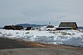
Bryce Canyon Airport

