National Register of Historic Places listings in Iron County, Michigan
Iron County, Michigan, is a place rich in history, especially when it comes to mining and logging. This article will take you on a journey through its past and highlight some of the most important historic buildings and places that are officially recognized on the National Register of Historic Places. These special places tell the story of how Iron County grew and changed over time.
History of Iron County
Iron County was first explored in 1851. Back then, it was mostly home to Native American tribes like the Menominee and Ojibwe. Even though iron ore was found early on, European settlers didn't start arriving in large numbers until 1875, looking for that valuable iron ore.
Mining and Growth
In 1880, two big discoveries of iron ore kicked off the county's growth. John Armstrong found the Crystal Falls Mine, and Donald C. MacKinnon opened the Iron River Mine. These two mines became the centers of the county's main towns. Their success brought many more people, and eventually, 70 mines were digging for ore in Iron County!
Around the same time, Logging also began in 1875. Lumber mills quickly became another important part of the local economy. To help move the ore and lumber, railroads, especially the Chicago and Northwestern Railroad, built lines into the county. Tracks reached Iron River and Crystal Falls in 1882, and both towns grew very fast.
Becoming a County
In 1882, Iron River and Crystal Falls became separate townships, but they were still part of Marquette County. People in the area really wanted their own county. So, in 1885, Iron County was officially created, splitting off from Marquette County.
When Iron County was formed, Iron River was chosen as the county seat (the main town for government). But there was a big disagreement between the east side (Crystal Falls) and the west side (Iron River) about where the county buildings should be. This argument lasted until 1889, when people voted, and Crystal Falls was chosen as the county seat.
Ups and Downs of the Economy
By 1890, nearly 4,500 people lived in Iron County, mostly working in mining and timber. However, a financial crisis in 1893, called the Panic of 1893, caused iron prices to drop. This led to almost all the iron mines closing and logging slowing down a lot. People had to turn to farming to support themselves.
The economy bounced back around 1900. Big mining companies like the M. A. Hanna Company and Pickands, Mather and Company bought up smaller mines. Logging of hardwood trees also started, leading to a long period of steady growth until the Great Depression.
The county's population grew a lot during this time, reaching over 20,800 people by 1930. Many new residents were immigrants from countries like Ireland, Italy, Poland, and Scandinavia. New towns were created, mostly for mine workers, including Alpha, Mineral Hills, Caspian, and Gaastra. Iron River, Crystal Falls, and Stambaugh also expanded. To serve everyone, an electric street car line was built in 1906, and many public schools opened.
The Great Depression stopped Iron County's economic boom. Iron mining completely halted, and logging was greatly reduced, leaving thousands of workers without jobs. The government helped by funding projects like the Cooks Run Trout Feeding Station (1933-34) and the Pentoga Park Office and Bathhouse (1936). The Civilian Conservation Corps (CCC) also built projects at Camp Gibbs (1934), providing jobs during tough times.
Mining got a temporary boost during World War II, but it steadily declined after the war. Most mines closed by the 1960s, and the last iron mine in the county shut down in 1979. However, logging has remained an important business, employing many people even today.
Historic Places in Iron County
There are 80 places in Iron County, Michigan, listed on the National Register of Historic Places. These buildings and areas mostly come from Iron County's busy period in the early 1900s, but some are even older, from when iron mining first began in the 1880s.
The very first place listed, in 1975, was the Iron County Courthouse. It's considered the most important building in the county for its architecture. Many other listings came from a special project in 1983 called the Iron County MRA, which aimed to recognize the most historically and architecturally important places in the county.
| Name on the Register | Image | Date listed | Location | City or town | Description | |
|---|---|---|---|---|---|---|
| 1 | Alpha Public Buildings Historic Complex |
(#83003659) |
404 Main St. 46°02′47″N 88°22′40″W / 46.046389°N 88.377778°W |
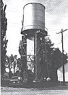
Alpha | The Alpha Public Buildings Historic Complex includes three buildings: the village hall, the George F. Porter public school, and the water tower. They were all built in 1914 when Alpha was growing fast. They show what typical public buildings looked like in the Upper Peninsula back then. The original water tower has been replaced. | |
| 2 | Amasa Historic Business District |
(#83003660) |
100, 200, and 300 blocks of Pine St. 46°13′58″N 88°26′54″W / 46.232778°N 88.448333°W |
Amasa | This historic area has buildings mostly from 1890 to 1920. It includes the town hall, a train station, a church, and several shops and homes. When local mines closed, Amasa stopped growing, so this area still looks much like it did in the early 1900s. | |
| 3 | Beechwood Store |
(#83003662) |
215 Beechwood Rd. 46°09′36″N 88°45′27″W / 46.16°N 88.7575°W |
Iron River | This building was made in 1912 for Albert J. Sandgren and Andres J.T. Anderson, who were important people in Beechwood. It was a country store, post office, and the main social spot for Beechwood, a small Swedish community that later became part of Iron River. | |
| 4 | Bethany Lutheran Church |
(#83003664) |
184 Beechwood Rd. 46°09′34″N 88°45′42″W / 46.159444°N 88.761667°W |
Iron River | The Bethany Lutheran Church was started in 1911 for the Swedish Lutheran people in Beechwood. Albert Sandgren, who owned the nearby Beechwood Store, drew the plans for the church. Volunteers from the church built most of it, finishing in 1913. It's important because it's a rural church from the early 1900s that hasn't been changed much. | |
| 5 | Bewabic Park |
(#16000179) |
1933 West US 2 46°05′25″N 88°25′56″W / 46.0902°N 88.4322°W |
Crystal Falls Township | Bewabic Park, located on Fortune Lake, was created in 1923 and is one of America's first roadside parks. Many of its buildings were built by government programs like the CWA and CCC during the Great Depression. | |
| 6 | Joseph Bowers House |
(#83003665) |
318 Hemlock Ave. 46°14′05″N 88°26′57″W / 46.234722°N 88.449167°W |
Amasa | This house was built in 1901. It's a great example of a typical miner's home from that time, with clapboard siding and a gable roof. | |
| 7 | Isaac W. Byers House |
(#83003667) |
5 N. 8th Ave. 46°05′16″N 88°38′50″W / 46.087778°N 88.647222°W |
Iron River | This house was built around 1919 for Isaac W. Byers, a lawyer and one of the main developers in the Iron River area. Byers and four friends, known as the "Big Five," helped start the Iron Savings and Loan Association in 1905 and funded much of the growth in Stambaugh, Iron River, and Caspian. | |
| 8 | Camp Gibbs |
(#93001408) |
129 Camp Gibbs Rd., Iron River Township, Ottawa National Forest 46°12′04″N 88°42′19″W / 46.201111°N 88.705278°W |
Gibbs City | Camp Gibbs was built by the Civilian Conservation Corps (CCC) in 1935. It was used until 1941 to house workers who helped in the forest. Today, it has 16 wooden buildings, including barracks, a kitchen, and garages. | |
| 9 | Caspian Community Center |
(#83003671) |
404 Brady Ave. 46°03′43″N 88°37′39″W / 46.061944°N 88.6275°W |
Caspian | The Caspian Community Center is an Arts and Crafts style building from 1921. It was built by the Presbyterian Board of National Missions to help immigrant families learn. It's still used as a community center today. | |
| 10 | Caspian Mine Headframe |
(#83003672) |
North of Caspian Rd. 46°04′04″N 88°37′31″W / 46.067778°N 88.625278°W |
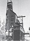
Caspian | The Caspian Mine was a very productive mine from 1903 to 1937. The current headframe, a tall steel structure used to lift miners and ore, was built in 1920. It stands 106 feet tall. | |
| 11 | Central School |
(#08000584) |
218 W. Cayuga St. 46°05′36″N 88°38′26″W / 46.093397°N 88.640442°W |
Iron River | The first part of Central School was built in 1904-05. Two more sections were added in 1910-11. It was a school until 1980. There are plans to turn it into apartments. | |
| 12 | Chicago, Milwaukee and Saint Paul Railway Iron River Depot |
(#07000479) |
50 4th Ave. 46°05′18″N 88°38′31″W / 46.088333°N 88.641944°W |
Iron River | This train station was built in 1913. Passenger trains used it until 1945. It's important because it's the last remaining train station in Iron River. | |
| 13 | Chicagon Mine Road – Chicagon Creek Bridge |
(#99001521) |
Chicagon Mine Rd. over Chicagon Creek 46°05′43″N 88°30′31″W / 46.095278°N 88.508611°W |
Bates Township | This bridge was built in 1910. It's an early example of a concrete slab bridge before bridge designs became standard in Michigan. | |
| 14 | Cloverland Hotel |
(#83003673) |
423 3rd St. 46°05′33″N 88°38′30″W / 46.0925°N 88.641667°W |
Iron River | The Cloverland Hotel was a brick building that looked like an old English pub. It opened around 1922. The building was torn down in 2008. | |
| 15 | Frank W. Cole House |
(#83003674) |
121 3rd St. 46°05′42″N 88°19′51″W / 46.095°N 88.330833°W |
Crystal Falls | This simple, two-story house with clapboard siding was built around 1899 for Frank W. Cole, a druggist. The house is no longer standing. | |
| 16 | Cooks Run Trout Feeding Station |
(#83003675) |
180 Cooks Run Rd. 46°09′18″N 88°53′32″W / 46.155°N 88.892222°W |
Stambaugh | The Cooks Run Trout Feeding Station is a small fish hatchery with a pond, dam, and buildings. The caretaker's cabin is special because it's a great example of a wilderness camp building, made with local materials and fine details. | |
| 17 | Courthouse Residential Historic District |
(#83003676) |
Roughly bounded by Crystal and Michigan Aves., Iron and 5th Sts. 46°05′46″N 88°20′12″W / 46.096111°N 88.336667°W |
Crystal Falls | This historic area includes the Iron County Courthouse and many of the nicest homes in Crystal Falls. These homes were built for important mining officials, lumbermen, and other business people when the mining and logging industries were at their peak. | |
| 18 | Crystal Falls Dam and Power Plant |
(#83003678) |
Pine St. 46°06′22″N 88°20′05″W / 46.106111°N 88.334722°W |
Crystal Falls | The Crystal Falls Dam and Power Plant were built in 1891, covering the waterfalls that gave Crystal Falls its name. The plant is still working today, providing about a third of Crystal Falls' power. It's likely the oldest hydro-electric plant still running in the Upper Peninsula. | |
| 19 | Crystal Inn |
(#83003680) |
400 Superior Ave. 46°05′49″N 88°19′59″W / 46.096944°N 88.333056°W |
Crystal Falls | The Crystal Inn was built in 1922 as a hotel. It was a hotel until 1963, then became a home for the elderly. In 2010, it was renovated into apartments. | |
| 20 | Ernest Diele House |
(#83003682) |
213 Marquette Ave. 46°05′44″N 88°19′50″W / 46.095556°N 88.330556°W |
Crystal Falls | This two-story American foursquare house was built for Ernest Diele, a head mason at a mining company. It's a good example of the solid, plain houses where managers and skilled workers in the mining industry lived. | |
| 21 | Dober Mining Company House |
(#83003681) |
1 19th St. 46°04′22″N 88°37′46″W / 46.072778°N 88.629444°W |
Caspian | The Dober Mining Company House is a four-family house built around 1910 to house miners' families. It's a two-story building with a gable roof and clapboard siding, divided into four separate homes. | |
| 22 | Rudolf Ericson House |
(#83003687) |
626 W. Boyington St. 46°05′24″N 88°38′47″W / 46.09°N 88.646389°W |
Iron River | This house stands out because it's built in the "English cottage style," which is rare in Iron County. It was built in 1937 for Rudolf Ericson, who was a general superintendent for a mining company. | |
| 23 | Falls Location Historic District |
(#83003689) |
At the Paint River 46°06′27″N 88°20′20″W / 46.1075°N 88.338889°W |
Crystal Falls | The Falls Location Historic District has seven log houses and other buildings built between 1880 and 1900. It's one of only three log dwelling settlements left in Iron County. | |
| 24 | Finnish and Swedish Mercantile Association Building |
(#83003691) |
336 Superior Ave. 46°05′49″N 88°19′56″W / 46.096944°N 88.332222°W |
Crystal Falls | This building was constructed in 1908 for a grocery and department store owned by local Finns and Swedes. It reminds us of the large Scandinavian population in Crystal Falls in the early 1900s. | |
| 25 | First National Bank Building |
(#83003692) |
303 Main St. 46°02′45″N 88°22′35″W / 46.045833°N 88.376389°W |
Alpha | This bank building was built in 1914. It's a single-story brick building with an angled entrance at the corner. | |
| 26 | Nelson E. Fisher House – High Banks |
(#83003694) |
US 2 46°05′51″N 88°40′29″W / 46.0975°N 88.674722°W |
Iron River | "High Banks" was built in 1912 for Nelson A. Fisher, an important businessman in Iron River and one of the "Big Five" who helped develop the area. Fisher's daughter, Aileen Fisher, later became a famous children's author, and her memories of this house appear in her books. | |
| 27 | Forest Route 157 – Tamarack River Bridge |
(#99001520) |
Forest Route 157 over the Tamarack River 46°14′50″N 88°58′41″W / 46.247222°N 88.978056°W |
Stambaugh Township | This bridge is important because it's one of the two oldest concrete girder bridges designed by the Michigan State Highway Department. It was the final part of a main road through Iron County, and its opening was a big event in 1916. | |
| 28 | Henry H. Frailing House |
(#83003696) |
19 W. Cuyuga St. 46°05′36″N 88°38′18″W / 46.093333°N 88.638333°W |
Iron River | The Henry H. Frailing House is an Italianate style house built around 1916 for Henry H. Frailing, who owned the Iron River Creamery. It's a brick house with a symmetrical design. | |
| 29 | Dennis J. Haggerty House |
(#83003699) |
7 N. 7th Ave. 46°05′16″N 88°38′44″W / 46.087778°N 88.645556°W |
Iron River | This brick Bungalow-style house was built in 1926 for Dennis J. Haggerty, a skilled worker in many local mines. Haggerty was one of the first settlers in the county, arriving in 1879. | |
| 30 | George Hamilton House |
(#83003703) |
504 Seldon Rd. 46°05′03″N 88°38′35″W / 46.084167°N 88.643056°W |
Stambaugh | This house was built in 1914 for George Hamilton, who was a city engineer and president of the Stambaugh village council. It's a bungalow with a gable roof and walls covered in stucco and shingles. | |
| 31 | Gottfried Hane House |
(#83003701) |
703 W. Cayuga St. 46°05′36″N 88°38′46″W / 46.093333°N 88.646111°W |
Iron River | This house was built in 1915 for Gottfried Hane, a blacksmith from Sweden. It was a Queen Anne / Colonial Revival style house, but it is no longer standing. | |
| 32 | M. A. Hanna Company Michigan District Superintendent's House |
(#83003705) |
506 Selden Rd. 46°05′03″N 88°38′36″W / 46.084167°N 88.643333°W |
Stambaugh | This house was built in 1933 by M.A. Hanna to house the main manager of the company's local mines. It's a two-story Colonial Revival building with a balanced front. | |
| 33 | John W. Hanson House |
(#83003707) |
601 Roosevelt Ave. 46°04′58″N 88°37′33″W / 46.082778°N 88.625833°W |
Stambaugh | This house was built around 1920 for John W. Hanson. It has unique Federal details, like arched side porches and special windows, making it one-of-a-kind in the county. | |
| 34 | Joseph Harris House |
(#83003709) |
615 Washington Ave. 46°04′56″N 88°37′55″W / 46.082222°N 88.631944°W |
Stambaugh | This two-story Prairie-style house has a large front porch that extends to form a covered driveway. It was first owned by Joseph Harris, who had a clothing store in Iron River. | |
| 35 | H. W. Harte Block – Crystal Falls Village Hall |
(#83003698) |
414-418 Superior Ave. 46°05′49″N 88°20′01″W / 46.096944°N 88.333611°W |
Crystal Falls | The Harte Block was a two-story commercial building built around 1890 for Henry W. Harte, a lumberman. It served as the Crystal Falls village office until 1913. The building is no longer standing. | |
| 36 | John Hasselstrom House |
(#83003723) |
400 Crystal Ave. 46°05′52″N 88°19′58″W / 46.097778°N 88.332778°W |
Crystal Falls | The John Hasselstrom House is a 1.5-story house built in 1898 by John Hasselstrom, a local carpenter. It's an unusual version of the Queen Anne style, with a noticeable octagonal tower and a steep roof. | |
| 37 | Hiawatha Mine Number One Complex |
(#83003711) |
West of Selden Rd. 46°04′33″N 88°38′38″W / 46.075833°N 88.643889°W |
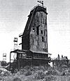
Stambaugh | The Hiawatha Mine Number One Complex includes five buildings. This mine was very productive from 1899 until 1950. The most striking part is the 120-foot tall steel Hiawatha Mine Number One headframe, built in 1904. It's the oldest surviving headframe in Michigan. | |
| 38 | Nels A. Holmes Farmstead |
(#83003713) |
Off M-189 46°03′01″N 88°38′38″W / 46.050278°N 88.643889°W |
Stambaugh | In 1884, Nelson Holmes, who came from Sweden, settled on this land. The farm has been in the Holmes and Sackerson family for over 100 years. | |
| 39 | House at 902 Selden Road |
(#83003714) |
902 Selden Rd. 46°04′49″N 88°38′36″W / 46.080278°N 88.643333°W |
Stambaugh | This house was built for the Youngstown Mines Corporation, likely for managers or supervisors. It has clapboard siding and Queen Anne style shingles on the gable. | |
| 40 | Frank C. Huse House |
(#83003724) |
408 5th St. 46°05′31″N 88°20′03″W / 46.091944°N 88.334167°W |
Crystal Falls | This house was probably built for Frank C. Huse, who was the local agent for the Chicago and Northwestern Railroad and the American Express Company. It looks a bit like a small-town train station. | |
| 41 | Iron County Courthouse |
(#75000948) |
Western end of Superior Ave. 46°05′48″N 88°20′07″W / 46.096667°N 88.335278°W |
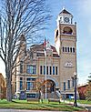
Crystal Falls | The Iron County Courthouse is a 2.5-story building with a unique style, sitting on a hilltop in Crystal Falls. Its location was part of a famous disagreement in the late 1800s between Crystal Falls and Iron River over where the county seat should be. | |
| 42 | Iron County Fair Exhibition Hall |
(#83003716) |
Franklin St. 46°06′02″N 88°38′47″W / 46.100556°N 88.646389°W |
Iron River | The Iron County Fair Exhibition Hall is a concrete building designed in 1931 for the Iron County Fair. It has a central, two-story octagonal part with single-story sections spreading out. It might be the last of its kind in Michigan. | |
| 43 | Iron River Creamery |
(#83003717) |
5 W. Cayuga St. 46°05′36″N 88°38′17″W / 46.093333°N 88.638056°W |
Iron River | The Iron River Creamery was started in 1913 by Henry H. Frailing. This new, larger creamery building was built in 1920. It's a good example of commercial architecture in the Classical Revival style. | |
| 44 | Iron River Town Hall |
(#83003718) |
106 W. Genesee St. 46°05′31″N 88°38′21″W / 46.091944°N 88.639167°W |
Iron River | This building was constructed in 1915. It's a three-story Neo-Classical building made of red brick. It still serves as the City of Iron River's town hall today. | |
| 45 | Italian Society Duke of Abruzzi Hall |
(#83003719) |
East of McGillis Ave. between Morgan and Sawyer Sts. 46°03′41″N 88°37′17″W / 46.061389°N 88.621389°W |
Caspian | The Duca Degli Abruzzi Italian Society built this hall in 1914. It was updated in 1929 with its current yellow brick front. The hall has a dance floor with its original tin ceiling and a room for making wine. A bocce ball court is next to the building. | |
| 46 | Jacob Jacobson House |
(#83003720) |
327 Maple Ave. 46°14′07″N 88°26′56″W / 46.235278°N 88.448889°W |
Amasa | This house was built by carpenter Jacob Jacobson in 1902 as his own home. It's a 1.5-story rectangular house with a gable roof and clapboard siding. | |
| 47 | James Mine Historic District |
(#83003721) |
Mineral Ave. and Mower St. 46°06′50″N 88°38′33″W / 46.113889°N 88.6425°W |
Mineral Hills | The James Mine operated from 1906 until 1950. The buildings in this district were built between 1906 and 1921 for the miners and mine officials. They include a dry house, pump house, blacksmith shop, and engine house, as well as homes and other buildings. | |
| 48 | Joseph Joseph House |
(#83003722) |
105 N. 8th Ave. 46°05′24″N 88°38′50″W / 46.09°N 88.647222°W |
Iron River | This house was built in 1925 for Joseph Joseph, an early Jewish settler who opened a clothing store in Iron River. This single-story house with white stucco and a red tile roof is a unique example of Spanish-style architecture in the county. | |
| 49 | Louis Levine House |
(#83003725) |
502 Selden Rd. 46°05′04″N 88°38′35″W / 46.084444°N 88.643056°W |
Stambaugh | This house was built around 1922-25. It's a special Colonial-style building with a porch across the front and clapboard and shingle siding. | |
| 50 | Lincoln School |
(#83003726) |
Northwest of Madison St. and 2nd Ave. 46°06′03″N 88°38′26″W / 46.100833°N 88.640556°W |
Iron River | The Lincoln School was designed in 1916 during Iron River's most prosperous time. It was the most developed Neo-Classical building in Iron County. This building is no longer standing. | |
| 51 | Alexander MacKinnon House |
(#83003727) |
134 Cayuga St. 46°05′37″N 88°38′23″W / 46.093611°N 88.639722°W |
Iron River | This house was built around 1900 for Alexander MacKinnon. Alexander and his brother Donald were pioneers in finding iron ore in the Iron River Valley. They also helped plan the village of Iron River in 1881. | |
| 52 | Donald C. MacKinnon House |
(#83003728) |
411 N. 9th St. 46°05′32″N 88°38′55″W / 46.092222°N 88.648611°W |
Iron River | This house was built in 1885 for Donald MacKinnon, who, with his brother Alexander, was key in discovering iron ore in the area. Donald C. MacKinnon was also the first village president of Iron River. This house is no longer standing. | |
| 53 | Mansfield Mine Location Historic District |
(#83003731) |
Stream Rd. 46°07′07″N 88°13′10″W / 46.118611°N 88.219444°W |
Mansfield | The Mansfield Mine was founded in 1889. In 1893, a terrible accident happened when the Michigamme River broke into the mine, causing a cave-in and drowning 27 miners. It was the worst mining accident in Iron County's history. The mine reopened later, and this district includes many log buildings built between 1896 and 1900. | |
| 54 | Mansfield Road – Michigamme River Bridge |
(#99001519) |
Mansfield Rd. over the Michigamme River 46°06′49″N 88°12′59″W / 46.113611°N 88.216389°W |
Mansfield Township | This bridge was completed in 1915. It was a special type of arch bridge. In 2007, the original bridge was taken down and replaced with a copy. | |
| 55 | John S. McLean House |
(#83003729) |
230 4th St. 46°05′03″N 88°37′53″W / 46.084167°N 88.631389°W |
Stambaugh | This house was built around 1882 for John McLean, a skilled blacksmith. It was one of several homes built by the Stambaugh Company for important mining workers. | |
| 56 | Lafayette McQuown House |
(#83003730) |
411 Adams St. 46°05′05″N 88°37′52″W / 46.084722°N 88.631111°W |
Stambaugh | This house was built around 1895 for Lafayette McQuown, an early resident of Stambaugh who helped survey the town. He was also involved in local government and education. It's a good example of a miner's home from the late 1800s. | |
| 57 | William Moss House |
(#83003734) |
528 W. Genesee St. 46°05′31″N 88°38′40″W / 46.091944°N 88.644444°W |
Iron River | This house, built around 1908, is unusual for Iron County because it's a middle-class duplex (two separate living spaces). The first and second floors have different layouts. The owner, William Moss, likely lived on one floor and rented out the other. | |
| 58 | Munro – M.A. Hanna Mining Company Office Building |
(#83003736) |
107 N. 4th St. 46°05′21″N 88°38′35″W / 46.089167°N 88.643056°W |
Iron River | This large, two-story brick building was constructed around 1920 by the Munro Mining Company. It later became the office for the M. A. Hanna Company. It's built in the Classical Revival style. | |
| 59 | Timothy Murphy House |
(#83003737) |
17 N. 4th St. 46°05′51″N 88°19′57″W / 46.0975°N 88.3325°W |
Crystal Falls | The Timothy Murphy House, also known as the Harbour House, is a large two-story house built around 1900. It has a unique two-story porch that wraps around the house. It's now a museum for the Crystal Falls Museum Society. | |
| 60 | Park City Historic District |
(#83003739) |
Park City and DNR Rds. 46°13′53″N 88°26′17″W / 46.231389°N 88.438056°W |
Amasa | The Park City Historic District is a group of seven log houses and other buildings built by iron miners. It's one of three log cabin settlements left in Iron County. This district is special because the miners themselves bought and developed it, not the mining company. | |
| 61 | John H. Parks Company – Wills Hardware Building |
(#83003740) |
319 Superior Ave. 46°05′48″N 88°19′54″W / 46.096667°N 88.331667°W |
Crystal Falls | This building was constructed around 1890 for the John H. Parks Company Department Store. John H. Parks was the first mayor of Crystal Falls. Later, the building became a hardware store. | |
| 62 | Herman Rau House |
(#83003742) |
309 Marquette Ave. 46°05′44″N 88°19′55″W / 46.095556°N 88.331944°W |
Crystal Falls | This house was built around 1890 for Herman Rau, who owned a local grocery and meat market. The house is known for its well-preserved Late Victorian details. | |
| 63 | David M. Ross House |
(#83003743) |
120 S. 4th St. 46°05′42″N 88°19′58″W / 46.095°N 88.332778°W |
Crystal Falls | This cobblestone house was built for David M. Ross, who owned a grocery store. It's one of the best examples of the bungalow style in Iron County. | |
| 64 | Steven Royce House |
(#83003744) |
920 Forest Parkway 46°05′49″N 88°20′30″W / 46.096944°N 88.341667°W |
Crystal Falls | This house was built by a mining company for its professional and managerial staff. Steven Royce, a geologist, was an early resident of the house. | |
| 65 | William Russell House |
(#83003746) |
209 Michigan Ave. 46°05′40″N 88°19′48″W / 46.094444°N 88.33°W |
Crystal Falls | This two-story house was built in 1888 for William Russell, an early Crystal Falls businessman. It's one of the finest Queen Anne houses in Iron County, with a cross-gable roof and wooden shingles on the gables. | |
| 66 | Scalcucci's Grocery |
(#83003748) |
2102 River Ave. 46°06′30″N 88°38′14″W / 46.108333°N 88.637222°W |
Iron River | This building was constructed in 1905. In 1914, John Scalcucci bought it and ran a grocery store on the first floor, living on the second. The grocery is famous for an event in 1920 where a disagreement happened between local police and state officials about rules, leading to a big local stir. | |
| 67 | John Soderman Farmhouse |
(#83003749) |
N. 6th St. 46°06′16″N 88°20′12″W / 46.104444°N 88.336667°W |
Crystal Falls | This house was originally owned by John Soderman, a successful dairy and potato farmer. Soderman was one of the few full-time farmers in Iron County. | |
| 68 | Spies Boardinghouse |
(#83003750) |
700 Grant St. 46°06′34″N 88°37′55″W / 46.109444°N 88.631944°W |
Mineral Hills | The Spies Boardinghouse is a long, two-story building with clapboard siding and a gable roof. It was built in 1909 by the Cleveland Cliffs Iron Company to house unmarried miners working at the nearby Spies Mine. | |
| 69 | St. Mary's Assumption Catholic Church |
(#83003759) |
105 5th Ave. 46°05′22″N 88°38′41″W / 46.089444°N 88.644722°W |
Iron River | This church was built for local Catholics of Polish heritage. The main part was built in 1920-22 in a Gothic Revival style. The church closed in 1981-82, and its members joined St. Agnes church nearby. | |
| 70 | Charles Stolberg House |
(#83003751) |
411 3rd St. 46°05′08″N 88°37′49″W / 46.085556°N 88.630278°W |
Stambaugh | This house was built in 1909 for Charles Stolberg, one of Stambaugh's first residents. Stolberg worked in local mines for 48 years. The house is important as one of the best-preserved Queen Anne buildings in Stambaugh. | |
| 71 | Robert H. Sturgeon House |
(#83003752) |
112 Cayuga St. 46°05′38″N 88°38′20″W / 46.093889°N 88.638889°W |
Iron River | This 2.5-story Queen Anne house was built around 1900. It was the home of Dr. Robert H. Sturgeon, Iron River's first doctor. Dr. Sturgeon worked for mining companies, had his own practice, and helped start the first hospital in Iron River. | |
| 72 | John Swanson House |
(#83003761) |
226 4th St. 46°05′03″N 88°37′54″W / 46.084167°N 88.631667°W |
Stambaugh | This house was built in 1913 for John Swanson, who started the Consolidated Mercantile Store. The Swanson House is a two-story American foursquare building with a front porch. | |
| 73 | Triangle Ranch Headquarters Historic District |
(#83003762) |
North of Amasa 46°18′54″N 88°25′13″W / 46.315°N 88.420278°W |
Amasa | Triangle Ranch was started in 1920 to raise special kinds of cattle. The owner bought a lot of land and built five huge buildings. However, it was hard to grow enough food for the animals in winter. The ranch tried other things like fur farming and a dude ranch, but it never made money and closed in 1952. | |
| 74 | William J. Tully House |
(#83003764) |
419 W. Cayuga St. 46°05′37″N 88°38′39″W / 46.093611°N 88.644167°W |
Iron River | This American foursquare house was built in 1909. It was the last home of William J. Tully, an early resident of Iron River who eventually owned a mine. | |
| 75 | US 2 – Iron River Bridge |
(#99001518) |
Old US 2 over the Iron River 46°06′07″N 88°30′00″W / 46.101944°N 88.5°W |
Iron River | The Iron River bridge is a 55-foot long arch bridge that was finished in 1917. | |
| 76 | Van Ornum's Addition Historic District |
(#83003770) |
927, 937, 941, 947, and 953 4th St. 46°05′52″N 88°38′32″W / 46.097778°N 88.642222°W |
Iron River | This district includes five houses. Four are bungalows built by Edward J. Van Ornum, a well-known builder and developer in Iron River. The fifth is Van Ornum's own home, a two-story house. He built the bungalows in 1934. | |
| 77 | Van Platen - Fox Lumber Camp Historic Complex |
(#83003766) |
281 University Rd. 46°10′35″N 88°53′21″W / 46.176389°N 88.889167°W |
Stambaugh | The Van Platen - Fox Lumber Camp Historic Complex has four wooden buildings. It's important because it might be the only logging camp still standing in the western Upper Peninsula. The camp was built in 1921 for harvesting hardwood trees. The University of Michigan later used it as a summer training camp for forestry students from 1937 to 1988. | |
| 78 | Harvey Van Wagner House |
(#83003767) |
103 N. 7th Ave. 46°05′21″N 88°38′45″W / 46.089167°N 88.645833°W |
Iron River | This house was built around 1920. It's a slightly changed version of a design from a 1918 house-plan book. The house has alternating narrow and wide rows of shingles and a porch with brick supports. | |
| 79 | Wall - Seppanen House |
(#83003768) |
21 N. 7th Ave. 46°05′17″N 88°38′45″W / 46.088056°N 88.645833°W |
Iron River | This house was built around 1920. It's a very nice bungalow design with craftsman elements, covered in stucco and cobblestones. It was once home to James S. Wall, a manager at a mining company, and later Wayne E. Seppanen, who became the superintendent of the Caspian Mine. | |
| 80 | Joseph Windsor House |
(#83003769) |
629 W. Genesee St. 46°05′30″N 88°38′44″W / 46.091667°N 88.645556°W |
Iron River | This brick and stucco house was built around 1912 for Joseph Windsor, who ran a funeral and furniture business with his brother William. |


