National Register of Historic Places listings in Kent County, Maryland facts for kids
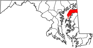
Welcome to Kent County, Maryland! This special place is home to many historic sites. These sites are so important that they are listed on the National Register of Historic Places. Think of it like a national hall of fame for buildings, areas, and objects that tell us about America's past.
When a place is on this list, it means it's recognized for its history, architecture, or what it means to our culture. It helps protect these places for future generations, like you, to learn from and enjoy. In Kent County, there are 42 amazing places on this list, including two that are even more special, called National Historic Landmarks!
Contents
What is the National Register of Historic Places?
The National Register of Historic Places is the official list of the nation's historic places worth saving. It's part of a program by the United States government to help people understand and protect important parts of our history. These places could be old homes, churches, schools, bridges, or even entire neighborhoods!
When a place is added to the Register, it gets special recognition. This can help people get grants or tax benefits to help take care of these historic spots. It also makes sure that if any big projects are planned nearby, the historic place is considered and protected.
Historic Places in Kent County
Kent County has a rich history, and its historic places show us what life was like long ago. Let's explore some of these cool spots!
Chestertown Historic District
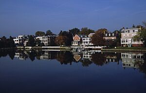
One of the most important places is the Chestertown Historic District. This whole area is like a living museum! It includes many old buildings and streets in Chestertown, especially near the Chester River. It was added to the National Register in 1970.
Walking through this district, you can see buildings from the 1700s and 1800s. They show different styles of architecture from those times. This district is important because it helps us remember what early American towns looked like and how people lived.
Historic Homes and Buildings
Kent County is full of beautiful old homes and other buildings that have stood for centuries.
Airy Hill
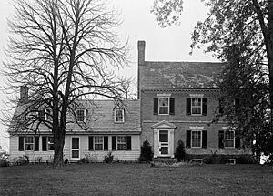
Airy Hill is a historic home located near Chestertown. It was built a long time ago and shows us the style of homes from that period. It was added to the Register in 1996.
Brampton
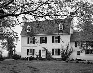
Brampton is another beautiful house near Chestertown. It's known for its grand design and history. This home became part of the National Register in 1983.
Carvill Hall
About 10 miles west of Chestertown, you'll find Carvill Hall. This historic building has been around since 1973 on the National Register. It's a great example of early architecture in the area.
Chestertown Armory
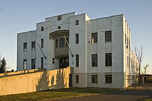
The Chestertown Armory is a unique building that was once used by the military. It's located on Quaker Neck Road in Chestertown and was listed in 1985. Armories were places where soldiers trained and stored their equipment.
Chestertown Railroad Station
The Chestertown Railroad Station on Cross Street in Chestertown reminds us of a time when trains were the main way to travel. This station, listed in 1982, played an important role in connecting Chestertown to other places.
Denton House
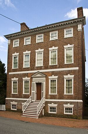
The Denton House is right on Water Street in Chestertown. It's a historic home that was added to the Register in 1971. It's a great example of the older homes found in the town.
Godlington Manor
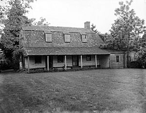
Godlington Manor is another historic estate near Chestertown, listed in 1972. These old manor homes often have interesting stories about the families who lived there.
Radcliffe Mill
The Radcliffe Mill on High Street in Chestertown is an old mill, listed in 2006. Mills were very important in the past for grinding grain into flour. This building shows us a piece of the county's industrial history.
Washington College: Middle, East and West Halls
Washington College is a very old college in Chestertown. Its historic buildings, including Middle, East, and West Halls, were added to the Register in 1979. These buildings have seen many students come and go over the years!
Widehall
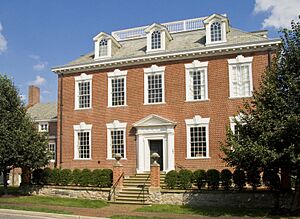
Also on Water Street in Chestertown is Widehall, a beautiful historic home listed in 1972. It's another example of the grand houses built in the area long ago.
Historic Churches
Churches often play a big part in a community's history. Kent County has several historic churches on the Register.
Christ Church, Graveyard and Sexton's House
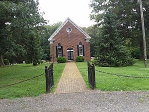
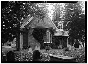
North of Worton, you'll find Christ Church, Graveyard and Sexton's House. This historic church, along with its graveyard and the house where the sexton (church caretaker) lived, was listed in 1980. It's a peaceful place that tells stories of past communities.
St. Paul's Church
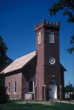
Near Fairlee, St. Paul's Church was added to the Register in 1980. These old churches are not just buildings; they are places where generations of people gathered.
Shrewsbury Church
Shrewsbury Church near Kennedyville is another historic church, listed in 1986. It's a beautiful example of early church architecture.
Historic Boats
Not all historic places are buildings! Some are boats that tell us about the county's connection to the water.
BERNICE J. (skipjack)
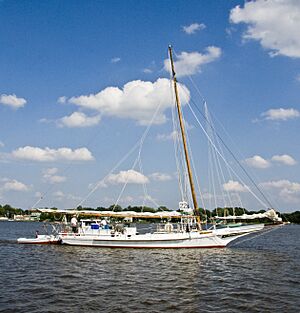
The BERNICE J. is a type of boat called a skipjack. Skipjacks were traditionally used for oyster dredging in the Chesapeake Bay. This boat, located at the Town Dock in Chestertown, was listed in 1985. It's a reminder of Maryland's important fishing history.
ELSWORTH (skipjack)
Another skipjack, the ELSWORTH, is also on the Register, listed in 1985. These boats are living pieces of history, showing how people worked and lived on the water.
NELLIE CROCKETT (Buy-Boat)
The NELLIE CROCKETT is a buy-boat, a type of boat used to buy seafood directly from fishermen. Located on the Sassafras River near Georgetown, it became a National Historic Landmark in 1994. This means it's considered one of the most important historic places in the entire country!
Other Notable Sites
There are many other interesting historic places across Kent County.
Betterton Historic District
The Betterton Historic District includes a significant part of the town of Betterton. This district, listed in 1984, shows how towns developed along the water.
Still Pond Historic District
The Still Pond Historic District in Still Pond was added to the Register in 2009. It includes several streets and buildings that show the history of this community.
Charles Sumner Post No. 25, Grand Army of the Republic
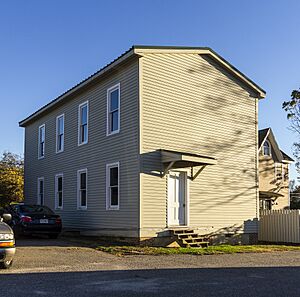
The Charles Sumner Post No. 25, Grand Army of the Republic building on South Queen Street in Chestertown was listed in 2005. This building was used by a group of American Civil War veterans. It's an important reminder of that time in American history.
Images for kids


