
National Register of Historic Places listings in Kenton County, Kentucky facts for kids

Have you ever wondered about old buildings and places that have a special story? In Kenton County, Kentucky, there are many such places! They are listed on something called the National Register of Historic Places. This is like a special list kept by the United States government. It helps protect important buildings, sites, and even whole neighborhoods that tell us about the past.
When a place is on this list, it means it's really important for history, architecture, or even how our communities grew. Kenton County has 66 places on this list! Two of them are even more special and are called National Historic Landmarks. Let's explore some of these amazing historic spots!
Contents
What is the National Register of Historic Places?
The National Register of Historic Places is the official list of the nation's historic places worth saving. It's part of a program to help people understand and protect America's rich history. When a building or area is added to this list, it gets special recognition. This can help protect it from being torn down or changed too much. It also helps people learn about the stories these places hold.
Historic Gems in Covington
Covington, Kentucky has many of Kenton County's historic places. It's a city with a long and interesting past!
Famous Bridges and Homes
- John A. Roebling Suspension Bridge: This amazing bridge connects Covington, Kentucky, to Cincinnati, Ohio. It was built by John A. Roebling before he designed the famous Brooklyn Bridge! It opened in 1866 and was a huge step forward in bridge building. It's so important that it's a National Historic Landmark.
- Daniel Carter Beard Boyhood Home: This house was once home to Daniel Carter Beard. He was a famous artist and writer who helped start the Boy Scouts of America. Imagine growing up in a house that inspired such a big movement! This home is also a National Historic Landmark.
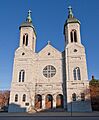
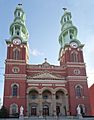
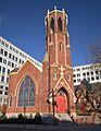
- Cathedral Basilica of the Assumption: This beautiful church on Madison Avenue is a grand building that looks a bit like famous cathedrals in Europe. It's known for its stunning architecture and stained-glass windows.
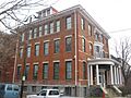
- Kenton County Library: This old library building on Scott Street was built with money from Andrew Carnegie, a famous businessman who helped build many libraries across the country. It's a great example of how important libraries were, and still are, to communities.
- Frank Duveneck House and Studio: This was the home and workplace of Frank Duveneck, a very talented American painter and teacher. He was known for his portraits and landscapes.
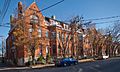
- Lincoln-Grant School: Located on Greenup Street, this school has an important history. It served African American students during a time when schools were segregated. It represents an important part of the community's past.
- Mother of God Roman Catholic Church: This church on West 6th Street is another beautiful and historic religious building in Covington, known for its unique design.
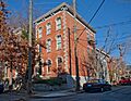
Historic Neighborhoods in Covington
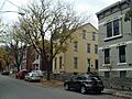
Many neighborhoods in Covington are also on the National Register. This means that the whole area, with its unique collection of homes and buildings, is considered special.
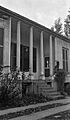
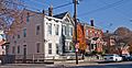
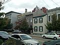
- Austinberg Historic District: This area is near the Licking River and has many historic homes.
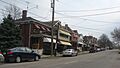
- Covington Downtown Commercial Historic District: This district covers a large part of downtown Covington, showing how the city's businesses and shops grew over time.
- Licking Riverside Historic District: This area along the Licking River is known for its beautiful old homes and scenic views.
- West Side-Main Strasse Historic District: This lively area, often called Main Strasse Village, has a strong German heritage. It's known for its historic buildings, shops, and restaurants.
- Seminary Square Historic District: This neighborhood is recognized for its historic homes and the way the community developed.
- Wallace Woods Area Residential Historic District: This district is known for its lovely residential streets and historic houses.
Historic Places in Other Kenton County Cities
Kenton County has historic sites beyond Covington too!
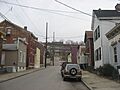
Ludlow's Landmarks
Ludlow, Kentucky also has some interesting places on the list:
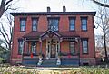
- Central Ludlow Historic District: This district includes many historic homes and buildings that show how Ludlow grew as a town.
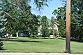
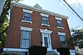
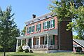
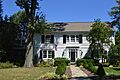
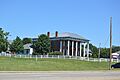
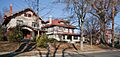
- Elmwood Hall: This grand house on Forest Avenue is a beautiful example of older architecture.
- Ludlow Lagoon Clubhouse: This building was once part of a popular amusement park called Ludlow Lagoon. It was a fun place for people to visit in the past!
- The Ludlow Theater: This old theater on Elm Street was a place where people gathered for entertainment, like movies or shows.
Fort Mitchell's Historic Areas
Fort Mitchell, Kentucky has several historic districts:
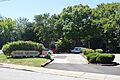
- Beechwood Historic District: This area is known for its historic homes and the way the neighborhood was planned.
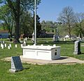
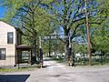
- Highland Cemetery Historic District: This cemetery is not just a burial ground; it's also recognized for its historic design, monuments, and landscaping.
- Old Fort Mitchell Historic District: This district includes some of the oldest parts of Fort Mitchell, showing its early development.
Erlanger and Bromley's Contributions
- Erlanger Proper Subdivision Historic District: In Erlanger, Kentucky, this district shows how neighborhoods were designed and built in the past.
- Pleasant Run Stone House I and II: These two stone houses in Bromley, Kentucky, are unique and show early building styles in the area.
Former Listings
Sometimes, a place might be removed from the National Register. This usually happens if the building is changed too much or is torn down. One example in Kenton County is the Champion Ice Manufacturing and Cold Storage Company in Covington, which was removed from the list in 1988.
These historic places in Kenton County help us remember the past and understand how our communities have changed over many years. They are like open-air museums, each with a story to tell!
Images for kids
-
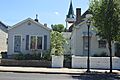
Austinberg Historic District
-
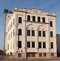
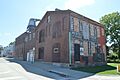
Bavarian Brewing Company
-
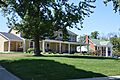
Beechwood Historic District
-
Central Ludlow Historic District
-
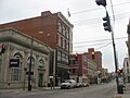
Covington Downtown Commercial Historic District
-
Dixie Highway Historic District
-
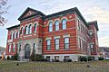
Eleventh District School
-
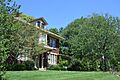
Elmwood Hall
-
Emery Row
-
Emery-Price Historic District
-
Erlanger Proper Subdivision Historic District
-
Fifth District School
-
Fort Mitchell Heights Historic District
-

Fourth District Elementary School
-
GAR Monument in Covington
-
Hearne House
-
Helentown Historic District
-
Hellman Lumber and Manufacturing Company
-
Holy Cross Church and School Complex-Latonia
-
House at 855-857 Oak Street
-
House at 859 Oak Street
-
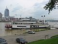
JOHN W. HUBBARD (sternwheeler)
-
Kenney's Crossing
-
Kruempelman Farmhouse
-
LaSalette Academy
-
Lee-Holman Historic District
-
Lewisburg Historic District
-
Licking Riverside Historic District
-
Linden Grove Cemetery
-
Ludlow Lagoon Clubhouse
-
The Ludlow Theater
-
Maxwell House
-
Moser Family Houses
-
Mother of God Roman Catholic Church
-
Mutter Gottes Historic District
-
Northern Bank of Kentucky
-
Odd Fellows Hall
-
Old Fort Mitchell Historic District
-

Park Hills Historic District
-
Robert Patton House
-
Pleasant Run Stone House I
-

Pleasant Run Stone House II
-
Ritte's Corner Historic District, Latonia
-

Riverside Drive Historic District
-
St. Augustine Church Complex
-
Seminary Square Historic District
-
Amos Shinkle Summer Residence
-
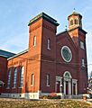
Trinity Episcopal Church
-
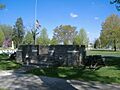
Veteran's Monument in Covington
-

Wadsworth Electric Manufacturing Company
-
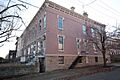
Wallace Woods Area Residential Historic District
-
West Fifteenth Street Historic District
-
Champion Ice Manufacturing and Cold Storage Company (Former Listing)


