
National Register of Historic Places listings in New Haven County, Connecticut facts for kids

Have you ever wondered about the oldest or most special buildings and places in your area? In New Haven County, Connecticut, there's a super important list called the National Register of Historic Places. It's like a hall of fame for buildings, neighborhoods, and other spots that are really important to American history, architecture, or culture.
When a place is added to this list, it means it's recognized as a special treasure. It helps protect these places and makes sure they can be enjoyed for many years to come.
New Haven County has a lot of these amazing historic places! There are 270 properties and areas listed here. Ten of these are even more special and are called National Historic Landmarks. The city of New Haven has many of its own listed places, so this article will focus on the other 203 cool spots found throughout the rest of the county.
What is the National Register?
The National Register of Historic Places is the official list of the nation's historic places worth saving. It's part of a program by the United States government to help people appreciate and protect historic buildings and sites.
Why are places listed?
Places get listed for many reasons:
- History: Maybe a famous person lived there, or an important event happened there.
- Architecture: The building might be a great example of a certain style, or it was designed by a famous architect.
- Culture: It could be a place that tells a story about how people lived long ago, or it's important to a community's heritage.
Being on the list doesn't stop people from changing their private property, but it does encourage them to preserve these special places.
Cool Historic Spots in New Haven County
Let's explore some of the interesting places on the National Register outside of New Haven city!
Historic Homes and Buildings
Many old houses are on the list, showing us how people lived centuries ago.
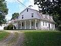
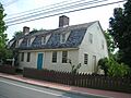
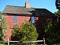
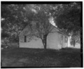
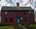
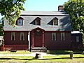
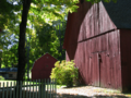
- The Acadian House in Guilford (listed 1975) is one such example.
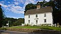
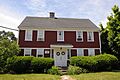
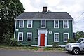
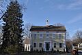
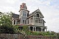
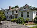
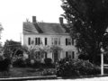
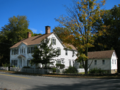
- The Allis-Bushnell House in Madison (listed 1982) is another old home that tells a story of the past.
- In Orange, the William Andrew House (listed 2002) is an 18th-century house that has stood for a very long time.
- The Moses Andrews House in Meriden (listed 1978) is a historic homestead.
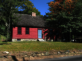
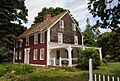
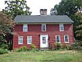
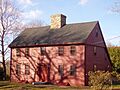
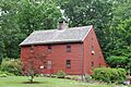
- The Solomon Goffe House in Meriden (listed 1979) is a special type of old house called a "saltbox" house.
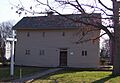
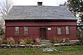
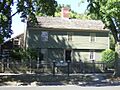
- The Henry Whitfield House in Guilford (listed 1997) is super old! It was built in 1639, making it the oldest house in Connecticut. Imagine living in a house built almost 400 years ago!
Other important buildings include:
- The Ansonia Library in Ansonia (listed 1985) is a beautiful building where people have been reading and learning for decades.
- The Charter Oak Firehouse in Meriden (listed 1994) is a historic fire station.
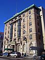
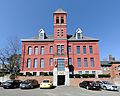
- The Elton Hotel in Waterbury (listed 1983) was built in 1906 after a big fire. It's a grand hotel with a fancy style.
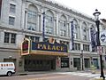
- The Palace Theater in Waterbury (listed 1983) is a historic theater where many shows and performances have taken place.
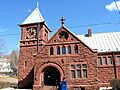
- The Sterling Opera House in Derby (listed 1968) is a very famous place! Many well-known performers like Amelia Earhart, Harry Houdini, and George Burns appeared on its stage.
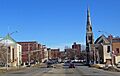
Historic Districts and Areas
Sometimes, not just one building, but a whole group of buildings or an entire neighborhood is historic. These are called "historic districts."
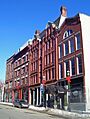
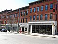
- The Bank Street Historic District in Waterbury (listed 1983) has cool brick buildings from the late 1800s.
- The Branford Center Historic District in Branford (listed 1987) shows what a town center looked like long ago.
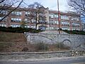
- The Downtown Waterbury Historic District (listed 1983) is the old heart of the city, with many buildings rebuilt after a fire in the early 1900s.
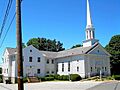
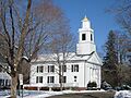
- The Guilford Historic Town Center (listed 1976) is a large area that includes many important historic buildings and spaces.
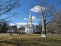
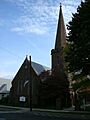
- The Orange Center Historic District in Orange (listed 1989) includes a beautiful church from 1810 and an old schoolhouse from 1878.
- The Russian Village Historic District in Southbury (listed 1988) is a unique neighborhood with a special history.
Parks and Outdoor Sites
Even parks and natural areas can be historic!
- East Rock Park in Hamden (listed 1997) was designed by Frederick Law Olmsted, a very famous landscape architect who also designed Central Park in New York City.
- Hubbard Park in Meriden (listed 1997) is another beautiful park on the list.
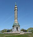
- The Sleeping Giant Tower in Hamden (listed 1986) is a cool stone tower at the top of Sleeping Giant State Park, offering amazing views.
Unique and Industrial Sites
Some listings highlight Connecticut's industrial past or unique features.
- The Branford Electric Railway Historic District (listed 1983) in Branford and East Haven includes an old trolley line and a collection of historic trolleys.
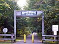
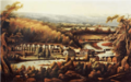
- The Farmington Canal (listed 1985) was once a canal for boats, then a railroad line, and now it's a popular multi-use trail for walking and biking! There's even a specific part called Farmington Canal Lock in Cheshire (listed 1973) that was built in 1822.
- The Falkner's Island Lighthouse (listed 1990) is located five miles south of Guilford in the Long Island Sound. Lighthouses are important for guiding ships.
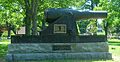
- The Eli Whitney Gun Factory in Hamden (listed 1974) is connected to Eli Whitney, a famous American inventor.
- The Stevenson Dam Hydroelectric Plant (listed 2000) in Oxford is a dam, bridge, and powerhouse built in 1917 on the Housatonic River. It shows how we used to get power.
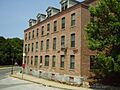
- The Waterbury Clock Company building (listed 1982) in Waterbury reminds us of the city's history of making clocks.
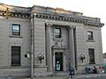
- The Waterbury Union Station (listed 1978) is a grand train station from 1908. Its clock tower has become a symbol of Waterbury!
These are just a few examples of the many interesting and important places in New Haven County that are recognized for their historical value. Each one tells a part of Connecticut's story!
Images for kids
-
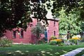
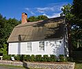
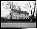
The Acadian House in Guilford.
-
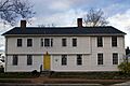
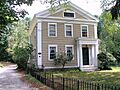
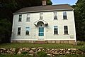
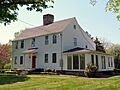
The Allis-Bushnell House in Madison.
-
The William Andrew House in Orange.
-
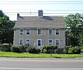
The Moses Andrews House in Meriden.
-
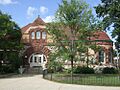
The Ansonia Library in Ansonia.
-
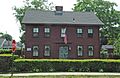
Buildings in the Bank Street Historic District, Waterbury.
-
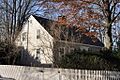
The Bullet Hill School in Southbury.
-
The Thomas Burgis II House in Guilford.
-
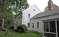
The Dr. Andrew Castle House in Woodbridge.
-
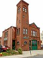
The Charter Oak Firehouse in Meriden.
-
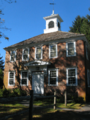
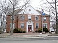
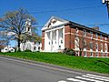
The Town Hall in the Cheshire Historic District.
-
The Curtis Memorial Library in Meriden.
-
The Thomas Darling House in Woodbridge.
-
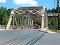
The Depot Street Bridge in Beacon Falls.
-

Buildings in the Downtown Seymour Historic District.
-
Buildings in the Downtown Waterbury Historic District.
-
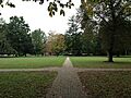
The East Haven Green Historic District.
-
East Rock Park in Hamden.
-
Edgerton in Hamden and New Haven.
-
The Eells-Stow House in Milford.
-
The Elton Hotel in Waterbury.
-
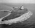
Falkner's Island Lighthouse in Guilford.
-
A sign for the Farmington Canal.
-
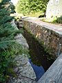
A lock on the Farmington Canal in Cheshire.
-
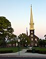
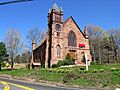
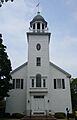
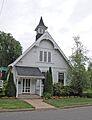
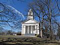
The First Congregational Church of Cheshire.
-
The First Congregational Church of East Haven.
-
The Edward Frisbie Homestead in Branford.
-
The Edward Frisbie House in Branford.
-
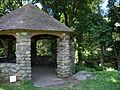
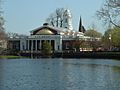
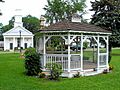
A gazebo in Lewis Fulton Memorial Park, Waterbury.
-
The Solomon Goffe House in Meriden.
-
The Griswold House in Guilford.
-
The Town Hall in the Guilford Historic Town Center.
-

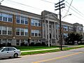
Hamden High School.
-
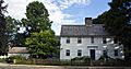
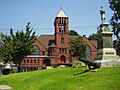
The Hamden Memorial Town Hall.
-
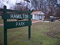
The entrance to Hamilton Park, Waterbury.
-

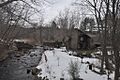
The Hammonasset Paper Mill Site in Madison.
-
The Timothy Baldwin House in Branford.
-
The Zaccheus Baldwin House in Branford.
-
The Bank Street Historic District in Waterbury.
-
The John Barker House in Wallingford.
-
The Samuel Beach House in Branford.
-
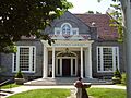
The Benedict-Miller House in Waterbury.
-
The Derby United Methodist Church in the Birmingham Green Historic District.
-
The Blackstone House in Branford.
-
The Joseph Blakeslee House in Wallingford.
-
The Timothy Bradley House in Branford.
-
The Branford Center Historic District.
-
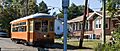
The Branford Electric Railway Historic District.
-
The Branford Point Historic District.
-

Bridge No. 1132 in Madison.
-
The Aaron Bronson House in Southbury.
-
The Buckingham House in Milford.
-

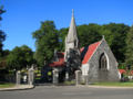
The Center Street Cemetery in Wallingford.
-
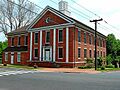
The Town Hall in the Cheshire Historic District.
-

The Colony Street-West Main Street Historic District in Meriden.
-
The Reuben Curtiss House in Southbury.
-
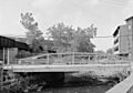
The Depot Street Bridge in Beacon Falls.
-
The East Haven Green Historic District.
-
The Eells-Stow House in Milford.
-
The Elton Hotel in Waterbury.
-
The Farmington Canal.
-
The Farmington Canal Lock in Cheshire.
-
The First Congregational Church of Cheshire.
-
The First Congregational Church of East Haven.
-
The Edward Frisbie Homestead in Branford.
-
The Edward Frisbie House in Branford.
-
Lewis Fulton Memorial Park in Waterbury.
-
The Solomon Goffe House in Meriden.
-
The Griswold House in Guilford.
-
The Guilford Historic Town Center.
-
Hamden High School.
-
The Hamden Memorial Town Hall.
-
Hamilton Park in Waterbury.
-
The Hammonasset Paper Mill Site in Madison.
-
The Kraus Corset Factory in Derby.
-
The Isaac C. Lewis Cottage in Branford.
-

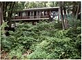
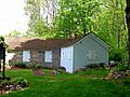
The Little Pootatuck Brook Archeological Site in Southbury.
-
The Madison Green Historic District.
-
The Marion Historic District in Cheshire.
-
The Meigs-Bishop House in Madison.
-
The Middlebury Center Historic District.
-
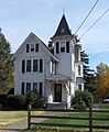
The Henry F. Miller House in Orange.
-
The Jonathan Murray House in Madison.
-
The Naugatuck Center Historic District.
-
The Nehemiah Royce House in Wallingford.
-
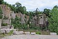
The Norcross Brothers Granite Quarry in Branford.
-
The North Branford Center Historic District.
-
The Northford Center Historic District.
-
The Norton House in Branford.
-
The Old West Haven High School.
-
The Orange Center Historic District.
-
Osbornedale in Derby.
-
The Palace Theater in Waterbury.
-
The Hezekiah Palmer House in Branford.
-
The Isaac Palmer House in Branford.
-
The Samuel Parsons House in Wallingford.
-
The Pine Orchard Union Chapel in Branford.
-
The Plaster House in Southbury.
-
The Col. Asa Platt House in Orange.
-
The Prospect Green Historic District.
-

The Quaker Farms Historic District in Oxford.
-
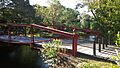
The Red Bridge in Meriden.
-
The River Park Historic District in Milford.
-
Riverside Cemetery in Waterbury.
-
The John Rogers House in Branford.
-
The Russian Village Historic District in Southbury.
-
The Sabbathday House in Guilford.
-
The Salem School in Naugatuck.
-
The Sanford Road Historic District in Southbury.
-

The Sanford-Humphreys House in Seymour.
-
The Seymour High School and Annex.
-

The Sheffield Street Bridge in Waterbury.
-
The Southwest District School in Wolcott.
-
St. Peter's Episcopal Church in Milford.
-
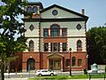
The Sterling Opera House in Derby.
-
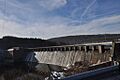
The Stevenson Dam Hydroelectric Plant in Oxford.
-
The Stick Style House at Stony Creek in Branford.
-
The Stony Creek-Thimble Islands Historic District.
-
The Swain-Harrison House in Branford.
-
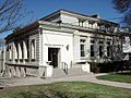
The Taylor Memorial Library in Milford.
-
The John Tyler House in Branford.
-
The Solomon Tyler House in Branford.
-
The Upper Main Street Historic District in Ansonia.
-
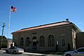
The US Post Office-Ansonia Main.
-
The US Post Office-Meriden Main.
-
The US Post Office-Milford Main.
-
The US Post Office-Naugatuck Main.
-
The Wallingford Center Historic District.
-
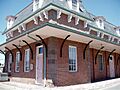
The Wallingford Railroad Station.
-
The Ward-Heitman House in West Haven.
-
The Washington Avenue Bridge in Waterbury.
-
The Washington Bridge in Milford.
-
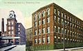
The Waterbury Clock Company building.
-
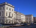
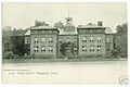
The Waterbury Municipal Center Complex.
-

The Waterbury Union Station.
-
The West Haven Green Historic District.
-

The Adin Wheeler House and Theodore F. Wheeler Wheelwright Shop in Southbury.
-
The Wheeler-Beecher House in Bethany.
-
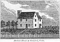
The Henry Whitfield House in Guilford.
-
The Eli Whitney Gun Factory in Hamden.
-
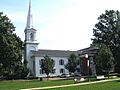
The Whitneyville Congregational Church in Hamden.
-
Wilby High School in Waterbury.
-
The Wolcott Green Historic District.
-
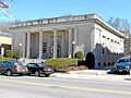
The Harcourt Wood Memorial Library in Derby.
-
The Woodbridge Green Historic District.
-
The Wooster Sawmill and Gristmill Site in Oxford.


.png)


.jpg)


.jpg)


