Orange, Connecticut facts for kids
Quick facts for kids
Orange, Connecticut
|
|||
|---|---|---|---|
| Town of Orange | |||
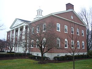
Orange Town Hall
|
|||
|
|||
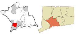 New Haven County and Connecticut New Haven County and Connecticut |
|||
| Country | |||
| U.S. state | |||
| County | New Haven | ||
| Region | South Central CT | ||
| Incorporated | 1822 | ||
| Government | |||
| • Type | Selectman-town meeting | ||
| Area | |||
| • Total | 17.4 sq mi (45.1 km2) | ||
| • Land | 17.2 sq mi (44.5 km2) | ||
| • Water | 0.2 sq mi (0.6 km2) | ||
| Elevation | 213 ft (65 m) | ||
| Population
(2020)
|
|||
| • Total | 14,280 | ||
| • Density | 820.7/sq mi (316.6/km2) | ||
| Time zone | UTC-5 (Eastern) | ||
| • Summer (DST) | UTC-4 (Eastern) | ||
| ZIP code |
06477
|
||
| Area code(s) | 203/475 | ||
| FIPS code | 09-57600 | ||
| GNIS feature ID | 0213485 | ||
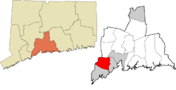
Orange is a town in New Haven County, Connecticut, United States. It's part of the South Central Connecticut Planning Region. In 2020, about 14,280 people lived here. The town is run by a group called the Board of Selectmen.
Contents
History of Orange
Long ago, the Paugusset and Algonquian Native American tribes lived in the area that is now Orange. In 1639, a man named Rev. Peter Prudden bought the land from them. He traded items like coats, blankets, and tools for the land.
When English settlers first arrived, Orange was the northern part of Milford. But by 1822, more people lived there. They wanted their own community, so Orange became its own town.
The town got its name from William III of England. He was known as the Prince of Orange before he became king. William became king after a big event called the Glorious Revolution in 1688. This happened because the previous king, James II, was seen as a ruler who didn't respect people's rights in Connecticut. He even tried to take away Connecticut's special Charter.
Orange kept growing in the 1800s. In 1921, Orange and West Haven officially separated. West Haven became its own city, taking most of the busy city areas. This made Orange a more quiet, rural town. But after World War II, Orange quickly grew into a suburban area with many homes.
Early roads through Orange included the Boston Post Road (now U.S. Route 1). Another important road was the Derby Turnpike (now Connecticut Route 34). This turnpike was once an old Native American path. A toll road was built in 1800 from New Haven to Derby. People paid a fee to use it until 1887.
A railroad, the New Haven and Derby Railroad, came through Orange in 1871. It had a station in town. Later, trolleys from New Haven to Derby started running in 1904. These trolleys led to the end of train service in 1925. Today, major highways like the Wilbur Cross Parkway and Interstate 95 pass through Orange.
There are plans for an Orange train station on the Metro-North Railroad's New Haven Line. Construction has been on hold since late 2017.
Geography of Orange
Orange covers about 17.4 square miles (45.1 square kilometers). Most of this is land, with a small part being water.
The town shares borders with several other towns. To the south is Milford. To the east is West Haven. To the north are New Haven, Woodbridge, and Derby. To the west, the Housatonic River separates Orange from Shelton. A small piece of land called Wooster Island in the Housatonic River is also part of Orange.
Several rivers flow through the town, including the Wepawaug, Indian, and Oyster rivers.
Orange Population Facts
| Historical population | ||
|---|---|---|
| Year | Pop. | ±% |
| 1830 | 1,341 | — |
| 1840 | 1,329 | −0.9% |
| 1850 | 1,476 | +11.1% |
| 1860 | 1,974 | +33.7% |
| 1870 | 2,634 | +33.4% |
| 1880 | 3,341 | +26.8% |
| 1890 | 4,537 | +35.8% |
| 1900 | 6,995 | +54.2% |
| 1910 | 11,272 | +61.1% |
| 1920 | 16,614 | +47.4% |
| 1930 | 1,530 | −90.8% |
| 1940 | 2,009 | +31.3% |
| 1950 | 3,032 | +50.9% |
| 1960 | 8,547 | +181.9% |
| 1970 | 13,524 | +58.2% |
| 1980 | 13,237 | −2.1% |
| 1990 | 12,830 | −3.1% |
| 2000 | 13,233 | +3.1% |
| 2010 | 13,956 | +5.5% |
| 2020 | 14,280 | +2.3% |
In 2000, there were 13,233 people living in Orange. About 35% of households had children under 18. Most households were married couples.
The population of Orange is spread out across different age groups. About 24.6% of people were under 18. The median age in town was 43 years old.
Economy in Orange
Orange is home to the North American headquarters of Pez candies. You know, those fun little dispensers with the candy! It's also where Avangrid and its energy companies, Southern Connecticut Gas and The United Illuminating Company, have their main offices.
Tangoe, Inc., a company that makes software for managing telecommunications, used to be based in Orange. Saab-Scania, a car company, had its US headquarters here from 1972 to 1992. Hubbell, which makes electrical products, was also headquartered in Orange for many years. In 2013, the University of New Haven bought the old Hubbell buildings to create a campus for graduate students.
Yale University also has a large campus, Yale's West Campus, partly in Orange. This campus used to belong to Bayer. In 2013, the Yale School of Nursing moved to a building on this campus that is mostly in Orange.
Even today, about three percent of Orange's land is used for farming. Field View Farm is a very old business. The Hine family has run this farm since 1639! Orange was also home to a seed company, Everett B. Clark Seed Company. This company later joined with others to form Asgrow, which is now part of Bayer.
You can find many stores and businesses along the Boston Post Road in Orange.
During the Cold War, Orange was a place where Nike missiles were kept. These missiles were meant to protect the Greater New Haven area. The old missile site is now home to the 103rd Air Control Squadron. This is part of the Connecticut Air National Guard.
Arts and Culture in Orange
Fun Events in Orange
Orange celebrates its farming history with the annual Orange Country Fair. This fair first ran from 1898 to 1912 and then started up again in 1975. It's still going strong today! You can see horse, oxen, and tractor pulls. There are also exhibits of animals, flowers, fruits, vegetables, and delicious baked goods.
In early August, the town also holds the Orange Volunteer Fireman's Carnival. This event helps raise money for the local volunteer fire department. Both the fair and the carnival happen at the fairgrounds near the High Plains Community Center.
Orange was also the location of one of the very first computer camps. It was held at the local Amity Jr. High School in 1977.
In 2009, Orange hosted ConnJam. This was a big Boy Scout event where over 3,000 Boy Scouts camped and took part in activities.
Historic Places in Orange
Several buildings and areas in Orange are listed on the National Register of Historic Places. This means they are important for their history or architecture.
- Col. Asa Platt House – This house was built in 1810 in the Federal style. It's known for its beautiful inside details, like oval shapes in the fireplaces and panels.
- Henry F. Miller House – This house was finished in 1949. It's built in the International Style, which was very modern at the time. It was even called "The House of Tomorrow" in a newspaper!
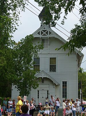
- Orange Center Historic District – This area includes several historic buildings around the town green. The Orange Congregational Church, built in 1810, is a main part of this district. It has a special window and a domed belfry. The district also has the Stone-Otis House, which is now a museum, and The Academy, an old schoolhouse from 1878, also a museum.
- William Andrew House (also known as Bryan-Andrew House) – This house was built around 1750 for the Bryan family, who were early settlers. It has detailed features like a fancy front cornice. The town bought the house in 2000 to restore it and turn it into a museum.
Library in Orange
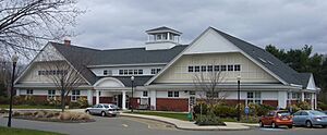
- Case Memorial Library
Sports in Orange
In 2005, the Orange Little League Girls softball team made it to the championship game of the Little League Softball World Series. They played against a team from McLean, Virginia.
Education in Orange
Students in Orange attend schools in the regional Amity Regional High School district, located in Woodbridge.
Here are some of the schools in Orange:
- Mary L. Tracy School, for kindergarten and pre-school students.
- Peck Place School, for first to sixth grades.
- Turkey Hill School, for first to sixth grades.
- Racebrook School, for first to sixth grades.
- Amity Middle School, for seventh to eighth grades (Orange campus).
Southern Connecticut Hebrew Academy (formerly New Haven Hebrew Day School) is also located in Orange.
Notable People from Orange
Many interesting people have lived in or come from Orange:
- Anni Albers (1899–1994), a famous artist.
- Josef Albers (1888–1976), also a well-known artist.
- William Atherton (born 1947), an actor, grew up in Orange.
- Art Ceccarelli (1930–2012), a baseball player.
- Christopher Collier (1930–2020), a historian and professor who won the Newbery Medal for his writing.
- John J. DeGioia (born 1957), the president of Georgetown University, was raised in Orange.
- Kristen Griest (born 1989), an Army Captain and one of the first two women to graduate from the US Army Ranger School.
- Henry Lee (born 1938), a famous forensic scientist known for investigating crimes.
- Lev Nussberg (born 1937), a Russian avant-garde painter.
- Patrick B. O'Sullivan (1887–1978), a US Congressman and judge.
- Tage Thompson (born 1997), an NHL player for the Buffalo Sabres.
- Stephen Valiquette (born 1977), an ice hockey goaltender.
Images for kids
See also
 In Spanish: Orange (Connecticut) para niños
 | Delilah Pierce |
 | Gordon Parks |
 | Augusta Savage |
 | Charles Ethan Porter |


