West Haven, Connecticut facts for kids
Quick facts for kids
West Haven, Connecticut
|
||
|---|---|---|
| City of West Haven | ||
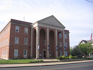
West Haven City Hall
|
||
|
||
| Motto(s): | ||
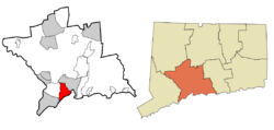 New Haven County and Connecticut New Haven County and Connecticut |
||
| Country | ||
| U.S. state | ||
| County | New Haven | |
| Region | South Central CT | |
| Incorporated (town) | 1921 | |
| Incorporated (city) | 1961 | |
| Government | ||
| • Type | Mayor-council | |
| Area | ||
| • Total | 10.92 sq mi (28.27 km2) | |
| • Land | 10.75 sq mi (27.84 km2) | |
| • Water | 0.17 sq mi (0.43 km2) | |
| Elevation | 33 ft (10 m) | |
| Population
(2020)
|
||
| • Total | 55,584 | |
| • Density | 5,171/sq mi (1,996.6/km2) | |
| Demonym(s) | Westie | |
| Time zone | UTC−5 (Eastern) | |
| • Summer (DST) | UTC−4 (Eastern) | |
| ZIP code |
06516
|
|
| Area code(s) | 203/475 | |
| FIPS code | 09-82800 | |
| GNIS feature ID | 0211953 | |
| Major highways | ||
| Commuter Rail | ||
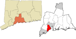
West Haven is a city in New Haven County, Connecticut, United States. It is located right on the coast of Long Island Sound. West Haven is part of the South Central Connecticut Planning Region. In 2020, about 55,584 people lived in the city.
Contents
Exploring West Haven's Past
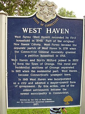
West Haven was first settled in 1648 and was known as West Farms. It was originally part of the New Haven Colony. In 1719, it became its own parish, but it was still officially part of New Haven until 1822.
West Haven During the American Revolution
During the American Revolution, West Haven was a busy spot for raiding parties. On July 5, 1779, British soldiers invaded New Haven Harbor. They came ashore in West Haven and East Haven.
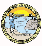
A brave teenager named Thomas Painter was watching for the British ships from Savin Rock. He is shown on the city's official seal. The main street, Campbell Avenue, is named after a British officer, William Campbell. He saved a local minister, Reverend Noah Williston, from being harmed by soldiers. Campbell even made his soldiers help the minister and set his broken leg. He also kept his troops in order and arrested soldiers who stole from locals. Sadly, Campbell was killed later that day on his way to New Haven. He is buried in the Allingtown area of West Haven.
Becoming a City: West Haven's Journey
West Haven tried to become its own town several times but failed. Finally, in 1822, it joined with North Milford to form the town of Orange. In 1921, West Haven separated from Orange and became its own town. It was officially made a city in 1961. This is why it's called "Connecticut's Youngest City," even though it's one of the state's oldest settlements.
The Fun Times at Savin Rock Amusement Park
The Savin Rock area of West Haven was once home to the famous Savin Rock Amusement Park. This park started in the late 1800s as a popular seaside resort. It grew into a big amusement park in the 1900s but closed in the 1960s. The park was located along the beachfront on the west side of New Haven Harbor.
After the park closed, there was a long effort to redevelop the area. It took about 40 years, with many votes and court cases. People wanted to protect the shoreline from too much building. Eventually, parts of the area became beautiful parks, like Bradley Point Veterans Memorial Park and Old Grove Park. These parks, with their walking and bike paths, are now part of Connecticut's longest public shoreline. Some restaurants still remain, reminding people of the area's past.
West Haven's Government and Fire Districts
West Haven has a mayor-council government. This means the city is led by a mayor and a city council. Nancy R. Rossi was the city's first female mayor, elected in 2017.
The city also has different fire districts. There are two independent fire districts: First Fire Taxation (Center) and West Shore. The Allingtown Fire District recently became part of the city. There are talks about combining the remaining fire districts to make things more organized.
Celebrating History and Helping Others
In 1986, West Haven celebrated the 200th birthday of the United States Constitution. The city held many events and even named an official ship, the USS Edson, and an official flower, the daylily. School children learned about the Constitution and marched in a parade.
In 2014, a special playground called "Where Angels Play" opened near Sea Bluff Beach. This playground was built to honor Charlotte Bacon, a young victim of the Sandy Hook Elementary School shooting. The playground is pink, Charlotte's favorite color, and includes some of her drawings.
Historic Places in West Haven
West Haven has several places listed on the National Register of Historic Places. These are important sites that are protected because of their historical value.
- American Mills Web Shop – 114-152 Boston Post Road (added 1983)
- Old West Haven High School – 278 Main Street (added 1985)
- Union School – 174 Center Street (added 1987)
- Ward-Heitman House – 277 Elm Street (added 2003)
- West Haven Green Historic District
West Haven's Location and Natural Features
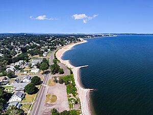
According to the U.S. Census Bureau, West Haven covers about 10.92 square miles (28.27 square kilometers). Most of this is land, with a small amount of water. West Haven is special because it has 3.5 miles of public beaches. This is a quarter of all the public beaches in Connecticut!
The hilly Allingtown area of the city is home to the University of New Haven. West Haven is bordered by the Oyster River to the southwest, Orange to the northwest, and New Haven to the north. The West River separates West Haven and New Haven. To the east is New Haven Harbor, and to the south is Long Island Sound. The Cove River also flows through the city.
Main Neighborhoods in West Haven
West Haven has three main neighborhoods, which are also its fire districts:
- Allingtown
- West Shore
- Center
There is also another neighborhood:
- Sandy Point - located next to the Sandy Point Beach and Bird Sanctuary.
People and Population in West Haven
| Historical population | |||
|---|---|---|---|
| Census | Pop. | %± | |
| 1930 | 25,808 | — | |
| 1940 | 30,021 | 16.3% | |
| 1950 | 32,010 | 6.6% | |
| 1960 | 43,002 | 34.3% | |
| 1970 | 52,851 | 22.9% | |
| 1980 | 53,184 | 0.6% | |
| 1990 | 54,021 | 1.6% | |
| 2000 | 52,360 | −3.1% | |
| 2010 | 55,564 | 6.1% | |
| 2020 | 55,584 | 0.0% | |
| U.S. Decennial Census | |||
In 2010, there were 55,564 people living in West Haven. The city had 19,886 households. The population density was about 5,170 people per square mile.
About 63.3% of the people were white, 20.6% were African American, and 4.2% were Asian American. About 23.2% of the population identified as Hispanic or Latino.
In 2019, the average income for a household in West Haven was about $62,985.
Businesses and Economy in West Haven
West Haven used to be a center for shipping and industry. It was known for companies that made buckles. Later, companies like Armstrong Rubber Co., Coleco (which made toys and video games), and Sikorsky Aircraft (which makes helicopters) had operations here.
Bayer Pharmaceuticals North America, a large company from Germany, had a plant in West Haven. However, they closed their operations in 2006. In 2007, Yale University bought the former Bayer campus. Yale now uses it for research in areas like biotechnology and pharmaceuticals.
Education in West Haven
The West Haven Board of Education manages the local public schools.
West Haven is also home to the University of New Haven. There is a U.S. Veterans Affairs hospital in the city. Yale Field, a baseball park for Yale University teams, is also located here. Some of Yale University's athletic fields extend into West Haven, including the Yale Bowl, which is the home field for the Yale Bulldogs football team.
Getting Around West Haven: Transportation
Major roads like Interstate 95, Connecticut State Route 34 (Derby Avenue), and U.S. Route 1 (Boston Post Road) pass through West Haven. Other state roads like Route 162 and Route 122 also serve the city.
Bus service is provided by Connecticut Transit New Haven. Buses connect different parts of West Haven and nearby areas.
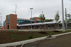
A rail line used by Metro-North Railroad and Amtrak runs through West Haven. In 2013, a new Metro-North station opened in West Haven. This station offers commuter rail service to New York City. While Amtrak trains pass through, they do not stop in West Haven. The closest Amtrak stop is in New Haven.
The closest airport with air service is Tweed New Haven Regional Airport, located in New Haven.
Famous People from West Haven
Many notable people have connections to West Haven:
- Marian Bergeron – Miss America 1933, the youngest winner ever.
- Ulish Booker – A former NFL football player.
- Dorinda Keenan Borer – A member of the Connecticut House of Representatives.
- Eleanor Estes – A well-known author of children's literature.
- Kevin Heffernan – An actor, writer, and comedian.
- Jamey Jasta – A metalcore musician.
- Judy Pancoast – A children's music singer and songwriter.
- Rufus Porter – A painter, inventor, and founder of Scientific American.
- William A. Soderman – A World War II hero who received the Medal of Honor.
- Tony Sparano – A former NFL coach.
- Ken Strong – An NFL football player who is in the Pro Football Hall of Fame.
- Smoky Joe Wood – A famous Major League Baseball pitcher.
See also
 In Spanish: West Haven (Connecticut) para niños
 | Roy Wilkins |
 | John Lewis |
 | Linda Carol Brown |


