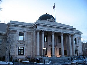
National Register of Historic Places listings in Washoe County, Nevada facts for kids
Contents: List of Registered Historic Places in Washoe County, Nevada, USA:
The locations of National Register properties and districts (at least for all showing latitude and longitude coordinates below), may be seen in an online map by clicking on "Map of all coordinates".
Current listings
Name on the Register | Image | Date listed | Location | City or town | Description | |
---|---|---|---|---|---|---|
1 | 1872 California-Nevada State Boundary Marker |
(#81000387) |
Northwest of Verdi on the California/Nevada border 39°31′28″N 120°00′07″W / 39.524389°N 120.001861°W |
Verdi | ||
2 | 20th Century Club |
(#83001113) |
335 W. 1st St. 39°31′29″N 119°49′02″W / 39.524722°N 119.817222°W |
Reno | ||
3 | Alamo Ranchhouse |
(#79001466) |
Southwest of Steamboat at 20205 S. Virginia St. 39°21′51″N 119°45′18″W / 39.364167°N 119.755°W |
Steamboat | ||
4 | Alpha Tau Omega Fraternity House |
(#03001508) |
205 University Terrace 39°32′08″N 119°49′10″W / 39.535556°N 119.819444°W |
Reno | ||
5 | Applegate-Lassen Trail |
(#78001722) |
Trail extends from Rye Patch northwest to the California state line 41°11′45″N 119°16′36″W / 41.195833°N 119.276667°W |
High Rock Canyon | ||
6 | Bank of Sparks |
(#07001013) |
948 Victorian Ave. 39°32′06″N 119°45′20″W / 39.535004°N 119.755419°W |
Sparks | ||
7 | W.E. Barnard House |
(#02000874) |
950 Joaquin Miller Dr. 39°30′47″N 119°49′09″W / 39.513056°N 119.819167°W |
Reno | ||
8 | Bethel AME Church |
(#01000587) |
220 Bell St. 39°31′34″N 119°49′13″W / 39.526111°N 119.820278°W |
Reno | ||
9 | Benson Dillon Billinghurst House |
(#74001151) |
729 Evans Ave. 39°31′51″N 119°48′49″W / 39.530833°N 119.813611°W |
Reno | ||
10 | Borland-Clifford House |
(#83001114) |
339 Ralston St. 39°31′42″N 119°49′11″W / 39.528333°N 119.819722°W |
Reno | ||
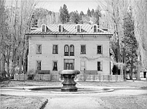
11 | Bowers Mansion |
(#76001143) |
19 miles (31 km) south of Reno off U.S. Route 395 39°17′04″N 119°50′26″W / 39.284444°N 119.840556°W |
Reno | ||
12 | Peleg Brown Ranch |
(#94001471) |
12945 Old Virginia Rd. 39°24′43″N 119°44′57″W / 39.411944°N 119.749167°W |
Reno | ||
13 | Charles H. Burke House |
(#84002077) |
36 Steward St. 39°31′16″N 119°48′31″W / 39.521111°N 119.808611°W |
Reno | ||
14 | Burke-Berryman House |
(#04000984) |
418 Cheney St. 39°31′06″N 119°48′06″W / 39.518333°N 119.801667°W |
Reno | ||
15 | Cal-Vada Lodge Hotel |
(#94000551) |
Junction of Stateline Rd. and State Route 28 39°13′38″N 120°00′16″W / 39.227222°N 120.004444°W |
Crystal Bay | ||
16 | California Building |
(#92001257) |
1000 Cowan Dr., Idlewild Park 39°31′19″N 119°50′00″W / 39.521944°N 119.833333°W |
Reno | ||
17 | Walter Cliff Ranch District |
(#85002428) |
7635 Old U.S. Route 395 39°13′29″N 119°48′42″W / 39.224722°N 119.811667°W |
Washoe Valley | ||
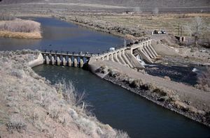
18 | Derby Diversion Dam |
(#78001727) |
19 miles (31 km) east of Sparks on Interstate 80 39°35′09″N 119°26′49″W / 39.585833°N 119.446944°W |
Sparks | Extends into Storey County | |
19 | El Cortez Hotel |
(#84002078) |
239 W. 2nd St. 39°31′36″N 119°48′57″W / 39.526667°N 119.815833°W |
Reno | ||
20 | Field Matron's Cottage |
(#03000416) |
1995 E. 2nd St. 39°31′40″N 119°47′11″W / 39.527775°N 119.786461°W |
Reno | ||
21 | First Church of Christ, Scientist |
(#99000939) |
501 Riverside Dr. 39°31′27″N 119°49′06″W / 39.524167°N 119.818333°W |
Reno | ||
22 | First United Methodist Church |
(#83001115) |
W. 1st and West Sts. 39°31′31″N 119°48′53″W / 39.525278°N 119.814722°W |
Reno | ||
23 | Fleischmann Atmospherium Planetarium |
(#94001148) |
N. Virginia St. on the University of Nevada, Reno campus 39°32′46″N 119°49′07″W / 39.546111°N 119.818611°W |
Reno | ||
24 | Francovich House |
(#83001116) |
557 Washington St. 39°31′41″N 119°49′10″W / 39.528056°N 119.819444°W |
Reno | ||
25 | Frey Ranch |
(#99000267) |
1140 W. Peckham Ln. 39°29′14″N 119°48′27″W / 39.487222°N 119.8075°W |
Reno | ||
26 | Galena Creek Schoolhouse |
(#11000255) |
16000 Callahan Rd. 39°21′39″N 119°49′06″W / 39.360833°N 119.818333°W |
Reno | School Buildings in Nevada MPS | |
27 | Luella Garvey House |
(#03001510) |
589-599 California Ave. 39°31′14″N 119°49′08″W / 39.520556°N 119.818889°W |
Reno | ||
28 | Gerlach Water Tower |
(#81000385) |
Main St. 40°39′05″N 119°21′13″W / 40.651389°N 119.353611°W |
Gerlach | ||
29 | Joseph Giraud House |
(#84002079) |
442 Flint St. 39°31′13″N 119°48′49″W / 39.520278°N 119.813611°W |
Reno | ||
30 | Glendale School |
(#78001729) |
Victorian Square 39°28′58″N 119°47′25″W / 39.482778°N 119.790278°W |
Sparks | ||
31 | William J. Graham House |
(#83001117) |
548 California Ave. 39°31′12″N 119°49′03″W / 39.52°N 119.8175°W |
Reno | ||
32 | Joseph H. Gray House |
(#87001472) |
457 Court St. 39°31′22″N 119°49′04″W / 39.522778°N 119.817778°W |
Reno | ||
33 | Greystone Castle |
(#02000875) |
970 Joaquin Miller Dr. 39°30′47″N 119°49′11″W / 39.513056°N 119.819722°W |
Reno | ||
34 | Hawkins House |
(#79001465) |
549 Court St. 39°31′19″N 119°49′07″W / 39.521944°N 119.818611°W |
Reno | ||
35 | Humphrey House |
(#83001118) |
467 Ralston St. 39°31′47″N 119°49′13″W / 39.529722°N 119.820278°W |
Reno | ||
36 | Immaculate Conception Church |
(#92001700) |
528 Pyramid Way 39°32′18″N 119°45′09″W / 39.538428°N 119.752586°W |
Sparks | ||
37 | J. Clarence Kind House |
(#05001121) |
751 Marsh Ave. 39°31′06″N 119°49′18″W / 39.518333°N 119.821667°W |
Reno | ||
38 | Lake Mansion |
(#72000767) |
250 Court Street 39°31′21″N 119°48′57″W / 39.5226°N 119.8159°W |
Reno | ||
39 | Landrum's Hamburger System No. 1 |
(#98001303) |
1300 S. Virginia St. 39°30′42″N 119°48′17″W / 39.511667°N 119.804722°W |
Reno | ||
40 | Levy House |
(#83001119) |
111-121 California Ave. 39°31′14″N 119°48′40″W / 39.520556°N 119.811111°W |
Reno | ||
41 | MacKay School of Mines Building |
(#82003258) |
University of Nevada, Reno campus 39°32′22″N 119°48′48″W / 39.539444°N 119.813333°W |
Reno | ||
42 | Marlette Lake Water System |
(#92001162) |
Roughly from Marlette Lake east to State Route 80 39°13′15″N 119°49′17″W / 39.220833°N 119.821389°W |
Virginia City | ||
43 | McCarthy-Platt House |
(#84002080) |
1000 Plumas St. 39°30′54″N 119°48′42″W / 39.515°N 119.811667°W |
Reno | ||
44 | McKinley Park School |
(#85002406) |
Riverside Dr. and Keystone Ave. 39°31′19″N 119°49′26″W / 39.521944°N 119.823889°W |
Reno | ||
45 | Miller-Rowe-Holgate House |
(#05000470) |
18 Winter St. 39°31′20″N 119°49′16″W / 39.522222°N 119.821111°W |
Reno | ||
46 | Morrill Hall, University of Nevada/Reno |
(#74001152) |
University of Nevada, Reno campus 39°32′15″N 119°48′46″W / 39.5375°N 119.812778°W |
Reno | Italianate building | |
47 | Mount Rose Elementary School |
(#77000841) |
915 Lander St. 39°30′56″N 119°48′53″W / 39.515556°N 119.814722°W |
Reno | ||
48 | Nevada-California-Oregon Railroad Depot |
(#80002469) |
325 E. 4th St. 39°31′52″N 119°48′34″W / 39.531111°N 119.809444°W |
Reno | ||
49 | Nevada-California-Oregon Railway Locomotive House and Machine Shop |
(#83001120) |
401 E. 4th St. 39°31′52″N 119°48′32″W / 39.531111°N 119.808889°W |
Reno | ||
50 | Newlands Historic District |
(#16000912) |
Bounded by Truckee R., Arlington & Marsh/Keystone Aves., Arlington & Monroe Sts., 39°30′57″N 119°49′16″W / 39.515844°N 119.821042°W |
Reno | ||
51 | Senator Francis G. Newlands House |
(#66000459) |
17 Elm Ct. 39°31′17″N 119°49′10″W / 39.521389°N 119.819444°W |
Reno | ||
52 | Mary Lee Nichols School |
(#02001277) |
400-406 Pyramid Way 39°32′13″N 119°45′09″W / 39.53706°N 119.75263°W |
Sparks | ||
53 | Nortonia Boarding House |
(#83001121) |
150 Ridge St. 39°31′19″N 119°48′46″W / 39.521944°N 119.812778°W |
Reno | ||
54 | Nystrom Guest House |
(#00000339) |
333 Ralston St. 39°31′41″N 119°49′11″W / 39.528056°N 119.819722°W |
Reno | ||
55 | Old Winters Ranch/Winters Mansion |
(#74001150) |
North of Carson City 39°18′43″N 119°49′18″W / 39.311944°N 119.821667°W |
New Washoe City | ||
56 | Patrick Ranch House |
(#03000417) |
1225 Gordon Ave. 39°30′44″N 119°49′04″W / 39.512222°N 119.817778°W |
Reno | ||
57 | Peavine Ranch |
(#00000337) |
11220 N. Virginia St. 39°37′46″N 119°55′13″W / 39.629444°N 119.920278°W |
Reno | ||
58 | Pincolini Hotel |
(#84000086) |
214 Lake St. 39°32′11″N 119°48′35″W / 39.536389°N 119.809722°W |
Reno | ||
59 | Pioneer Theater-Auditorium |
(#04001528) |
100 S. Virginia St. 39°31′27″N 119°48′37″W / 39.524167°N 119.810278°W |
Reno | ||
60 | Rainier Brewing Company Bottling Plant |
(#80002470) |
310 Spokane St. 39°31′54″N 119°47′57″W / 39.531667°N 119.799167°W |
Reno | ||
61 | Reno National Bank-First Interstate Bank |
(#86002257) |
204 N. Virginia St. 39°31′30″N 119°48′20″W / 39.525°N 119.805556°W |
Reno | ||
62 | Reno Southern Pacific Railroad Depot |
(#12000929) |
280 Commercial Row 39°31′43″N 119°48′37″W / 39.528738°N 119.810371°W |
Reno | ||
63 | Riverside Hotel |
(#86002256) |
17 S. Virginia St. 39°31′28″N 119°48′41″W / 39.524444°N 119.811389°W |
Reno | ||
64 | Robison House |
(#06000895) |
409 13th St. 39°32′14″N 119°45′35″W / 39.537139°N 119.759681°W |
Sparks | ||
65 | Southside School |
(#93000683) |
190 E. Liberty 39°31′20″N 119°48′29″W / 39.522222°N 119.808056°W |
Reno | ||
66 | Twaddle Mansion |
(#83001122) |
485 W. 5th St. 39°31′49″N 119°49′12″W / 39.530278°N 119.82°W |
Reno | ||
67 | Twaddle-Pedroli Ranch |
(#00000340) |
4970 Susan Lee Circle 39°16′04″N 119°50′06″W / 39.267778°N 119.835°W |
Washoe Valley | ||
68 | Tyson House |
(#83001123) |
242 W. Liberty St. 39°31′15″N 119°48′50″W / 39.520833°N 119.813889°W |
Reno | ||
69 | University of Nevada Reno Historic District |
(#87000135) |
Virginia St. 39°32′18″N 119°48′50″W / 39.538333°N 119.813889°W |
Reno | ||
70 | Pearl Upson House |
(#03000749) |
937 Jones St. 39°31′20″N 119°49′25″W / 39.522222°N 119.823611°W |
Reno | ||
71 | US Post Office-Reno Main |
(#90000135) |
50 S. Virginia St. 39°31′29″N 119°48′39″W / 39.524722°N 119.810833°W |
Reno | ||
72 | Vachina Apartments-California Apartments |
(#86002258) |
45 California Ave. 39°31′30″N 119°48′20″W / 39.525°N 119.805556°W |
Reno | ||
73 | Veterans Memorial School |
(#93000690) |
1200 Locust St. 39°30′48″N 119°47′53″W / 39.513333°N 119.798056°W |
Reno | ||
74 | Veterans of Foreign Wars Building |
(#08000511) |
301 Burris Ln. 39°29′21″N 119°47′57″W / 39.489167°N 119.799167°W |
Reno | ||
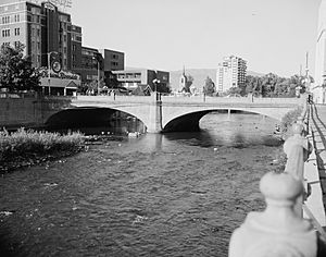
75 | Virginia Street Bridge |
(#80002471) |
Spans the Truckee River 39°31′30″N 119°48′42″W / 39.525°N 119.811667°W |
Reno | ||
76 | Wadsworth Union Church |
(#04000298) |
Junction of Lincoln Highway and Railroad Ave. 39°38′00″N 119°17′01″W / 39.633328°N 119.283656°W |
Wadsworth | ||
77 | Washoe County Courthouse |
(#86002254) |
117 S. Virginia St. 39°31′25″N 119°48′24″W / 39.523611°N 119.806667°W |
Reno | ||
78 | Washoe County Library |
(#13000011) |
301 S. Center St. 39°31′20″N 119°48′37″W / 39.522292°N 119.810287°W |
Reno | ||
79 | Washoe County Library-Sparks Branch |
(#92000116) |
814 Victorian St. 39°32′07″N 119°45′08″W / 39.535278°N 119.752222°W |
Sparks | ||
80 | Whittell Estate |
(#00001207) |
5000 State Route 28 39°10′29″N 119°55′55″W / 39.174623°N 119.931961°W |
Incline Village | Also known as Thunderbird Lodge | |
81 | Withers Log House |
(#00000341) |
344 Wassou 39°14′11″N 120°00′04″W / 39.236389°N 120.001111°W |
Crystal Bay |
Former listings
Name on the Register | Image | Date listed | Date removed | Location | City or town | Summary | |
---|---|---|---|---|---|---|---|
1 | Bell Telephone of Nevada |
(#86002260) |
|
100 N. Center |
Reno | Demolished in 1994. | |
2 | Mapes Hotel and Casino |
(#84002081) |
|
10 N. Virginia St. |
Reno | Imploded January 20, 2000. | |
3 | Odd Fellows Building |
(#78001730) |
|
133 N. Sierra St. |
Reno | Demolished in 1992. | |
4 | Riverside Mill Company Flourmill |
(#82003259) |
|
345 E. 2nd St. |
Reno | Demolished sometime in the 1980s. | |
5 | George Wingfield House |
(#82003260) |
|
219 Court Street |
Reno |
All content from Kiddle encyclopedia articles (including the article images and facts) can be freely used under Attribution-ShareAlike license, unless stated otherwise. Cite this article:
National Register of Historic Places listings in Washoe County, Nevada Facts for Kids. Kiddle Encyclopedia.