National Register of Historic Places listings in White Pine County, Nevada facts for kids
This article is about the amazing historic places you can find in White Pine County, Nevada. These places are special because they are listed on the National Register of Historic Places, which means they are important parts of American history and culture. Think of it like a Hall of Fame for buildings, sites, and objects! When a place is on this list, it helps protect it so future generations can learn from and enjoy it.
You can even see where many of these places are on a map by clicking on "Map of all coordinates" at the top of the page.
Contents
Exploring Historic Places in White Pine County
White Pine County is full of cool historical spots, especially around the cities of Ely, McGill, and Baker. Many of these places tell stories about mining, railways, and how people lived a long time ago.
Historic Buildings in Ely
Ely is a city with many buildings that have stood the test of time.
Theaters of Ely
Ely has two old movie theaters that are now on the historic list.
- The Capital Theater at 464–468 Aultman Street was a popular spot for entertainment. Imagine watching movies there decades ago!
- The Central Theater at 145 West 15th Street is another historic theater. Both of these buildings remind us of how people used to spend their free time.
Ely City Hall and Fire Station
The Ely City Hall and Fire Station at 501 Mill Street is a building that has served the community for many years. It's where important city decisions were made and where firefighters kept the city safe. It was added to the list in 2018.
Ely L.D.S. Stake Tabernacle
The Ely L. D. S. Stake Tabernacle at 900 Aultman Street is a beautiful building that was used for religious gatherings. It was built a long time ago and shows the history of faith in the area.
US Post Office, Ely, Nevada
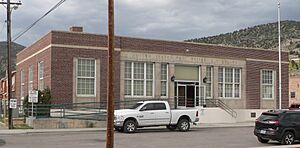
The US Post Office, Ely, Nevada at 415 5th Street was once the main place where people sent and received mail. It was built in 1937 and is now part of the Hotel Nevada's convention center.
White Pine County Courthouse
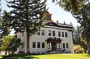
The White Pine County Courthouse on Campton Street is where important legal matters and government work for White Pine County happen. It's a significant building that represents the county's history and justice system.
McGill's Historic Spots
McGill is another town with interesting historical sites, especially related to its industrial past.
American Legion Hall
The American Legion Hall at 24 Avenue J in McGill is a place where veterans and community members gathered. It's a reminder of the people who served their country and the community spirit in McGill.
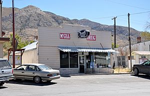
McGill Drug Store Museum
The McGill Drug Store at 11 4th Street is now a museum! It shows what a drug store looked like many years ago. You can imagine people buying medicines, candy, and other items there.
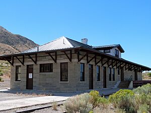
Nevada Northern Railway – McGill Depot
The Nevada Northern Railway – McGill Depot at 1 Avenue K was a train station where people and goods would arrive and depart from McGill. It's an important part of the railway history that connected these towns.
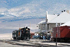
The Nevada Northern Railway Museum
The Nevada Northern Railway Museum in Ely is a very special place. It includes the East Ely Depot at 11th Street and the Nevada Northern Railway East Ely Yards and Shops at 1100 Avenue A. This whole area is like a living museum of trains! You can see old locomotives, train cars, and the workshops where they were repaired. It's a fantastic place to learn about the history of trains and how they helped Nevada grow.
Historic Sites Near Baker and Great Basin National Park
Near Baker and inside Great Basin National Park, you'll find several historic places that tell stories of early settlers and mining.
Baker Ranger Station
The Baker Ranger Station is located within Great Basin National Park. This station was important for managing the park and surrounding lands.
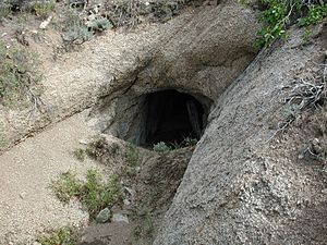
Johnson Lake Mine Historic District
The Johnson Lake Mine Historic District is also in Great Basin National Park. This area shows what an old mining site looked like. It reminds us of the gold and silver rushes that brought many people to Nevada.
Lehman Orchard and Aqueduct
The Lehman Orchard and Aqueduct in Great Basin National Park shows how early settlers grew food and brought water to their farms. An aqueduct is like a bridge or channel built to carry water.
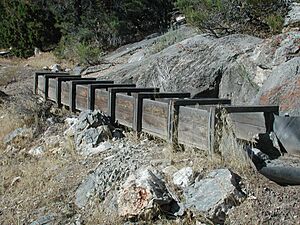
Osceola Ditch
The Osceola (East) Ditch starts about half a mile east of Grouse Canyon and runs for about 18 miles to Lehman Creek in Great Basin National Park. This ditch was an amazing engineering feat, built to bring water for mining and other uses.
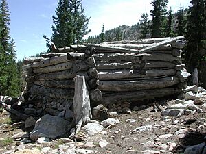
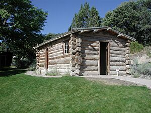
Rhodes Cabin
The Rhodes Cabin is another historic spot within Great Basin National Park. It's an old cabin that shows how people lived in the wilderness many years ago.
Other Notable Historic Places
Fort Ruby
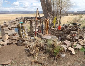
Fort Ruby, near Hobson, was a very important fort. It was built to protect the famous Pony Express riders and stagecoaches as they traveled across the country. Imagine how dangerous it must have been to deliver mail and travel back then!
Fort Schellbourne
Fort Schellbourne is located about 43 miles north of Ely, off U.S. Route 93. This fort also played a role in protecting travelers and communications routes in the past.
Lund Grade School
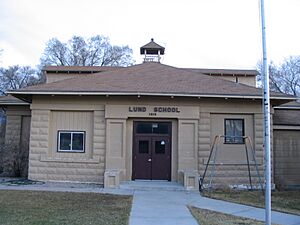
The Lund Grade School at 30 West Center Street in Lund is a historic school building. It's where many children in Lund learned and grew up. It reminds us of the importance of education in rural communities.
Ward Charcoal Ovens
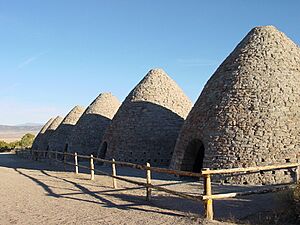
The Ward Charcoal Ovens are located south of Ely, off U.S. Route 6. These unique, beehive-shaped stone structures were used to make charcoal for the mining industry. They are a fascinating example of old industrial technology and are now part of a State Historic Park.


