National Register of Historic Places listings in Churchill County, Nevada facts for kids
The National Register of Historic Places is like a special list of important buildings, places, and objects in the United States. These places are chosen because they have a big story to tell about American history, architecture, archaeology, engineering, or culture. When a place is on this list, it means it's recognized as valuable and worth protecting for future generations.
In Churchill County, Nevada, there are many fascinating places on this list. They help us learn about the past, from ancient times when people lived in caves to the days of the Pony Express and the early towns. You can even see some of these places on a map by clicking on "Map of all coordinates" if they have location details.
Contents
- Historic Places in Churchill County
- Carson River Diversion Dam
- Churchill County Courthouse
- Churchill County Jail
- Cold Springs Pony Express Station Ruins
- The Cottage Schools
- Douglass-Frey Ranch
- Robert L. Douglass House
- Fallon City Hall
- Federal Building and Post Office
- Fort Churchill and Sand Springs Toll Road
- Grimes Point
- Harmon School
- Hazen Store
- Holy Trinity Episcopal Church
- Humboldt Cave
- Lahontan Dam and Power Station
- Lovelock Cave
- Maine Street Historic District
- Oats Park Grammar School
- Sand Springs Station
- Stillwater Marsh
Historic Places in Churchill County
Carson River Diversion Dam
The Carson River Diversion Dam was built on the Carson River near Fallon. It's an important part of how water is managed in the area. Dams like this help control water for farming and other uses, which was very important for early settlers in dry Nevada. It was added to the list in 1981.
Churchill County Courthouse
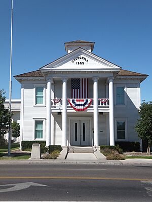
The Churchill County Courthouse is located at 10 Williams Street in Fallon. This building is where many important decisions for the county have been made over the years. Courthouses are often grand buildings because they represent justice and local government. It became a historic place in 1992.
Churchill County Jail
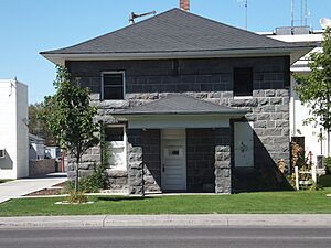
Right near the courthouse, at 10 West Williams Avenue in Fallon, is the old Churchill County Jail. This building tells us about the early justice system in the county. It was added to the National Register in 2002.
Cold Springs Pony Express Station Ruins
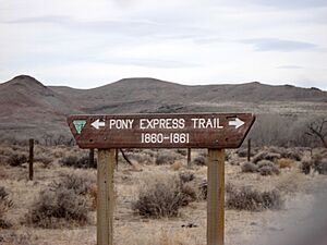
Imagine a time when letters were delivered by riders on horseback across the country! The Pony Express was a famous mail service in the 1860s. The Cold Springs Pony Express Station Ruins near Frenchman are what's left of one of the stops where riders would change horses and rest. It's a reminder of how fast mail used to travel before trains and cars. This site was recognized in 1978.
Cold Springs Station Site
Another related site, the Cold Springs Station Site, is about 51 miles west of Austin on U.S. Route 50. This was also a key stop for travelers and mail in the old days. It was added to the list in 1972.
The Cottage Schools
Located at 255 East Stillwater Avenue in Fallon, The Cottage Schools are important because they show us how education used to be organized. These buildings were part of a group of schools, and they were added to the list in 2008.
Douglass-Frey Ranch
The Douglass-Frey Ranch is a historic ranch located near Fallon. Ranches like this played a huge role in the development of Nevada, providing food and resources. It was added to the National Register in 2015.
Robert L. Douglass House
The Robert L. Douglass House at 10 South Carson Street in Fallon is a beautiful old home. It belonged to Robert L. Douglass, an important person in Fallon's history. Old houses like this often show us the styles and ways of life from a different era. It became a historic place in 2001.
Fallon City Hall
The Fallon City Hall at 55 East Williams Avenue in Fallon is where the city's government operates. This building has been a central point for the community's decisions and services for many years. It was added to the list in 2004.
Federal Building and Post Office
The Federal Building and Post Office at 90 North Maine Street in Fallon served as a key place for mail services and federal government activities. Post offices were vital connections for communities in the past. This building was recognized in 2006.
Fort Churchill and Sand Springs Toll Road
The Fort Churchill and Sand Springs Toll Road is a historic road that was once used for travel and trade. Toll roads were common ways to fund road construction in early times. This road is connected to Fort Churchill, an important military post in Nevada's history. It was added to the list in 1997.
Grimes Point
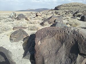
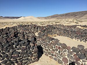
Grimes Point is an amazing archaeological site located about 7 miles east of Fallon along U.S. Route 50. It's famous for its ancient rock carvings, called petroglyphs, made by Native Americans thousands of years ago. These carvings tell us about the early people who lived in this area. It became a historic place in 1972.
Harmon School
The Harmon School is located at the junction of Kirn Road and Harmon Road near Fallon. Like The Cottage Schools, this building shows us the history of education in rural Nevada. It was added to the National Register in 1989.
Hazen Store
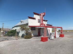
The Hazen Store at 600 Reno Highway in Hazen was a central gathering place for the community. General stores were often the heart of small towns, providing everything from food to tools and a place for people to meet. It was recognized as historic in 2002.
Holy Trinity Episcopal Church
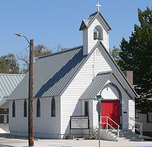
The Holy Trinity Episcopal Church at 507 Churchill Street in Fallon is a beautiful example of historic church architecture. Churches often serve as important community centers and reflect the history of a town's people and their beliefs. It was added to the list in 2003.
Humboldt Cave
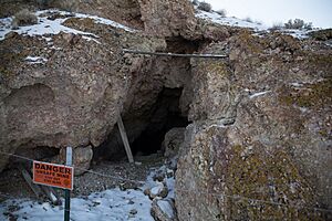
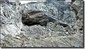
Humboldt Cave is an important archaeological site south of Lovelock. Caves like this were used by ancient people for shelter and storage, and they often contain artifacts that tell us about their lives. It became a historic place in 1976.
Lahontan Dam and Power Station
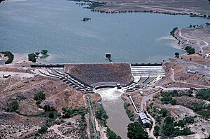
The Lahontan Dam and Power Station, southwest of Fallon, is another significant dam in Churchill County. Built for irrigation and power generation, it was crucial for developing agriculture in the region. It was added to the National Register in 1981.
Lovelock Cave
Lovelock Cave near Lovelock is one of the most famous archaeological sites in Nevada. It's known for its incredible preservation of ancient artifacts, including baskets, tools, and even mummified remains, which have taught us a lot about the early Native American cultures in the Great Basin. It was recognized as a historic place in 1984.
Maine Street Historic District
The Maine Street Historic District covers downtown areas along Maine and Center Streets and Williams Avenue in Fallon. A historic district means that a whole area, not just one building, is important because of its history and the way it looks. This district shows how Fallon grew and developed over time. It was added to the list in 2019.
Oats Park Grammar School
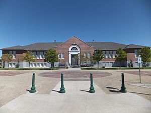
The Oats Park Grammar School at 167 East Park Street in Fallon is another historic school building. It's a reminder of the importance of education in the community's past. It became a historic place in 1990.
Sand Springs Station
The Sand Springs Station was another important stop along the historic Pony Express route. These stations were vital for the riders and their horses, allowing them to rest and continue their journey across the vast Nevada landscape. The ruins of this station near Fallon were added to the list in 1980.
Stillwater Marsh
The Stillwater Marsh near Fallon is a significant natural area. While not a building, natural landscapes can also be historic if they have cultural or archaeological importance. Marshes like Stillwater are important ecosystems and may have been used by early inhabitants. It was added to the National Register in 1975.


