National Register of Historic Places listings in Pershing County, Nevada facts for kids
The National Register of Historic Places is like a special list of important places in the United States. These places could be buildings, areas, or even trails that tell us a lot about history, architecture, or what life was like long ago. When a place is on this list, it means it's recognized as valuable and efforts are made to protect it.
This article shares some of the amazing historic places found in Pershing County, Nevada. These sites help us understand the past of this part of Nevada, from ancient times when people lived in rock shelters to the days of railroads and early towns.
Contents
Historic Places in Pershing County
Applegate-Lassen Trail
The Applegate-Lassen Trail is a historic path that stretches from Rye Patch northwest towards the state line, crossing the Black Rock Desert. This trail was an important route for pioneers and travelers heading west in the 1800s. It helped people find their way through the tough Nevada landscape, making it a key part of American history.
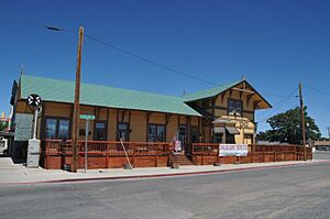
Central Pacific Railroad Depot
Located at 1005 W. Broadway Avenue in Lovelock, the Central Pacific Railroad Depot is an old train station. This building played a big role in the growth of Lovelock and the surrounding area. Train stations like this one were once busy hubs where people traveled and goods were moved, connecting towns across the country.
Dave Canyon, Se'aquada, Table Mountain
These three areas – Dave Canyon, Se'aquada, and Table Mountain – are important historic sites near Lovelock. Their exact locations are kept private to help protect them. These places likely hold clues about ancient cultures or natural history, making them very special for understanding the past.
Leonard Rock Shelter
The Leonard Rock Shelter is another important site near Lovelock whose location is kept secret for its protection. A "rock shelter" is a natural overhang in a rock formation that was often used by early people as a place to live or take shelter. This site is very valuable for archaeologists who study how people lived thousands of years ago.
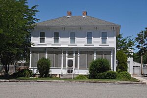
Marzen House
The Marzen House is a historic home located just south of Lovelock. Old houses like the Marzen House often show us how people lived, what kind of architecture was popular, and how families shaped the community in earlier times. It's a glimpse into the daily life of the past.
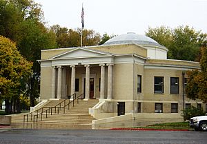
Pershing County Courthouse
You can find the Pershing County Courthouse at 400 Main Street in Lovelock. Courthouses are usually important buildings in any town, serving as the center for local government and legal matters. This courthouse has been a key part of Pershing County's community and history for many years.
Rye Patch Archeological Sites
The Rye Patch Archeological Sites are a group of important historical areas near Lovelock. Like some other sites on this list, their exact locations are not shared to help keep them safe from harm. Archeological sites are places where scientists dig up and study old objects and remains to learn about past human life and activities.
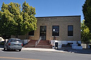
US Post Office-Lovelock Main
The main post office in Lovelock, known as the US Post Office-Lovelock Main, is located at 390 Main Street. Post offices have always been vital community buildings, helping people send letters and packages, and connecting towns to the wider world. This building has served the people of Lovelock for a long time.
Vocational-Agriculture Building
The Vocational-Agriculture Building stands at 1170 Elmhurst Street in Lovelock. This building was likely used to teach students about farming and other practical skills, which were very important in many communities. It shows how education has changed over time and how schools have helped prepare young people for different jobs.


