
National Register of Historic Places listings in York County, Maine facts for kids

Welcome to York County, Maine! This area is full of amazing old buildings and places that tell stories about the past. Many of these special spots are listed on the National Register of Historic Places. Think of it like a special list kept by the United States government to protect important historical places. When a place is on this list, it means it's recognized for its history, architecture, or what happened there.
In York County, there are over 180 places on this list! Some are single buildings, while others are entire neighborhoods called "Historic Districts." A few are even more special, known as "National Historic Landmarks," which means they are important to the history of the entire country. Let's explore some of these cool places!
Contents
What is the National Register of Historic Places?
The National Register of Historic Places is the official list of the nation's historic places worth saving. It's managed by the National Park Service. Being on the Register helps protect these places and often makes them eligible for special grants or tax breaks for their upkeep. It's like giving a gold star to buildings and areas that have played a big part in history!
Cool Historic Places in York County
York County has a rich history, from early settlements to bustling mill towns and beautiful coastal areas. Here are just a few examples of the many special places you can find here:
Lighthouses: Guiding Lights of the Past
Lighthouses are iconic symbols of Maine, and York County has several historic ones that have guided ships for centuries.
Boon Island Light Station
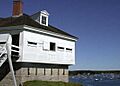
Imagine a lighthouse standing alone on a tiny, rocky island far out at sea! That's the Boon Island Light, located off the coast of York. It's a tall, granite tower that has warned sailors away from dangerous rocks since 1811. It's a truly wild and remote place, showing how important these lights were for safety at sea.

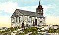
Cape Neddick Light Station (The Nubble)
One of Maine's most famous lighthouses is the Cape Neddick Light, often called "The Nubble." It's located on a small island just off the coast of York Beach. Built in 1879, this beautiful white tower with a red roof is a popular spot for visitors and photographers. It's a great example of how lighthouses were built to withstand harsh ocean weather.

Goat Island Light Station
Near Cape Porpoise, you'll find the Goat Island Light on a small island in the harbor. This lighthouse, first built in 1833, has a charming white tower and a keeper's house. It's still active today, helping boats navigate the busy waters.

Whaleback Light Station
Standing at the entrance to Portsmouth Harbor, the Whaleback Light is a sturdy granite tower built in 1872. It's designed to withstand powerful storms and has been a crucial aid to navigation for ships entering and leaving the harbor.

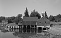
Wood Island Light Station
Off the coast of Biddeford Pool, the Wood Island Light has a long history, with the first lighthouse built here in 1808. The current tower dates back to 1858. It's a beautiful spot that reminds us of the maritime heritage of Maine.

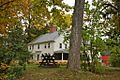
Historic Homes and Buildings
Many homes and public buildings in York County are on the National Register, showcasing different architectural styles and the lives of people from the past.
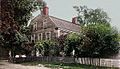
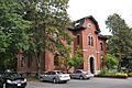
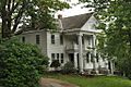
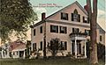
Sarah Orne Jewett House
In South Berwick, you can visit the Sarah Orne Jewett House. Sarah Orne Jewett was a famous American writer from the late 1800s. Her home is a beautiful example of colonial architecture and offers a glimpse into her life and times. It's even a National Historic Landmark!

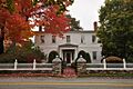
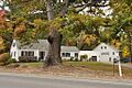
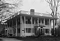
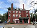
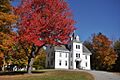
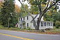
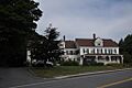
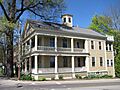
Lady Pepperrell House
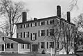
The Lady Pepperrell House in Kittery Point is another National Historic Landmark. Built in 1760, this grand mansion belonged to Lady Mary Pepperrell, the wife of Sir William Pepperrell, a famous colonial military leader. It's a stunning example of Georgian architecture.

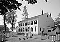
Old York Gaol
The Old York Gaol in York is a very old building, dating back to 1719! It was once a colonial jail and is now a museum. It's one of the oldest public buildings in the United States and gives us a fascinating look at what life was like for prisoners long ago. It's also a National Historic Landmark.

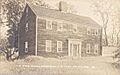
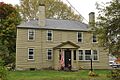
McIntire Garrison House
Also in York, the McIntire Garrison House is a rare example of a "garrison house," a type of fortified home built in the late 1600s to protect against attacks. It's one of the oldest surviving buildings of its kind in Maine and a National Historic Landmark.

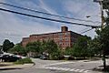
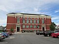
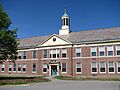
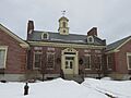
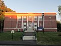
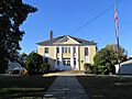
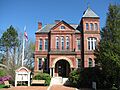
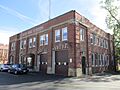
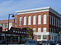
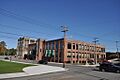
Biddeford City Hall
The Biddeford City Hall in Biddeford is a grand building rebuilt in 1895-96 after a fire. It was designed by a famous Maine architect, John Calvin Stevens. It's a great example of late 19th-century public architecture.

Ogunquit Playhouse
The Ogunquit Playhouse in Ogunquit is a historic summer theater that opened in 1933. Many famous actors have performed here over the years. It's a wonderful example of a regional theater that has brought entertainment to generations.

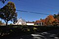
Historic Districts: Preserving Whole Neighborhoods
Sometimes, it's not just one building that's important, but a whole group of buildings that together tell a story. These are called Historic Districts.
Alfred Historic District
The Alfred Historic District in Alfred includes many of the town's older buildings, showing what a traditional New England village looked like. It's a charming area with homes and public buildings that have been around for a long time.

Alfred Shaker Historic District
Also in Alfred, the Alfred Shaker Historic District preserves buildings from a Shaker community. The Shakers were a religious group known for their simple lifestyle and craftsmanship. This district shows how they lived and worked.

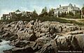
Kennebunkport Historic District
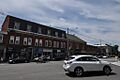
The Kennebunkport Historic District covers a large part of the charming coastal town of Kennebunkport. It includes many beautiful old homes, shops, and buildings that reflect the town's history as a shipbuilding and fishing community, and later as a popular summer resort.

The Portsmouth Naval Shipyard in Kittery is a very important historic district. It's one of the oldest naval shipyards in the United States, dating back to 1800. It has played a crucial role in American naval history, building and repairing ships for over two centuries.

Former Listings
Sometimes, a place might be removed from the National Register of Historic Places. This usually happens if the building is destroyed or changed so much that it no longer looks like it did historically.
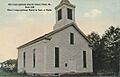
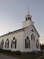
First Parish Congregational Church (Saco, Maine)
The First Parish Congregational Church in Saco was once on the Register. Sadly, it was destroyed by a fire in 2000 and was removed from the list in 2004.
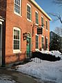
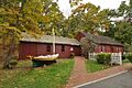
Gerrish Warehouse
The Gerrish Warehouse in Kittery was also on the list but was demolished. It was removed from the Register in 2015.
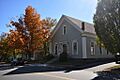
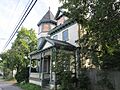
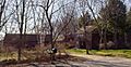
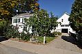
Images for kids
-
Alfred Historic District
-
Alfred Shaker Historic District
-

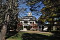
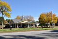
Cape Arundel Golf Club
-
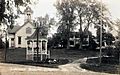
Austin-Hennessey Homestead
-
Caleb R. Ayer House
-
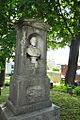
Samuel Badger Monument
-
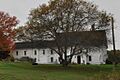
Barrell Homestead
-
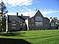
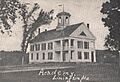
Berwick Academy
-
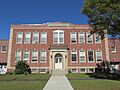
Former Berwick High School
-
Biddeford Main Street Historic District
-
Biddeford-Saco Mills Historic District
-
Blazo-Leavitt House
-
Bourne Mansion
-
Bray House
-
Royal Brewster House
-
Buxton Powder House
-
Cape Arundel Summer Colony Historic District
-

Capt. Josiah E. Chase Octagon House
-
George F. Clifford House
-
Clock Farm
-
Colonial Inn
-
Conant-Sawyer Cottage
-
Conway Junction Railroad Turntable Site
-
Cummings' Guest House
-
Cummings Shoe Factory
-
Benjamin and Abigail Dalton House
-
J.G. Deering House
-

Dennett Garrison
-
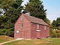
District No. 5 School
-
Division No. 9 School
-
Dorfield Farm
-
Dudley Block
-
Early Post Office
-
Eaton House
-
Elden's Store
-
Elder Grey Meetinghouse
-
Emery Homestead
-

Emery House
-
Emery School
-
First Baptist Church
-
First Congregational Church and Parsonage
-

First Congregational Church of Buxton
-
Former First Congregational Church
-
First Parish Meetinghouse
-

James Montgomery Flagg House
-
William Fogg Library
-
Fort McClary
-
Levi Foss House
-
Frank C. Frisbee Elementary School
-

Frost Garrison and House
-

Goodale-Bourne Farm
-
Goodale-Stevens Farm
-
Louis B. Goodall Memorial Library
-
Thomas Goodall House
-
Edmund E. Goodwin House
-
Grant Family House
-
Abbott Graves House
-
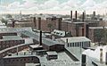
Great Falls Manufacturing Company Newichawannock Canal Historic District
-

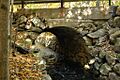
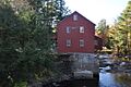
Grist Mill Bridge
-
John Hancock Warehouse
-

Harper Family House
-
Hatch House
-
Hawkes Pharmacy
-
Thomas Hobbs, Jr., House
-
Sen. John Holmes House
-

William Dean Howells House
-

Mary R. Hurd House
-
Hussey Plow Company Building
-
Isles of Shoals
-
Jacobs Houses and Store
-

Jewett-Eastman House
-

Dennis Johnson Lumber Company Mill
-
John Paul Jones Memorial Park
-
Old Kennebunk High School
-
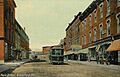
Kennebunk Historic District
-
Kennebunk River Club
-
Laudholm Farm
-
James Leavitt House
-
Libby's Colonial Tea Room
-

Libby-MacArthur House
-
Limerick Upper Village Historic District
-
Limington Academy
-
Limington Historic District
-
Lincoln School
-
Littlefield Homestead
-

Littlefield Tavern
-
Littlefield-Chase Farmstead
-
Littlefield-Dustin Farm
-
Littlefield-Keeping House
-
Lord Farm
-
Lord Mansion
-
Capt. Nathaniel Lord Mansion
-

Lord-Dane House
-

Lower Alewive Historic District
-
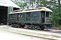
Maine Trolley Cars
-
Mill House
-
Moody Homestead
-

Capt. James Morison House
-
Morrell House
-
Newfield (Willowbrook) Historic District
-
North Berwick Woolen Mill
-
Ocean Park Historic Buildings
-
Odd Fellows-Rebekah Hall
-
Ogunquit Memorial Library
-
Old Grist Mill
-
Old Schoolhouse
-
Old Town House
-
Parsons-Piper-Lord-Roy Farm
-
Parsonsfield Seminary
-
Paul Family Farm
-
Pebbledene
-
William Pepperrell House
-
Perkins Tide Mill
-
Charles Perkins House
-
LeRoy F. Pike Memorial Building
-
Porter-Parsonfield Bridge
-
Portsmouth Company Cotton Mills: Counting House
-
J.L. Prescott House
-
Rice Public Library
-
Rock Rest
-
Robert Rose Tavern
-
Saco Central Fire Station
-
Saco City Hall
-
Saco High School (old)
-
Saco Historic District
-
St. Andre's Parish
-
St. Joseph's School
-
St. Peter's By-The-Sea Protestant Episcopal Church
-

Salmon Falls (East) Historic District
-
Salmon Falls (West) Historic District
-
Sanford Mills Historic District
-
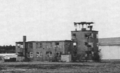
Former Sanford Naval Air Station Administration Building and Control Tower
-
Former Sanford Town Hall
-
A. B. Seavey House
-
John Sedgley Homestead
-

James Smith Homestead
-
Smith-Emery House
-
South Berwick Village Historic District
-
Spiller Farm Paleoindian Site
-
Staples Inn
-
Sunnycroft
-
John Tarr House
-
The Temple
-
Thacher-Goodale House
-
Timber Point
-
Robert and Louisa Traip House
-
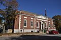
U.S. Customhouse
-
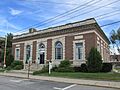
U.S. Post Office
-
US Post Office-Sanford Maine
-
Wallingford Hall
-
Waterboro Grange, No. 432
-
Way Way General Store
-
Andrew Welch Homestead
-
Wells Baptist Church Parsonage
-
Wells Homestead
-
Mark F. and Eliza J. Wentworth House
-
West Lebanon Historic District
-
Kate Douglas Wiggin House
-
Winn House
-
York Cliffs Historic District
-

York Historic District
-
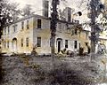
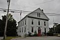
Gerrish Warehouse


.jpg)


.jpg)


