Natoma, Kansas facts for kids
Quick facts for kids
Natoma, Kansas
|
|
|---|---|

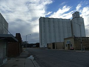
Facing southwest, as the tracks and the streets were perpendicular to the tracks (2014)
|
|

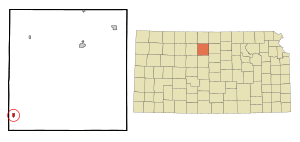
Location within Osborne County and Kansas
|
|

|
|
| Country | United States |
| State | Kansas |
| County | Osborne |
| Founded | 1888 |
| Incorporated | 1905 |
| Area | |
| • Total | 0.42 sq mi (1.09 km2) |
| • Land | 0.42 sq mi (1.09 km2) |
| • Water | 0.00 sq mi (0.00 km2) |
| Elevation | 1,831 ft (558 m) |
| Population
(2020)
|
|
| • Total | 302 |
| • Density | 719/sq mi (277.1/km2) |
| Time zone | UTC-6 (CST) |
| • Summer (DST) | UTC-5 (CDT) |
| ZIP code |
67651
|
| Area code | 785 |
| FIPS code | 20-49425 |
| GNIS ID | 2395159 |
Natoma is a small city located in Osborne County, Kansas, in the United States. As of the 2020 census, about 302 people lived there.
Contents
History of Natoma
Natoma was started in 1888. A railroad officer named it after an American Indian railroad worker. The name "Natoma" means "new born."
The first post office in the area opened in December 1878. It was first called Tapley. In July 1890, its name changed to Natoma. The town officially became a city in 1905. This process is called being incorporated.
Geography and Location
Natoma is found in the Smoky Hills area of the Great Plains. This is a large, flat region in central North America. The city is about 9 miles (14 km) north of the Saline River. Paradise Creek, a smaller stream, flows along the city's southern edge.
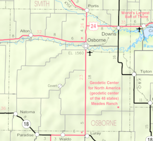
Natoma is in north-central Kansas. It is about 135 miles (217 km) northwest of Wichita. It is also about 230 miles (370 km) west of Kansas City. The city is located on K-18, a main road. It is about 25 miles (40 km) southwest of Osborne, which is the main town of the county.
The United States Census Bureau says Natoma covers about 0.41 square miles (1.06 square kilometers). All of this area is land.
People of Natoma (Demographics)
| Historical population | |||
|---|---|---|---|
| Census | Pop. | %± | |
| 1910 | 407 | — | |
| 1920 | 518 | 27.3% | |
| 1930 | 583 | 12.5% | |
| 1940 | 651 | 11.7% | |
| 1950 | 775 | 19.0% | |
| 1960 | 775 | 0.0% | |
| 1970 | 603 | −22.2% | |
| 1980 | 515 | −14.6% | |
| 1990 | 392 | −23.9% | |
| 2000 | 367 | −6.4% | |
| 2010 | 335 | −8.7% | |
| 2020 | 302 | −9.9% | |
| U.S. Decennial Census | |||
Population in 2020
The 2020 United States census counted 302 people living in Natoma. There were 126 households, which are groups of people living together. Most people (93.05%) were white or European American. About 6.29% of the population were from two or more races.
About 23.8% of the people were under 18 years old. About 21.9% were 65 years old or older. The average age in Natoma was 47.0 years.
Population in 2010
In the 2010 census, there were 335 people living in Natoma. Most people (97.0%) were White. About 2.1% of the population were Hispanic or Latino.
About 23.3% of the people were under 18 years old. About 26% were 65 years old or older. The average age was 43.5 years.
Culture and Events
Community Events
Natoma has a special celebration every year on Labor Day. This community festival includes a parade and a barbecue. There is also other fun entertainment for everyone.
Interesting Places to Visit
The Natoma Presbyterian Church was built in 1899. It is famous for its unique design. Because of its special architecture, it is listed in the National Register of Historic Places.
Education in Natoma
Students in Natoma are served by the Natoma–Paradise–Waldo USD 399 public school district. This district has two schools located right in the city:
- Natoma Elementary School (for students in Grades K-6)
- Natoma High School (for students in Grades 7-12)
The Natoma High School sports teams are called the Natoma Tigers. They have won several Kansas State High School championships:
- 1958 Boys' basketball - Class B
- 1959 Boys' basketball - Class B
- 1974 Boys' cross country - Class 1A
- 1975 Boys' basketball - Class 1A
- 1982 Girls' basketball - Class 1A
- 2014 Boys' cross country - Class 1A
- 2015 Boys' cross country - Class 1A
Transportation
K-18 is a state highway that runs east and west. It comes into Natoma from the west. Then, it turns southeast along the eastern side of the city.
See also
 In Spanish: Natoma para niños
 | Audre Lorde |
 | John Berry Meachum |
 | Ferdinand Lee Barnett |

