Navi Mumbai facts for kids
Quick facts for kids
Navi Mumbai
Navī Muṁbaī (Marathi)
New Bombay
|
|
|---|---|
|
Form top left to right:
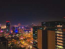
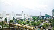
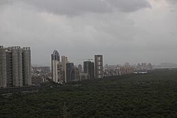
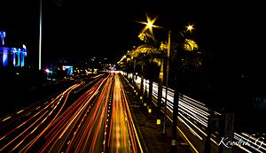
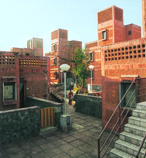
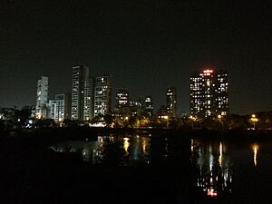
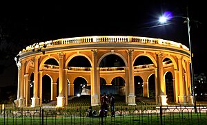
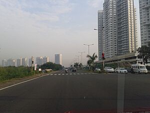
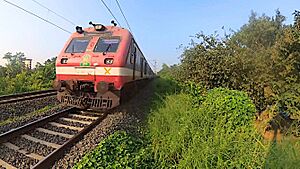
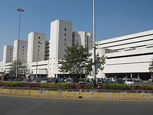
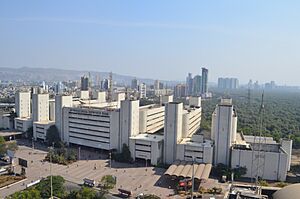
Navi Mumbai Skyline, Vashi Sector 30A, Utsav Chowk, Vashi Sector 30A, Vashi Railway Station, Navi Mumbai Municipal Corporation, Seawoods Grand Central mall, PKP IT Park in Airoli Naka, Pandavkada Falls, Wonders Park, Seawoods, Rajiv Gandhi Joggers Park, Buildings along Palm Beach Road. |
|
| Nickname(s):
Flamingo City
|
|
| Country | |
| State | |
| Division | Konkan |
| District |
|
| Planned and Developed by | City and Industrial Development Corporation |
| Government | |
| • Type | Municipal Corporation |
| • Body |
|
| Area | |
| • Total | 344 km2 (133 sq mi) |
| Elevation | 14 m (46 ft) |
| Population | |
| • Total | 1,618,000 |
| Demonym(s) | Navi Mumbaikar |
| Time zone | UTC+5:30 (IST) |
| Vehicle registration | MH-43 (Thane district) MH-46 (Raigad district) |
Navi Mumbai (also known as New Bombay) is a large city in the western Indian state of Maharashtra. It is located right next to Mumbai on the mainland of India. Navi Mumbai is part of the bigger Mumbai Metropolitan Area.
This city is known for being very clean. It has been ranked third among many cities in India for cleanliness and hygiene. This ranking is part of a national survey called Swachh Bharat Abhiyan. Navi Mumbai has kept its third-place rank for two years in a row (2022 and 2023).
Navi Mumbai has many schools and colleges. Lots of big companies have offices here, making it an important business center. Roads like Thane–Belapur Road and Palm Beach Road are popular for businesses and homes.
Contents
Early Times and Forts
Long ago, in the late 1500s, a group called the Siddis of Janjira built a fort called Belapur Fort. It was on a small hill near a water channel. In 1682, the Portuguese took control of this fort.
Later, in 1733, the Marathas, led by Chimaji Appa, fought and won the fort from the Portuguese. Appa had promised to place a garland of beli leaves at a nearby temple if they won. After their victory, the fort was named Belapur Fort. The Marathas ruled the area until 1817. Then, the British East India Company captured it. The British partly destroyed the fort to weaken Maratha strongholds.
Navi Mumbai started to be planned in the early 1970s. The government of Maharashtra saw that Mumbai was getting too crowded. There wasn't enough housing, and the city's services were struggling. So, they decided to create a new city to help ease the pressure on Mumbai.
Planning and Development
The Need for a New City
Between 1951 and 1971, the population of Greater Mumbai doubled. This huge growth made life difficult for many people in the city. To solve this, a plan was made in 1970 to build a "twin city" across the harbor, to the east of Mumbai.
Building the New City
The planning for Navi Mumbai began in 1971. Important architects and city planners helped design it. The City and Industrial Development Corporation (CIDCO) was created to lead this big project.
CIDCO planned for the new city to hold about 2.1 million people. They bought land from 86 villages to create Navi Mumbai. The city covers parts of Thane district and Raigad district.
City Layout and Growth
CIDCO divided Navi Mumbai into 19 smaller areas called "nodes." These nodes include places like Airoli, Vashi, Nerul, and Kharghar. Each node was designed to develop fully.
CIDCO built railway stations, roads, and public spaces. In 1973, the Vashi bridge opened, making it easier to travel to areas like Vashi and CBD Belapur. The Sion-Panvel Highway was also built to cut down travel time.
Big changes happened after 1990. A large market for farm products opened in Turbhe. Also, a new train line connecting Mankhurd to Vashi started in 1992. These changes helped Navi Mumbai grow quickly, bringing more jobs and people.
The city was planned to offer affordable homes for people who couldn't afford to live in Mumbai. However, like many big cities, some areas still have informal settlements.
By the late 1990s, private builders also started to develop parts of Navi Mumbai. A new train link between Nerul and Uran opened on November 11, 2018. The southern parts of Navi Mumbai, like Kharghar and Panvel, are growing fast. This is because of the new Navi Mumbai International Airport being built nearby.
Navi Mumbai is also recognized as the 5th best "National Clean Air City" in India.
Navi Mumbai is home to many flamingos, especially in the Greater Mumbai Region. The city also has areas with mangrove trees, which are important for the environment.
CIDCO's Role
The City and Industrial Development Corporation (CIDCO) was in charge of building, maintaining, and collecting taxes for Navi Mumbai since the 1970s.
CIDCO planned 14 main areas for the city. Seven were in the North (like Airoli and Vashi), and seven were in the South (like Kharghar and Panvel). Later, two separate city councils were created: the Navi Mumbai Municipal Corporation (NMMC) for the North and the Panvel Municipal Corporation for the South. Each area is further divided into smaller sections called sectors.
CIDCO first developed areas like Vashi, Nerul, and CBD Belapur, building homes, schools, and roads. As the population grew, CIDCO focused on newer areas like Kharghar and Panvel. Private builders also helped a lot in developing these areas.
The Navi Mumbai Municipal Corporation (NMMC) was formed on December 17, 1991. Its job is to maintain some of the developed parts of Navi Mumbai.
NMMC started its work on January 1, 1992. It was given control over seven of the 14 planned nodes. However, CIDCO still owns the open land in these areas.
The NMMC's area stretches from Digha Gaon in the North to Belapur in the South. This area includes seven main zones: Belapur, Nerul, Sanpada, Vashi, Kopar Khairane, Ghansoli, and Airoli.
The NMMC is known as one of the richest city councils in Maharashtra. It is led by a Municipal Commissioner and an elected Mayor.
| Religion in Navi Mumbai City (2011) | ||||
|---|---|---|---|---|
| Religion | Percent | |||
| Hinduism | 80.39% | |||
| Islam | 8.68% | |||
| Buddhism | 6.23% | |||
| Christianity | 2.35% | |||
| Sikhism | 1.01% | |||
| Jainism | 0.99% | |||
| Other or not stated | 0.36% | |||
In 2011, the population of Navi Mumbai was about 1.12 million people. More than 60% of the people in Navi Mumbai speak the Marathi language.
Navi Mumbai has a great transportation system. It's easy to get around the city and to other parts of India. The city is also less polluted than Mumbai.
Public Transport
- Buses: The NMMT runs buses all over Navi Mumbai. They also connect to Mumbai, Thane, and other nearby areas.
- Trains: The Mumbai Suburban Railway network covers most of Navi Mumbai. Important stations include Vashi, Nerul, Belapur, and Panvel. Panvel is the busiest station and connects to almost all parts of India.
- Auto Rickshaws: These are a common way to travel short distances within the city.
- Taxis: Taxis are available from special stands and charge set rates.
Roads and Bridges
The Mumbai-Pune Expressway starts in Kalamboli, Navi Mumbai. The Mumbai Trans Harbour Link (MTHL), a 22 km long bridge, connects South Mumbai with Navi Mumbai. This bridge opened on January 12, 2024, making travel much faster. The Palm Beach Marg is a 10 km long, six-lane road that runs along the water, connecting Vashi to CBD Belapur.
Ports and Airports
Navi Mumbai is home to the Jawaharlal Nehru Port at Nhava Sheva. This is India's second-largest container port, handling a lot of the country's shipping. The closest airport is the Chhatrapati Shivaji Maharaj International Airport, about 30 km away.
A new airport, the Navi Mumbai International Airport, is being built in Panvel. Construction started in August 2021 and it is expected to be ready by March 2025. This airport will be very modern, connecting to the city by metro, train, and road. It will link to three major roads, a railway station, and two metro lines.
Metro System
The Navi Mumbai Metro is a new train system for the city. The first line opened on November 17, 2023. This line connects the CBD Belapur station to Pendhar village. Future phases will extend the line to the new international airport.
Other City Features
Navi Mumbai has a steady supply of electricity. It also has good roads with many flyovers and parking areas, making driving easy. There were plans for a hovercraft service, and CIDCO is looking into bringing it back.
Shopping and Services
Navi Mumbai has many useful services and places to shop. You can find banks, restaurants, malls, and other stores.
Shopping Malls and Stores
The city has several shopping malls like Little World Mall, Glomax Mall, and Orion Mall. There are also big supermarkets and hypermarkets like Big Bazaar, Reliance Smart, and DMart for all your shopping needs.
Banks and Hotels
Many major banks, including State Bank of India, HDFC Bank, and ICICI Bank, have branches and ATMs in Navi Mumbai. The city also has several three-star and five-star hotels, such as Royal Tulip and Four Points by Sheraton.
Business and Economy
The Navi Mumbai Special Economic Zone (SEZ) is a special area designed to boost business and create jobs. It's located near the new airport and has attracted a lot of investment. Navi Mumbai is becoming a popular place for new companies and startups to set up their offices.
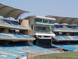
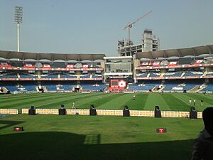
Cricket is the most popular sport here. Navi Mumbai has its own international cricket stadium called the DY Patil Stadium in Nerul. This stadium has hosted big matches, including finals of the IPL T-20 cricket tournament. It was also one of the venues for the first Women's Premier League in 2023.
The DY Patil Stadium is also the home ground for the Indian Super League football club Mumbai City FC. The Fr. Agnel Stadium in Vashi is where the team trains.
Navi Mumbai was a host city for the 2017 FIFA U-17 Men's World Cup and the 2022 FIFA U-17 Women's World Cup. The DY Patil Stadium hosted the final of the women's event in 2022.
The Navi Mumbai Sports Association is an old sports complex that has helped create international athletes. Navi Mumbai also has an Olympic-size swimming pool in Nerul. There are plans for golf courses and other sports facilities in the large Central Park being built in Kharghar.
Providing good schools and colleges was a top priority when Navi Mumbai was planned. Each area (node) was designed to have enough schools and colleges for its residents.
Learning Options
The nodes are self-sufficient, meaning they have many good schools. Students can choose from different education systems, including State Education Board, CBSE, IGCSE, IB, and ICSE. CIDCO also encouraged private schools to open.
Most students in Navi Mumbai walk to school or college. About 76% of students travel this way. Others use public transport or bicycles.
Top Schools and Colleges
Navi Mumbai has many excellent schools and colleges. Students from Mumbai and other places even come here for quality education. This is why Navi Mumbai is becoming known as an "educational hub."
Colleges and Universities
- Amity University
- Bharati Vidyapeeth College of Architecture
- Bharati Vidyapeeth Institute of Technology
- DY Patil University
- Dr.K M Vasudevan Pillai Campus
- IIM Indore, Mumbai Campus
- Indian Maritime University, Navi Mumbai Campus
- ITM Group of Institutions
- NIFT Mumbai
- Chhatrapati Shivaji Maharaj University
Engineering Colleges
- Fr. Conceicao Rodrigues Institute of Technology, Vashi
- Datta Meghe College of Engineering, Airoli
- Indian Institution of Industrial Engineering, Belapur
- Lokmanya Tilak College of Engineering, Koparkhairane
- Pillai College of Engineering, New Panvel
- Ramrao Adik Institute of Technology, Nerul
- SIES Graduate School of Technology, Nerul
- Terna Engineering College, Nerul
Medical Colleges
- Bharati Vidyapeeth Dental College, Kharghar
- Dr. D Y Patil Medical College, Nerul
- MGM Institute of Health Sciences, Kalamboli
- Terna Medical College, Nerul
Schools
- Avalon Heights International School
- Dayanand Anglo Vedic Public School, Airoli
- Fr. Agnel Multipurpose School and Junior College, Vashi
- Vishwajyot High School, Kharghar
See also
 In Spanish: Navi Mumbai para niños
 | Misty Copeland |
 | Raven Wilkinson |
 | Debra Austin |
 | Aesha Ash |


