
Neighborhoods of Hartford, Connecticut facts for kids
The neighborhoods of Hartford, Connecticut in the United States are diverse and full of history. Each area has its own special story and character.

Contents
- Downtown Hartford: The City's Center
- Parkville: From Farms to Factories
- Frog Hollow: A Hub of Innovation
- Asylum Hill: Historic Homes and Insurance Companies
- West End: Parks and Grand Houses
- Sheldon/Charter Oak: Industry and History
- Clay-Arsenal and Upper Albany: A Resilient Community
- South End and Little Italy: A Taste of Europe
- South Green: Historic Charm and Healthcare
- Barry Square: Home to Trinity College
- South Meadows: Industrial Hub
- Southwest: Residential and Green Spaces
- Behind the Rocks: A Quiet Corner
- North Meadows: Entertainment and Transportation
- Blue Hills: Diverse Community and Schools
- Northeast: Parks and History
- Images for kids
Downtown Hartford: The City's Center
Downtown is the main business area of Hartford. It's where the city government offices are, along with the State Capitol building. This is the heart of the city's activity.
Parkville: From Farms to Factories
Parkville is a busy neighborhood located west of Pope Park and stretching towards West Hartford. It got its name because it's where two branches of the Park River (which now flows underground) meet. For a long time, Parkville was mostly farmland.
In the late 1800s, things changed when Michael Kane started a brickyard. This led to a period of fast growth and new factories. Soon, companies like Pope Manufacturing, Underwood Typewriter, and Royal Typewriter set up shop here. Hartford even became known as the "Typewriter Capital of the World" because of these factories!
These factories offered many skilled jobs, attracting people from all over. Irish, French-Canadian, Scandinavian, and German immigrants came to live and work in Parkville. This led to many new houses being built for working-class families.
After World War II, the factories in Parkville started to close down, and the building of Interstate 84 changed the area. Many middle-class families moved to the suburbs. New immigrants, especially from Portugal, Brazil, Puerto Rico, and the Caribbean, moved in, bringing new life and businesses to Park Street.
Today, Parkville is also home to Real Art Ways, a cool place for contemporary art exhibits, live performances, and movies. The neighborhood also has the Parkville station, which is part of the CTfastrak bus line connecting downtown Hartford to New Britain.
Frog Hollow: A Hub of Innovation
Frog Hollow is located west of the State Capitol, near Trinity College. It got its name from the marshy, low-lying land that used to be there.
This area was mostly farmland until 1852, when the Sharps Rifle Manufacturing Company built a factory. This started Frog Hollow's journey to becoming a major industrial area. Later, the Weed Sewing Machine Company took over the factory.
A man named Albert Pope saw a high-wheel bicycle at an exhibition in 1876. He bought the rights to make bicycles in the U.S. and had the Weed Sewing Machine Company produce his first bicycles. Bicycles became very popular, and by 1890, Pope bought the Weed factory and renamed it the Pope Manufacturing Company.
The bicycle craze didn't last forever, as people started wanting cars. Pope tried to make electric cars, and for a while, it seemed Hartford might become the center of the automobile industry!
Today, Frog Hollow is known for its large Puerto Rican population, and Park Street is sometimes called "New England's Spanish Main Street" because of all the vibrant businesses. The neighborhood is also home to Hartford Superior Court and Trinity College.
Asylum Hill: Historic Homes and Insurance Companies

Asylum Hill is a central neighborhood in Hartford, located uphill from Downtown Hartford. It was first called 'Lords Hill' after one of the city's early settlers. In 1807, a school for deaf and dumb people was founded here, and the area became known as Asylum Hill. This school, the American School for the Deaf, was the first of its kind in the country.
In the mid-1800s, a literary community grew here, attracting famous writers like Harriet Beecher Stowe and Mark Twain. Twain wrote some of his most famous books, like The Adventures of Tom Sawyer, while living in Hartford. His house, along with others, is now a museum you can visit.

Starting in the 1920s, big insurance companies like The Hartford and Aetna began moving to Asylum Hill. To make space for their offices and employee housing, many older homes were replaced with apartment buildings. Aetna is still a major company in the neighborhood today.
Asylum Hill also has important churches, like the Asylum Hill Congregational Church and the modern Cathedral of St. Joseph. Saint Francis Hospital, a large Catholic hospital, was established here in 1897.
West End: Parks and Grand Houses
The West End neighborhood stretches from the Park River past the Mark Twain House to the West Hartford border. In the early 1900s, many two and three-story homes were built, giving the area its beautiful Victorian look that you can still see today.
Elizabeth Park is a highlight of the West End. It was created in 1895 and is famous for having the oldest and one of the largest municipal rose gardens in the United States. It's a great place for recreation and offers views of the downtown skyline.
The University of Connecticut School of Law, Watkinson School, and the Hartford Seminary are all located in the West End. You can also find grand mansions along Prospect Avenue and Scarborough Street, including the Governor's Mansion.
Sheldon/Charter Oak: Industry and History

This neighborhood is just south of Downtown Hartford, near the Connecticut River. It's where the Park River connects to the Connecticut River underground. In 1633, the Dutch set up a trading post here, and the area became known as Dutch Point.
This area is also famous for the Charter Oak, a very old white oak tree. Legend says that colonists hid the Connecticut Royal Charter of 1662 inside this tree to protect it from an English governor. The tree became a symbol of freedom for Connecticut.

A major influence on this neighborhood was Samuel Colt, who invented the automatic revolver, and his wife Elizabeth. Colt opened the Colt Armory in 1848 and built a whole community around it for his workers, called Coltsville. It was like a small city within Hartford, with homes, a wharf, and a gathering hall. Colt's own home, Armsmear, was a very luxurious Italian villa.
After a fire destroyed the original armory, Colt's widow rebuilt it, adding its famous blue onion dome with gold stars and a golden horse. This dome is still visible today and is a monument to Colt's industrial empire. Elizabeth Colt also commissioned the Church of the Good Shepherd in 1896, which has unique architectural features like gun parts in its design!
When Elizabeth Colt passed away, she gave her estate, Armsmear, to the City of Hartford to become a public park. Today, Colt Park offers athletic fields, playgrounds, and a swimming pool for the community.
Another important industrialist here was George Capewell, who invented a machine to make horseshoe nails. His factory, built in 1903, made Hartford the "horseshoe nail capital" of the world.
Towards the end of the 1800s, many Polish immigrants moved to this neighborhood, working in factories like Colt and Capewell. They built a strong community, establishing the Polish National Alliance and the Saints Cyril and Methodius church. The Polish National Home, an Art Deco building from 1930, still serves the Polish-American community today.
Clay-Arsenal and Upper Albany: A Resilient Community
These neighborhoods, once home to Irish and Jewish populations, are now primarily African American, West Indian/Caribbean, and Latino. After World War II, the construction of Interstate 84 divided the neighborhood from downtown. Many factories closed, and people moved away. A major event was the riot on April 4, 1968, following the assassination of Dr. Martin Luther King Jr., which caused significant damage to Albany Avenue.
Despite challenges, Upper Albany and Clay-Arsenal are home to a lively West Indian/Caribbean community. Places like the West Indian Social Club and Scott's Jamaican Bakery are important parts of the neighborhood. Efforts are being made to improve the area, with new homes being built and some streets undergoing revitalization.
South End and Little Italy: A Taste of Europe
The South End is located near the Hartford-Wethersfield town line. Franklin Avenue in this area is known as Hartford's "Little Italy." Even though many Italian families have moved to nearby towns, there's still a strong Italian presence with many bakeries and shops.
When Italy won the FIFA World Cup in 2006, thousands of people celebrated on Franklin Avenue, showing the strong community spirit. In recent years, many Eastern European groups, like Bosnians and Albanians, have also moved into the South End.
Part of Goodwin Park, a large park with recreational facilities, is also located in the South End.
South Green: Historic Charm and Healthcare
South Green is home to Barnard Park, named after Henry Barnard, whose historic home is on Main Street. Congress Street and Morris Street form a historic district with many beautiful old homes. These streets are now well-maintained, with charming cobblestone crosswalks.
The neighborhood also houses Hartford Hospital, the largest hospital in the area, and the Connecticut Children's Medical Center, which is the only hospital specifically for children.
Barry Square: Home to Trinity College
South of South Green is Barry Square, named after Father Michael Barry of St. Augustine's Church. The campus of Trinity College is located in this neighborhood.
South Meadows: Industrial Hub
This area in the southeastern part of the city is mainly for industrial and commercial businesses. It's home to the Regional Market, a large facility with warehouses. Brainard Field, a small airport, is also here, offering flight instruction. The Hartford Electric Light Company, which started in 1921, is still operating in South Meadows.
Southwest: Residential and Green Spaces
Southwest is mostly a residential neighborhood in the city's southwestern corner, bordering Wethersfield, Newington, and West Hartford. Cedar Hill Cemetery, a beautiful landscape-park style space, is located here.
Fairfield Avenue, which runs along a natural ridge, was once known for its amazing views of the Connecticut valley. Most of the houses in Southwest were built between the 1940s and 1960s, with various styles like colonial revival and cape cod designs.
Besides Cedar Hill Cemetery, the neighborhood also has Hyland Park, an old stone quarry site that became a park in 1911, offering playgrounds and sports fields.
Behind the Rocks: A Quiet Corner
Behind the Rocks is a mostly residential neighborhood in the southwestern part of Hartford, next to West Hartford. It gets its name from the rocky hills that form the western border of the Trinity College campus.
In the 1890s, the Rocky Hill Quarry here produced trap rock for road building. Today, this quarry site is known as the Thomas Hyland Memorial Park, providing a playground and sports fields for local families.
North Meadows: Entertainment and Transportation
Located north of downtown along the Connecticut River and I-91, North Meadows is a commercial and industrial area. It's home to many car dealerships, the CT Expo Center for exhibitions, and the Meadows Music Theater, which hosts many concerts each year.
Riverside Park is also in North Meadows, part of a project to reconnect Hartford with the Connecticut River. The park has a high ropes course, a playground, a boat launch, and a boathouse for rowing teams from local schools.
Blue Hills: Diverse Community and Schools
Blue Hills is mainly a residential neighborhood in the city's northwest section, bordering Bloomfield and West Hartford. It's home to about 10,000 residents and several schools, including the University of Hartford. Other well-known places include Mount Sinai Hospital and Oak Hill Academy, which helps people with disabilities.
The neighborhood has a mix of housing styles, from large historic homes to duplexes and smaller houses. Blue Hills is mostly a working-class, African-American and Caribbean-American community. Its main roads, like Blue Hills Avenue and Albany Avenue, are busy routes for both cars and buses.
Northeast: Parks and History
The Northeast neighborhood (sometimes called North End) is located east of Blue Hills and west of Interstate 91. It's home to the Hartford Circus Fire Memorial from 1944.
This area also features Keney Park, which is the largest municipal park in New England. Weaver High School, a local high school, is also in this neighborhood.
Images for kids
-

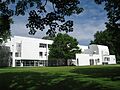
Watkinson School art barn
-
Hartford Seminary
-
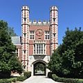
Downes Memorial Clock Tower, Trinity College Hartford
-
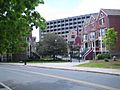
The Maple Avenue Mews condominiums
-
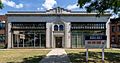
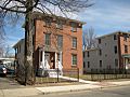
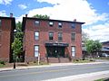
Art Deco building at 122 Washington Street
-
North End Police Headquarters
-
North End Decay
-
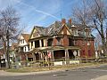
Abandoned house on Albany Avenue, North End
-
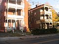
Belden Street revitalization
-
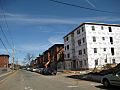
Bellevue St. revitalization
-
Biltmore Commons condominiums
-

The Maple Avenue Mews condominiums


.jpg)


