New Port, South Australia facts for kids
Quick facts for kids New PortAdelaide, South Australia |
|||||||||||||||
|---|---|---|---|---|---|---|---|---|---|---|---|---|---|---|---|
| Established | 12 July 2007 | ||||||||||||||
| Postcode(s) | 5015 | ||||||||||||||
| Time zone | ACST (UTC+9:30) | ||||||||||||||
| • Summer (DST) | ACST (UTC+10:30) | ||||||||||||||
| LGA(s) | City of Port Adelaide Enfield | ||||||||||||||
| Region | Western Adelaide | ||||||||||||||
| County | Adelaide | ||||||||||||||
| State electorate(s) | Port Adelaide | ||||||||||||||
| Federal Division(s) | Hindmarsh | ||||||||||||||
|
|||||||||||||||
|
|||||||||||||||
| Footnotes | LGA Adjoining suburbs |
||||||||||||||
New Port is a suburb located in the north-western part of Adelaide, South Australia. It is part of the City of Port Adelaide Enfield area.
Contents
History of New Port
New Port has an interesting history, starting with a big plan to change the Port Adelaide waterfront. In 2004, the leader of South Australia, called the Premier, Mike Rann, announced a huge project. This project, named Newport Quays, was planned to cost about $1.2 billion. It aimed to build 2,000 homes, along with cafes, museums, parks, and shops.
In 2007, the suburb of New Port was officially created. It was formed from parts of nearby suburbs like Birkenhead, Ethelton, Glanville, and Semaphore Park. The name "Newport Quays" was suggested for the suburb, but it was not approved. Later, in 2009, the eastern edge of the suburb was moved to the middle of the Port River.
By 2007, the first part of Newport Quays was finished, and the second part was being built. There were even bigger plans for a third part, including an apartment building over the Port River. However, these plans never happened, and the Newport Quays project eventually stopped.
The Newport Quays development faced a lot of criticism from local people. They felt it did not fit with the area and was destroying local history. A government committee found problems with the plans for the second stage of the development. These issues included not enough open space and buildings that were too tall. In 2008, people living in New Port worried that the new development felt like a "ghost town." The local council thought that less than half of the finished homes were actually lived in. Also, investors who bought properties faced problems as the value of their homes dropped a lot.
No new buildings were constructed in New Port after the second stage. In 2011, the new Premier, Jay Weatherill, officially cancelled the Newport Quays project. The government then planned to create a new masterplan for the empty areas that were part of the original development.
Fletcher's Slip Development
After eight years with no new construction, a government agency called Renewal SA announced a new plan. The remaining land in New Port would be developed by a company named Cedar Woods Properties. This new plan involves building up to 500 new townhouses and apartments. These homes will be located in the north-west part of New Port, near Glanville railway station and Fletcher's Slip. This area used to be the site of a Holden factory.
Just like the earlier project, the Fletcher's Slip development has also received some criticism. Local community members accused Cedar Woods of destroying local historical buildings. They said these buildings were supposed to be kept as part of the development. For example, an old warehouse known as Shed 26 was torn down in 2019, even after many protests.
In July 2022, the first new residents moved into the homes built during the first stage of the Fletcher's Slip development.
Geography of New Port
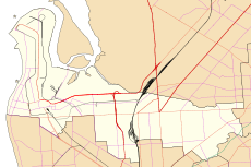
New Port is mainly bordered by the Port River on one side and the Outer Harbor railway line on another. The northern edge of the suburb is defined by Semaphore Road and Nelson Street.
People in New Port
The 2021 Australian census counted 647 people living in New Port. Of these, about 52.4% were male and 47.6% were female.
Most residents, about 66%, were born in Australia. Other common birthplaces included England (9.4%), Malaysia (1.9%), New Zealand (1.7%), Vietnam (1.4%), and Northern Ireland (1.1%). Also, about 0.8% of the suburb's population identified as Aboriginal and/or Torres Strait Islander.
Getting Around New Port
Roads in New Port
New Port can be reached by Causeway Road to the west and Semaphore Road to the north. There are no major roads that go directly through the suburb itself.
Public Transport in New Port
New Port has good access to public transport, with both bus and train services nearby.
Bus Services
Adelaide Metro bus route 333 runs from Glanville Interchange during weekday mornings and afternoons. These buses connect to Port Adelaide and North Haven.
Train Services
New Port is located near the Outer Harbor railway line, which means it has two train stations nearby. Ethelton railway station is next to Karra Cove. Glanville railway station is near Torrens Avenue, within the Fletcher's Slip development area. Some train services run directly to Adelaide from Port Adelaide during busy morning times.
 | Emma Amos |
 | Edward Mitchell Bannister |
 | Larry D. Alexander |
 | Ernie Barnes |


