North Elba, New York facts for kids
Quick facts for kids
North Elba, New York
|
|
|---|---|
|
|
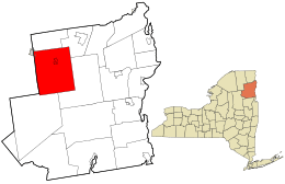
Location in Essex County and the state of New York
|
|
| Country | United States |
| State | New York |
| County | Essex |
| Government | |
| • Type | Town Council |
| Area | |
| • Total | 156.43 sq mi (405.15 km2) |
| • Land | 151.69 sq mi (392.89 km2) |
| • Water | 4.74 sq mi (12.27 km2) |
| Elevation | 1,949 ft (594 m) |
| Population
(2020)
|
|
| • Total | 7,480 |
| Time zone | UTC-5 (Eastern (EST)) |
| • Summer (DST) | UTC-4 (EDT) |
| FIPS code | 36-031-51935 |
| GNIS feature ID | 0979286 |
North Elba is a town in Essex County, New York, United States. In 2020, about 7,480 people lived there.
North Elba is located on the western side of Essex County. It is about 57 miles (92 km) southwest of Plattsburgh. It is also 112 miles (180 km) south-southwest of Montreal and 138 miles (222 km) north of Albany. Even though it's only 59 miles (95 km) west-southwest of Burlington, Vermont, you would need to take a ferry across Lake Champlain or drive around it to get there. The entire village of Lake Placid is inside North Elba. A part of the village of Saranac Lake is also located here.
Contents
History of North Elba
The first settlers arrived in North Elba around 1814. By 1840, only six families lived in the area. The town of North Elba was officially created in 1849. It was formed from a part of the town of Keene.
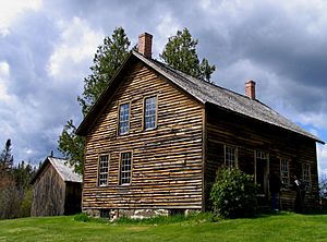
A famous person named John Brown came to North Elba in 1849. He was an abolitionist, meaning he was against slavery. Brown wanted to create a community for formerly enslaved Black people. He was inspired by Gerrit Smith, another abolitionist who owned land in the area. Smith tried to help free Black people settle on land here. However, the land was not very good for farming. John Brown left his farm in North Elba in 1859 for his famous raid on Harpers Ferry.
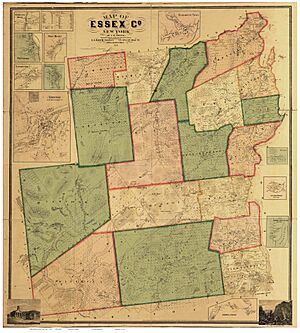
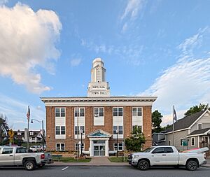
In 1861, a visitor noted that North Elba had a building that served as a school, a church, and a town hall. At that time, the village of Lake Placid did not exist. A map from 1858 shows that North Elba was also a small settlement. It was located where New York State Route 73 and Adirondack Loj roads meet today.
North Elba and its village, Lake Placid, are famous for hosting the 1932 and 1980 Winter Olympics. Two historic buildings, Barngalow and the Larom-Welles Cottage, were added to the National Register of Historic Places in 1992.
People from North Elba
- John Brown was a well-known abolitionist. He was put to death after being found guilty of treason and murder in Virginia. He is buried on his family's farm in North Elba. His son, Watson Brown, is also buried there. In 1899, the bodies of twelve other people who took part in Brown's raid on Harpers Ferry were moved to a shared grave near Brown's. This group included his son Oliver.
- Melvil Dewey created the Dewey Decimal System, which is used to organize books in libraries. He started a resort in North Elba.
Geography of North Elba
North Elba covers a total area of about 156.4 square miles (405.0 square km). Most of this area, about 151.7 square miles (392.8 square km), is land. The rest, about 4.7 square miles (12.3 square km), is water.
Some of the tallest mountains in the Adirondack Park, called the High Peaks, are in the southern part of the town. The West Branch of the Au Sable River flows out of the northeastern corner of North Elba.
The western border of the town is also the border of Franklin County.
Two main roads, New York State Route 73 and New York State Route 86, run through the town from east to west. They meet in the village of Lake Placid.
Places to See in North Elba
- North Country Community College is a college located in the area.
- The Adirondack Scenic Railroad is a train line that goes through the town.
- John Brown Farm State Historic Site is the historic farm where John Brown lived. You can visit it today.
Population Information
| Historical population | |||
|---|---|---|---|
| Census | Pop. | %± | |
| 1850 | 210 | — | |
| 1860 | 366 | 74.3% | |
| 1870 | 349 | −4.6% | |
| 1880 | 480 | 37.5% | |
| 1890 | 1,117 | 132.7% | |
| 1900 | 1,986 | 77.8% | |
| 1910 | 3,896 | 96.2% | |
| 1920 | 4,343 | 11.5% | |
| 1930 | 6,472 | 49.0% | |
| 1940 | 6,092 | −5.9% | |
| 1950 | 6,069 | −0.4% | |
| 1960 | 6,005 | −1.1% | |
| 1970 | 5,776 | −3.8% | |
| 1980 | 6,597 | 14.2% | |
| 1990 | 7,870 | 19.3% | |
| 2000 | 8,661 | 10.1% | |
| 2010 | 8,957 | 3.4% | |
| 2020 | 7,480 | −16.5% | |
| U.S. Decennial Census | |||
In 2000, there were 8,661 people living in North Elba. There were 2,944 households and 1,675 families. The population density was about 57 people per square mile (22 per square km).
About 17.6% of the people were under 18 years old. The average age was 37 years. For every 100 females, there were about 146 males.
Communities and Locations in North Elba
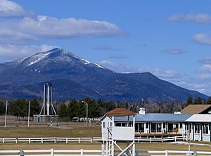
- Buck Island – An island located in Lake Placid.
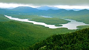
- Lake Placid – A lake in the north-central part of the town.
- Lake Placid – A village in the middle of the town. It is where NY-73 and NY-86 meet.
- Lake Placid Airport (LKP) – A small airport for private planes. It is south of Lake Placid village.
- Mirror Lake – A small lake next to Lake Placid village.
- Moose Island – Another island in Lake Placid, located north of Buck Island.
- North Elba – This is also the name of a small settlement (hamlet) southeast of Lake Placid village on NY-73.
- Ray Brook – A hamlet located between Saranac Lake and Lake Placid villages on NY-86.
- Federal Correctional Institution, Ray Brook – A federal prison near Ray Brook hamlet. It is a medium-security prison for men. When it was built, it was used as a village for athletes during the Olympics.
- Round Lake – A small lake, east of the North Elba hamlet.
- Saranac Lake – A village. Part of it is on the western border of the town on NY-86.
- Timbuctoo (1850–1870) – This was a community of Black farmers that did not succeed. John Brown helped bring them there.
- Undercliff – A hamlet on the northwestern shore of Lake Placid.
- Whiteface – A hamlet on the southwestern shore of Lake Placid.
See also
 In Spanish: North Elba (Nueva York) para niños
 | Delilah Pierce |
 | Gordon Parks |
 | Augusta Savage |
 | Charles Ethan Porter |


