North Maclean, Queensland facts for kids
Quick facts for kids North MacleanCity of Logan, Queensland |
|||||||||||||||
|---|---|---|---|---|---|---|---|---|---|---|---|---|---|---|---|

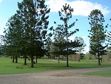
Tully Memorial Park, 2014
|
|||||||||||||||
| Population | 1,581 (2021 census) | ||||||||||||||
| • Density | 77.12/km2 (199.7/sq mi) | ||||||||||||||
| Postcode(s) | 4280 | ||||||||||||||
| Area | 20.5 km2 (7.9 sq mi) | ||||||||||||||
| Time zone | AEST (UTC+10:00) | ||||||||||||||
| LGA(s) | City of Logan | ||||||||||||||
| State electorate(s) | Logan | ||||||||||||||
| Federal Division(s) | |||||||||||||||
|
|||||||||||||||
North Maclean is a small area, or locality, located in the City of Logan in Queensland, Australia. In 2021, about 1,581 people lived here.
Contents
Exploring North Maclean's Location
North Maclean is located along the Mount Lindesay Highway. The Logan River forms its eastern and southern edges. Just south of North Maclean is South Maclean. The western side of North Maclean follows the Sydney–Brisbane rail corridor, which is where train tracks are.
A Look Back at North Maclean's History
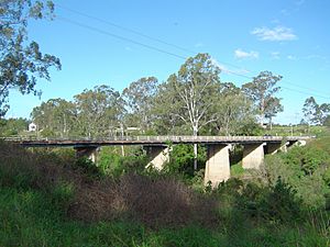
North Maclean and South Maclean used to be one area. It was first called Logan Bridge. This was because a low bridge crossed the Logan River here way back in 1860. The area later got the name Maclean. This name likely came from Alexander Grant McLean, who was a very important surveyor in New South Wales from 1856 to 1861.
In 1863, the town was planned out. It had blocks of land on both sides of the river.
Early Schools in the Area
A school called North Maclean Provisional School opened on July 18, 1882. It taught students until it closed in 1912.
Later, Maclean Provisional School opened on April 16, 1926. Ruby Eunice Dunn was its first teacher. That same year, it became Maclean State School. This school closed in 1963. It was located at 4805-4831 Mount Lindesay Highway.
Becoming Part of Logan City
North Maclean used to be part of the Shire of Beaudesert. But in March 2008, many local government areas joined together. That's when North Maclean became part of Logan City.
Who Lives in North Maclean?
In 2016, about 1,536 people lived in North Maclean. By 2021, the number of people living there grew slightly to 1,581.
Learning Opportunities in North Maclean
The Australian Technology and Agricultural College is a private high school in North Maclean. It teaches students from Year 10 to 12. It's located on the corner of Mount Lindesay Highway and Trace Road.
This school offers different ways for students to learn. It's great for those who want to work in farming or industrial jobs. In 2018, the school had 16 students, 3 teachers, and 3 other staff members.
There are no regular government schools right inside North Maclean. However, there are many nearby options for students.
Nearby Schools for Students
For primary school, students can go to Greenbank State School in Greenbank. Other choices include Park Ridge State School in Park Ridge, Jimboomba State School in Jimboomba, or Flagstone State School in Flagstone.
For high school, students can attend Park Ridge State High School in Park Ridge. Another option is Flagstone State Community College in Flagstone.
Fun Places and Parks
North Maclean has several parks where you can relax and play:
- Giesemann Park
- Olson Road Park
- Scottdale Park
- Skerman Park
- Trace Road Park
- Tully Memorial Park
Tully Memorial Park is on the Mount Lindesay Highway, right by the Logan River. It has many sports fields for different games. There's also a special plaque there. It remembers when Patrick Logan crossed the Logan River in July 1828.
Community Facilities
The Logan City Council looks after the Maclean Cemetery. It is located on Scott Lane.
 | Charles R. Drew |
 | Benjamin Banneker |
 | Jane C. Wright |
 | Roger Arliner Young |


