Munruben, Queensland facts for kids
Quick facts for kids MunrubenLogan City, Queensland |
|||||||||||||||
|---|---|---|---|---|---|---|---|---|---|---|---|---|---|---|---|

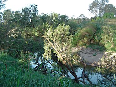
Logan River at Gieseman Park, 2014
|
|||||||||||||||
| Population | 2,753 (2021 census) | ||||||||||||||
| • Density | 227.5/km2 (589/sq mi) | ||||||||||||||
| Established | 1991 | ||||||||||||||
| Postcode(s) | 4125 | ||||||||||||||
| Area | 12.1 km2 (4.7 sq mi) | ||||||||||||||
| Time zone | AEST (UTC+10:00) | ||||||||||||||
| Location |
|
||||||||||||||
| LGA(s) | Logan City | ||||||||||||||
| State electorate(s) | Logan | ||||||||||||||
| Federal Division(s) | |||||||||||||||
|
|||||||||||||||
Munruben is a quiet area in Queensland, Australia. It is part of Logan City. This place used to be mostly farms and open land. Now, it's a community where people live in homes with plenty of space. In 2021, about 2,753 people called Munruben home.
Contents
Exploring Munruben's Landscape
The main road that goes through Munruben is called the Mount Lindesay Highway. There's a spot known as Jerry's Downfall. This area is famous for getting very muddy and often floods.
A Look Back: Munruben's History
How Munruben Got Its Name
Back in the 1800s, from 1840 to 1860, a man named William Norris had a large sheep farm. It covered about 16,000 acres between the Oxley Creek and the Logan River. He named his farm Mun Rubens. People believe this name came from the Bundjalung language. It was likely the name for a local waterhole or lagoon.
The area was officially named Munruben in 1991. At that time, it was part of the Shire of Beaudesert.
A Sad Day on the Logan River
On July 6, 1882, something very sad happened. William Norris's daughter, Emma Evans, and three of her children drowned. They were trying to cross the Logan River in a small boat that was not in good condition.
Today, there is a special memorial for the family. You can find it in Gieseman Park.
Becoming Part of Logan City
Munruben used to be in the Shire of Beaudesert. But in March 2008, local governments changed. Munruben then became part of Logan City.
Who Lives in Munruben?
Population Facts
In 2011, about 2,809 people lived in Munruben. Almost half were female (48%) and a bit more than half were male (52%). The average age of people in Munruben was 38 years old. This was just one year older than the national average.
Most people (77.6%) living in Munruben were born in Australia. The next most common birthplaces were England (5.8%), New Zealand (5%), and Germany (1%).
Languages Spoken at Home
Most people (91.1%) in Munruben spoke only English at home. Other languages spoken included German, Hmong, Hindi, Serbian, and Vietnamese.
In 2016, Munruben's population grew slightly to 2,871 people. By 2021, the population was 2,753 people.
Learning in Munruben
There are no schools located right inside Munruben. Kids usually go to nearby schools. The closest primary school is Park Ridge State School. It is located in Park Ridge, just to the north. For high school, students attend Park Ridge State High School, also in Park Ridge.
Places to Visit in Munruben
Community Spots
Riverwood Ministries Church of Christ is a local church. You can find it at 1756 Chambers Flat Road.
Local Parks
Munruben has several parks where you can enjoy the outdoors:
- Chambers Flat Road Park
- Giesemann Park
- Jerrys Downfall Reserve
- Norris Creek Park
The Story of Jerry's Downfall Reserve
Jerry's Downfall Reserve is in the north-east part of Munruben. This name remembers an early wagon driver who had an accident there. The name Jerry's Downfall has been used since at least 1866.
One story says that Jerry was a Kanaka worker. He might have been from a cotton farm nearby. He supposedly tipped over a wagon full of cotton while crossing Chambers Creek. Another idea is that the incident is linked to the Keaveny family. The Beaudesert Historical Society has put up a special plaque at the reserve to explain its history.
 | Anna J. Cooper |
 | Mary McLeod Bethune |
 | Lillie Mae Bradford |


