North Yamhill River facts for kids
Quick facts for kids North Yamhill River |
|
|---|---|

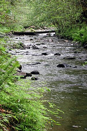
North Yamhill River near Flying M Airport
|
|
|
Location of the mouth of North Yamhill River in Oregon
|
|
| Country | United States |
| State | Oregon |
| County | Yamhill |
| Physical characteristics | |
| Main source | Northern Oregon Coast Range Siuslaw National Forest, in western Yamhill County, Oregon 2,467 ft (752 m) 45°23′51″N 123°25′23″W / 45.39750°N 123.42306°W |
| River mouth | Yamhill River between McMinnville and Dayton, Yamhill County, Oregon 75 ft (23 m) 45°13′33″N 123°08′42″W / 45.22583°N 123.14500°W |
| Length | 31 mi (50 km) |
| Basin features | |
| Basin size | 177 sq mi (460 km2) |
The North Yamhill River is a river in Oregon, USA. It flows for about 31 miles (50 km). This river is a branch, or tributary, of the Yamhill River. It helps drain water from the Northern Oregon Coast Range mountains. It also drains part of the Willamette Valley, which is a large, fertile area.
The North Yamhill River starts in the mountains of northwestern Yamhill County. It flows east, then southeast, and then south. It passes by the city of Yamhill. Finally, it joins the South Yamhill River about 2 miles (3.2 km) east of McMinnville. When these two rivers meet, they form the main Yamhill River.
River's Journey: Where it Starts and Ends
The North Yamhill River begins high up in the Northern Oregon Coast Range mountains. Its starting point is about 2,467 feet (752 meters) above sea level. From there, it flows downhill, dropping about 2,392 feet (729 meters) before it reaches its end.
The river's source is near a peak called Trask Mountain. This mountain is 3,412 feet (1,040 meters) tall. The river starts close to the border between Tillamook County and Yamhill County. This is northwest of the city of Yamhill.
River's Path: From Mountains to Valley
For its first mile (1.6 km), the river flows south and then southeast. Along the way, smaller streams join it. Perkins Creek flows into the river from the right side.
As the river turns east, Maroney Creek also joins from the right. The river then passes by the Flying M Ranch and Flying M Airport. Here, Hanna Creek joins from the left side, and Petch Creek joins from the right.
Continuing its journey east, the North Yamhill River receives more streams. Fairchild Creek comes in from the left, Haskins Creek from the right, and Cedar Creek from the left. The river then reaches a place called Pike.
Shortly after Pike, the river turns southeast. Turner Creek flows into it from the left.
Valley Widens: Meandering Through the Landscape
About 1 mile (1.6 km) downstream from Pike, the valley around the river gets wider. The river starts to curve and bend more, which is called meandering. It also turns more sharply south. Hutchcroft Creek joins from the right, and Salt Creek joins from the left.
The river then turns southeast again and flows past the city of Yamhill. The city is on the left side of the river. Rowland Creek and Yamhill Creek both join the river from the left.
From Yamhill to its end, the North Yamhill River generally flows south. It runs roughly next to Oregon Route 47, a highway that is on its left side. Soon, the river passes Alecs Butte, a 384-foot (117-meter) hill, which is also on the left.
About 1 mile (1.6 km) later, the river enters the Carlton Lake Wildlife Refuge. It flows through this protected area and then reaches the city of Carlton, which is on the left side.
Further downstream, Panther Creek joins the river from the right. The river then flows under Oregon Route 99W. Finally, it meets the South Yamhill River. Together, they form the Yamhill River, which is an 11-mile (18 km) long branch of the Willamette River.
 | Mary Eliza Mahoney |
 | Susie King Taylor |
 | Ida Gray |
 | Eliza Ann Grier |


