Nottawasaga River facts for kids
Quick facts for kids Nottawasaga River |
|
|---|---|

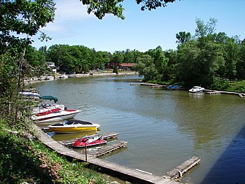
The Nottawasaga River in Wasaga Beach
|
|
|
Location of the mouth of the Nottawasaga River in southern Ontario
|
|
| Country | Canada |
| Province | Ontario |
| Region | Central Ontario |
| Counties | |
| Physical characteristics | |
| Main source | Orangeville Reservoir Orangeville, Dufferin County 412 m (1,352 ft) 43°56′29″N 80°05′29″W / 43.94139°N 80.09139°W |
| River mouth | Nottawasaga Bay Wasaga Beach, Simcoe County 176 m (577 ft) 44°32′12″N 80°00′29″W / 44.53667°N 80.00806°W |
| Length | 120 km (75 mi) |
| Basin features | |
| River system | Great Lakes Basin |
| Basin size | 3,361 km2 (1,298 sq mi) |
| Tributaries |
|
The Nottawasaga River is a cool river in Ontario, Canada. It flows through Simcoe County and Dufferin County. This river is part of the huge Great Lakes Basin. It eventually flows into Lake Huron.
The Nottawasaga River starts at the Orangeville Reservoir near the town of Orangeville. It then travels through the Niagara Escarpment. It also passes through the Minesing Wetlands, which is a very important wetland area. Finally, the river empties into Nottawasaga Bay at Wasaga Beach. Nottawasaga Bay is a part of Georgian Bay on Lake Huron.
The name "Nottawasaga" comes from the Algonquin language. Nottawa means "Iroquois" and saga means "mouth of the river". Algonquin scouts used this word as a warning. It meant that Iroquois raiding parties were seen near the river's mouth.
Contents
Where the Nottawasaga River Gets Its Water
The Nottawasaga River gets its water from several places. These include the Niagara Escarpment and the Simcoe Uplands. It also gets water from the Oak Ridges Moraine and the Oro Moraine.
The area that collects water for the river is called its drainage basin or watershed. This basin covers about 3,361 square kilometers (1,298 square miles). Besides Dufferin and Simcoe counties, parts of Grey County and the Regional Municipality of Peel are also in this watershed.
A Shipwreck Story: HMS Nancy
The Nottawasaga River is home to a famous shipwreck. This ship is called HMS Nancy. It was a merchant ship that the Royal Navy used during the War of 1812.
In 1814, the Nancy faced three American warships. These were the USS Niagara, USS Tigress, and USS Scorpion. The Nancy was a small ship and lost the battle. But its commander, Lt. Miller Worsley, and his crew managed to escape.
They rowed a long way, about 360 miles, to Fort Michilimackinac. Three days later, Lt. Worsley returned with 92 men. They bravely captured the Tigress and Scorpion!
Over time, an island formed around the sunken Nancy. Today, the ship's hull is kept safe in a museum. You can see it at the Nancy Island Historic Site. This site is part of Wasaga Beach Provincial Park.
Nature and Wildlife Along the River
The Nottawasaga River is important for fish. There are special structures called fish ladders on the river. These ladders help rainbow trout swim upstream. They can reach their spawning grounds to lay their eggs.
The Nottawasaga Valley Conservation Authority helps protect the river. They work to keep the river and its surrounding lands healthy.
Smaller Rivers Joining the Nottawasaga
Many smaller rivers and creeks flow into the Nottawasaga River. These are called tributaries. Here are some of them:
- McIntyre Creek (joins from the left side)
- Little Marl Creek (joins from the right side)
- Marl Creek (joins from the right side)
- Willow Creek (joins from the right side)
- Mad River (joins from the left side)
- Bear Creek (joins from the right side)
- Pine River (joins from the left side)
- Boyne River (joins from the left side)
- Innisfil Creek (joins from the right side)
- Sheldon Creek (joins from the left side)
 | Aaron Henry |
 | T. R. M. Howard |
 | Jesse Jackson |


