Oglesby, Illinois facts for kids
Quick facts for kids
Oglesby
|
|
|---|---|
| City of Oglesby | |
 |
|

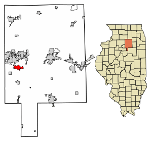
Location of Oglesby in LaSalle County, Illinois.
|
|

Location of Illinois in the United States
|
|
| Country | United States |
| State | Illinois |
| County | LaSalle |
| Township | LaSalle |
| Government | |
| • Type | City commission government |
| Area | |
| • Total | 4.99 sq mi (12.93 km2) |
| • Land | 4.99 sq mi (12.93 km2) |
| • Water | 0.00 sq mi (0.00 km2) |
| Elevation | 637 ft (194 m) |
| Population
(2020)
|
|
| • Total | 3,712 |
| • Density | 743.59/sq mi (287.11/km2) |
| Time zone | UTC−6 (CST) |
| • Summer (DST) | UTC−5 (CDT) |
| ZIP code |
61348
|
| Area code(s) | 815 |
| FIPS code | 17-55353 |
| GNIS feature ID | 2395310 |
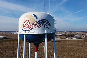
Oglesby is a city in LaSalle County, Illinois, United States. In 2020, about 3,712 people lived there. It is part of the larger Ottawa area.
Contents
History of Oglesby
Oglesby was once a busy place for mining. Workers dug for coal, limestone, and silica. It is located near where the Illinois River and the Vermilion River meet.
The city grew from several small mining villages. These included Kenosha, Portland, and Black Hollow. It was first called Portland. This name came from the cement mined there. This cement was similar to Portland Cement from England.
In 1913, the city was renamed Oglesby. This honored a coal company and Richard J. Oglesby. He was a former U.S. Senator. He also served three times as the Governor of Illinois.
Early Mining in Oglesby
In 1865, the Kenosha Coal Company started a coal mine in Oglesby. Later, Thatcher Tucker Bent bought this mine. He named it the Oglesby Coal Company. The Bent family was very involved in the community. Mrs. Josephine Bent even taught English classes to the wives of immigrant miners.
The Marquette Cement Manufacturing Company also mined limestone nearby. They claimed the Bent's mine was causing collapses. This led to the Oglesby Coal Company closing down. The Bents sold their equipment and animals.
The Black Hollow Mine was dug in the 1890s. It was a slope mine along the Vermilion River. This mine supplied coal to the Illinois Zinc Company in Peru, Illinois.
Important Mining Resources
The ground around Oglesby had lots of exposed limestone and coal. The rivers also made it easy to transport goods. Because of this, Oglesby became a major center for making cement.
Before open-pit mining became common, there were several underground mines:
- Illinois Clay Products Mine (1913–1924)
- Reynolds Clay Mine
- Marquette Cement Mine
There were also several coal mines:
- Jones Mine (1865–1930)
- Oglesby Mine (1865–1919)
- Deer Park Mine (1900–1920)
- Black Hollow Mine (around the 1890s)
Geography and Nature
Oglesby is located at 41°17′48″N 89°3′58″W / 41.29667°N 89.06611°W. The city covers about 4.11 square miles (10.64 square kilometers) of land.
Rivers and Resources
Oglesby is near where the Illinois River and the Vermilion River meet. The area had excellent limestone and coal close to the surface. This made it a great place for mining and cement production.
Nearby State Parks
Matthiessen State Park and Starved Rock State Park are just a few miles east of Oglesby. You can find them on Illinois State Route 178. Starved Rock is very popular. Over two million people visit it each year. It is the most visited state park in Illinois.
People of Oglesby
| Historical population | |||
|---|---|---|---|
| Census | Pop. | %± | |
| 1910 | 3,194 | — | |
| 1920 | 4,135 | 29.5% | |
| 1930 | 3,910 | −5.4% | |
| 1940 | 3,938 | 0.7% | |
| 1950 | 3,922 | −0.4% | |
| 1960 | 4,215 | 7.5% | |
| 1970 | 4,175 | −0.9% | |
| 1980 | 3,979 | −4.7% | |
| 1990 | 3,619 | −9.0% | |
| 2000 | 3,647 | 0.8% | |
| 2010 | 3,791 | 3.9% | |
| 2020 | 3,712 | −2.1% | |
| U.S. Decennial Census | |||
In 2020, Oglesby had 3,712 residents. There were 1,522 households and 1,035 families. The city had about 743 people per square mile.
About 24% of the people were under 18 years old. The average age in the city was 40.7 years.
The average income for a household in Oglesby was $61,250. For families, it was $70,260. About 6.3% of the people lived below the poverty line.
Education in Oglesby
Oglesby has several schools. These include Oglesby Lincoln School and Oglesby Washington School. There is also Holy Family parochial School. For higher education, Illinois Valley Community College is located in Oglesby.
Arts and Culture

From 1934 to 1943, the U.S. government created murals across the country. These murals were meant to cheer up Americans during the Great Depression. They showed positive and inspiring scenes.
In 1942, artist Fay E. Davis painted a mural for Oglesby's post office. It is called The Illini and Potawatomes Struggles at Starved Rock. The painting's colors faded over time. It was restored in 1988. For a while, the painting was hidden by a venetian blind. It was only shown if someone asked to see it. Later, people signed a petition to have the blinds removed.
Transportation
Oglesby does not have its own public bus system. However, you can find intercity bus service nearby. Burlington Trailways provides bus service in Peru, which is a close town.
Notable People from Oglesby
Many interesting people have connections to Oglesby:
- Jim Bottomley – A famous first baseman in baseball. He played for the St. Louis Cardinals and other teams.
- Frank Lamanske – A pitcher who played for the Brooklyn Dodgers.
- Bo Molenda – A fullback and later a coach for the Green Bay Packers and New York Giants. He was born in Oglesby.
- Walt Tauscher – A pitcher for the Pittsburgh Pirates and Washington Senators.
See also
 In Spanish: Oglesby (Illinois) para niños
 | Kyle Baker |
 | Joseph Yoakum |
 | Laura Wheeler Waring |
 | Henry Ossawa Tanner |

