Olallie Lake (Washington) facts for kids
Quick facts for kids Olallie Lake |
|
|---|---|

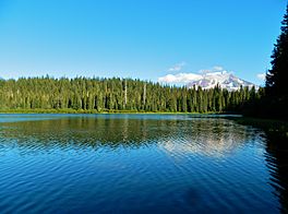
Olallie Lake, in the High Lakes Area of Washington State
|
|
| Location | Skamania County, Washington, United States |
| Coordinates | 46°17′20″N 121°37′00″W / 46.2889474°N 121.6165437°W |
| Type | natural |
| Primary inflows | runoff/snowmelt |
| Primary outflows | Sheep Creek |
| Catchment area | 0.038610 sq mi (0.10000 km2) |
| Basin countries | United States |
| Max. length | 1,210.5 ft (369.0 m) |
| Max. width | 925.1 ft (282.0 m) |
| Surface area | 15.8 acres (6.4 ha) |
| Surface elevation | 4,242 ft (1,293 m) |
| Islands | 0 |
| Settlements | (none) |
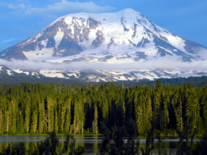
Olallie Lake is a beautiful alpine lake located high up in the mountains of Washington state. It's one of several lakes in this area that get their water from streams flowing off the big glaciers of nearby Mount Adams. This small but popular lake is a great spot for camping and enjoying nature. You can also go boating without a motor and try your hand at fishing. Olallie Lake sits at an elevation of about 4,200 feet (1,280 meters) in the Gifford Pinchot National Forest.
Contents
A Look Back in Time
Olallie Lake, located in Skamania County, has been a favorite place for people to visit for a long time. Even in the early 1900s, it was a popular spot for fun and relaxation. Before that, Native Americans knew about the lake and visited it while they were berry picking in the Midway High Lakes Area.
Fun Things to Do at Olallie Lake
This small lake, covering about 15.8 acres, is a fantastic place for many outdoor activities. People love to come here for fishing, camping, and photography. The lake offers amazing views of Mount Adams and its impressive, icy northwest side. You can also see the Adams Glacier, which is the second largest glacier in the connected United States.
The Olallie Lake Campground is right next to the lake. It's managed by the Cowlitz Ranger District of the Gifford Pinchot National Forest. This small campground has five campsites and a boat ramp. This means you can launch non-motorized boats like canoes and kayaks to explore the lake.
Exploring Nearby Trails
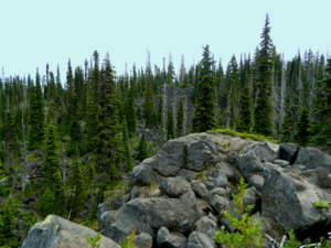
If you enjoy hiking, there are some great trails near Olallie Lake. The High Lakes Trail #116 and East Canyon Trail #265 offer even more chances to see Mount Adams. These trails also lead you through beautiful forests, past other lakes, and along scenic creeks. The High Lakes Trail even crosses the lower part of the Takh Takh Lava Flow, which is a cool area formed by ancient lava.
How to Get There
Olallie Lake is a popular place to visit in the summer. You can reach it by car using Primary Road 23, then turning onto Road 5601. This route can be taken from Trout Lake on the south side of Mount Adams.
If you are coming from Randle or Packwood in the north, you can also use Primary Road 23 to Road 5601. Another way from Packwood is to go south on Primary Road 21, then east on Road 2160, southwest on Road 56, and finally south on Road 2329.
Many people enjoy driving the "High Lakes Loop." This scenic drive starts from Packwood, goes south to Takhlakh Lake and other lakes in the Midway High Lakes area (including Olallie Lake). Then, it heads northwest along the beautiful Cispus River to Randle, and finally back east to Packwood along US Route 12. This loop is part of the White Pass Scenic Byway.


